Peraía elevation
Peraía (Central Macedonia, Nomós Thessaloníkis), Greece elevation is 52 meters and Peraía elevation in feet is 171 ft above sea level [src 1]. Peraía is a seat of a third-order administrative division (feature code) with elevation that is 99 meters (325 ft) smaller than average city elevation in Greece.
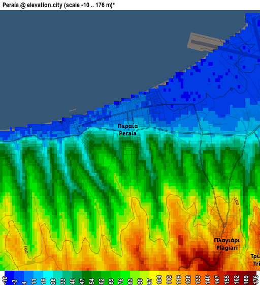
Below is the Elevation map of Peraía, which displays elevation range with different colors. Scale of the first map is from -10 to 176 m (-33 to 577 ft) with average elevation of 61.3 meters (=201 ft) [note 1]
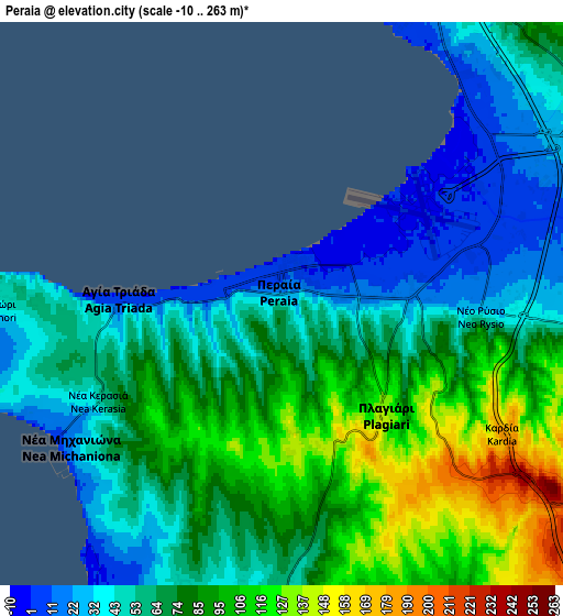
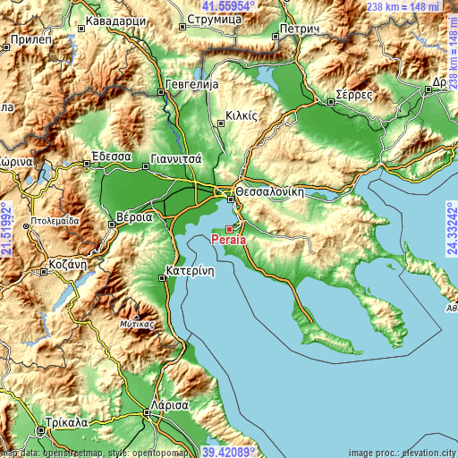
These maps also provides idea of topography and contour of this city, they are displayed at different zoom levels. More info about maps, scale and edge coordinates you can find below images.
| \ | Map #1 | Map #2 | Topo.Map |
| Scale [m] | -10..176 m | -10..263 m | × |
| Scale [ft] | -33..577 ft | -33..863 ft | × |
| Average | 61.3 m = 201 ft | 71.2 m = 234 ft | × |
| Width | 7.43 km = 4.6 mi | 14.86 km = 9.2 mi | 237.8 km = 147.8 mi |
| Height | 7.43 km = 4.6 mi | 14.86 km = 9.2 mi | 237.8 km = 147.8 mi |
| ↑Max Latitude | 40.532149° | 40.565541° | 41.55954° |
| Latitude at center | 40.49874° | 40.49874° | 40.49874° |
| ↓Min Latitude | 40.465315° | 40.431873° | 39.42089° |
| ← Min Longitude | 22.882225° | 22.838279° | 21.51992° |
| Longitude center | 22.92617° | 22.92617° | 22.92617° |
| →Max Longitude | 22.970115° | 23.014061° | 24.33242° |
Nearby cities:
Cities around Peraía sort by population:
• Kalamariá elevation 39 m
9.5 km,  12°
12°
• Thérmi 54 m
9.6 km,  55°
55°
• Epanomí 40 m
8.1 km,  179°
179°
• Néa Michanióna 26 m
6.7 km,  234°
234°
• Trílofos 143 m
5.1 km,  130°
130°
• Plagiári 139 m
3.9 km,  137°
137°
• Néoi Epivátes 45 m
1.2 km,  269°
269°
• Agía Triáda 3 m
4.5 km, 271°
• Kardiá 184 m
6.6 km,  119°
119°
• Néo Rýsi 43 m
5.2 km,  93°
93°
• Káto Scholári 204 m
11.7 km, 131°
• Agía Paraskeví 82 m
10.5 km,  100°
100°
Multilingual:
 En español:
Peraía elevación 52 m.
 En France:
Peraía élévation 52 m.


Sources and notes:
- [note 1] Map square and city borders are not equal. Map elevation data is calculated only from area inside that square.
- [src 1] Elevation data from geonames database provided with same terms of usage.
- [src 2] The elevation map of Peraía is generated using elevation data from NASA's 3 arcsec (90m) resolution SRTM data.
- [src 3] Base (background) map © OpenStreetMap contributors tiles are generated by Geofabrik and OpenTopoMap.
Copyright & License:
This Peraía Elevation Map is licensed under CC BY-SA. You may reuse any part from this page, if you give a proper credit by linking to this URL:
 More info on terms of use page.