Políchni elevation
Políchni (Central Macedonia, Nomós Thessaloníkis), Greece elevation is 109 meters and Políchni elevation in feet is 358 ft above sea level [src 1]. Políchni is a populated place (feature code) with elevation that is 42 meters (138 ft) smaller than average city elevation in Greece.
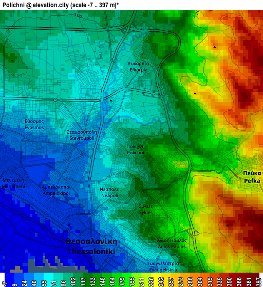
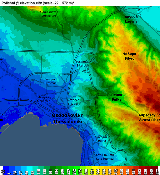
Below is the Elevation map of Políchni, which displays elevation range with different colors. Scale of the first map is from -7 to 397 m (-23 to 1302 ft) with average elevation of 126.1 meters (=414 ft) [note 1]
These maps also provides idea of topography and contour of this city, they are displayed at different zoom levels. More info about maps, scale and edge coordinates you can find below images.
| \ | Map #1 | Map #2 | Topo.Map |
| Scale [m] | -7..397 m | -22..572 m | × |
| Scale [ft] | -23..1302 ft | -72..1877 ft | × |
| Average | 126.1 m = 414 ft | 174.1 m = 571 ft | × |
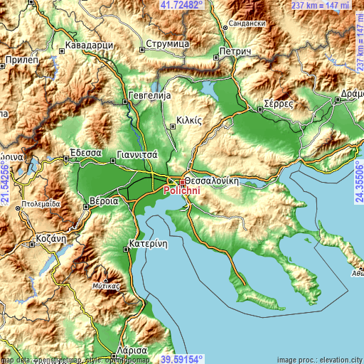
| Width | 7.41 km = 4.6 mi | 14.83 km = 9.2 mi | 237.2 km = 147.4 mi |
| Height | 7.41 km = 4.6 mi | 14.83 km = 9.2 mi | 237.2 km = 147.4 mi |
| ↑Max Latitude | 40.700035° | 40.733343° | 41.72482° |
| Latitude at center | 40.66671° | 40.66671° | 40.66671° |
| ↓Min Latitude | 40.633369° | 40.60001° | 39.59154° |
| ← Min Longitude | 22.904865° | 22.860919° | 21.54256° |
| Longitude center | 22.94881° | 22.94881° | 22.94881° |
| →Max Longitude | 22.992755° | 23.036701° | 24.35506° |
Nearby cities:
Cities around Políchni sort by population:
• Thessaloníki elevation 8 m
3 km,  210°
210°
• Sykiés 115 m
1.9 km,  174°
174°
• Neapoli 82 m
1.6 km,  202°
202°
• Meneméni 7 m
4.5 km,  257°
257°
• Triandría 71 m
6.2 km,  158°
158°
• Ágios Pávlos 145 m
3 km, 161°
• Fíliro 395 m
5.5 km,  59°
59°
• Efkarpía 109 m
2.4 km,  9°
9°
• Péfka 250 m
3.9 km,  104°
104°
• Évosmos 43 m
3.4 km,  277°
277°
• Ampelókipoi 26 m
2.4 km,  231°
231°
• Stavroúpoli 45 m
1 km,  288°
288°
Multilingual:
 En español:
Políchni elevación 109 m.
 En France:
Políchni élévation 109 m.
 Auf Deutsch:
Políchni höhe über dem Meeresspiegel ist 109 m.

Sources and notes:
- [note 1] Map square and city borders are not equal. Map elevation data is calculated only from area inside that square.
- [src 1] Elevation data from geonames database provided with same terms of usage.
- [src 2] The elevation map of Políchni is generated using elevation data from NASA's 3 arcsec (90m) resolution SRTM data.
- [src 3] Base (background) map © OpenStreetMap contributors tiles are generated by Geofabrik and OpenTopoMap.
Copyright & License:
This Políchni Elevation Map is licensed under CC BY-SA. You may reuse any part from this page, if you give a proper credit by linking to this URL:
 More info on terms of use page.