Anatolí elevation
Anatolí (Epirus, Nomós Ioannínon), Greece elevation is 503 meters and Anatolí elevation in feet is 1650 ft above sea level [src 1]. Anatolí is a populated place (feature code) with elevation that is 352 meters (1155 ft) bigger than average city elevation in Greece.
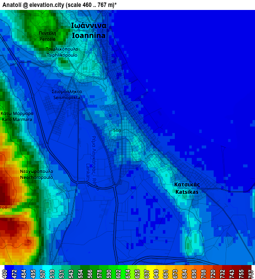
Below is the Elevation map of Anatolí, which displays elevation range with different colors. Scale of the first map is from 460 to 767 m (1509 to 2516 ft) with average elevation of 496.6 meters (=1629 ft) [note 1]
These maps also provides idea of topography and contour of this city, they are displayed at different zoom levels. More info about maps, scale and edge coordinates you can find below images.

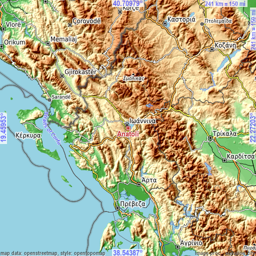
| \ | Map #1 | Map #2 | Topo.Map |
| Scale [m] | 460..767 m | 460..1570 m | × |
| Scale [ft] | 1509..2516 ft | 1509..5151 ft | × |
| Average | 496.6 m = 1629 ft | 606.8 m = 1991 ft | × |
| Width | 7.53 km = 4.7 mi | 15.05 km = 9.4 mi | 240.8 km = 149.6 mi |
| Height | 7.53 km = 4.7 mi | 15.05 km = 9.4 mi | 240.8 km = 149.6 mi |
| ↑Max Latitude | 39.669145° | 39.702963° | 40.70979° |
| Latitude at center | 39.63531° | 39.63531° | 39.63531° |
| ↓Min Latitude | 39.601459° | 39.567591° | 38.54387° |
| ← Min Longitude | 20.821835° | 20.777889° | 19.45953° |
| Longitude center | 20.86578° | 20.86578° | 20.86578° |
| →Max Longitude | 20.909725° | 20.953671° | 22.27203° |
Nearby cities:
Cities around Anatolí sort by population:
• Ioánnina elevation 505 m
3.5 km,  340°
340°
• Katsikás 486 m
2.3 km,  126°
126°
• Eleoúsa 501 m
10.1 km,  321°
321°
• Kardamítsia 511 m
6.2 km, 320°
• Eksochí 512 m
6.9 km,  327°
327°
• Pediní 492 m
4.4 km,  206°
206°
• Pérama 476 m
6.7 km,  345°
345°
• Tsiflikópoulo 517 m
3.3 km, 315°
• Stavráki 518 m
4.7 km,  299°
299°
• Vounoplagiá 501 m
9.3 km,  312°
312°
• Neochorópoulo 527 m
2.8 km,  247°
247°
• Koutselió 563 m
6.6 km,  143°
143°
Multilingual:
 En español:
Anatolí elevación 503 m.
 En France:
Anatolí élévation 503 m.


Sources and notes:
- [note 1] Map square and city borders are not equal. Map elevation data is calculated only from area inside that square.
- [src 1] Elevation data from geonames database provided with same terms of usage.
- [src 2] The elevation map of Anatolí is generated using elevation data from NASA's 3 arcsec (90m) resolution SRTM data.
- [src 3] Base (background) map © OpenStreetMap contributors tiles are generated by Geofabrik and OpenTopoMap.
Copyright & License:
This Anatolí Elevation Map is licensed under CC BY-SA. You may reuse any part from this page, if you give a proper credit by linking to this URL:
 More info on terms of use page.