Árta elevation
Árta (Epirus, Nomós Ártas), Greece elevation is 52 meters and Árta elevation in feet is 171 ft above sea level [src 1]. Árta is a seat of a second-order administrative division (feature code) with elevation that is 99 meters (325 ft) smaller than average city elevation in Greece.
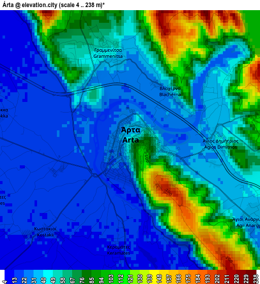
Below is the Elevation map of Árta, which displays elevation range with different colors. Scale of the first map is from 4 to 238 m (13 to 781 ft) with average elevation of 51.9 meters (=170 ft) [note 1]
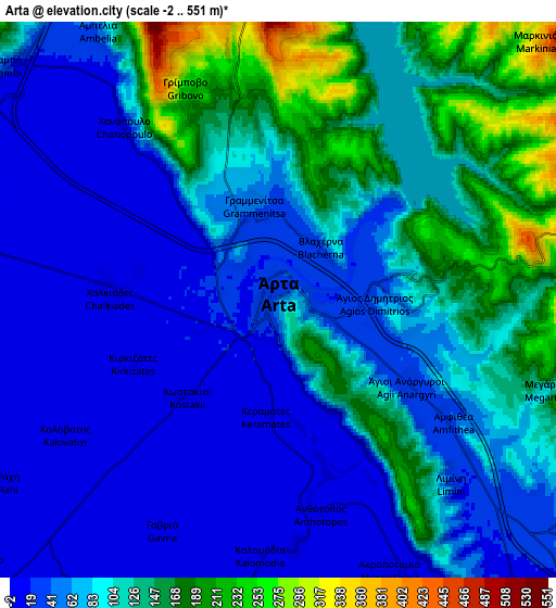
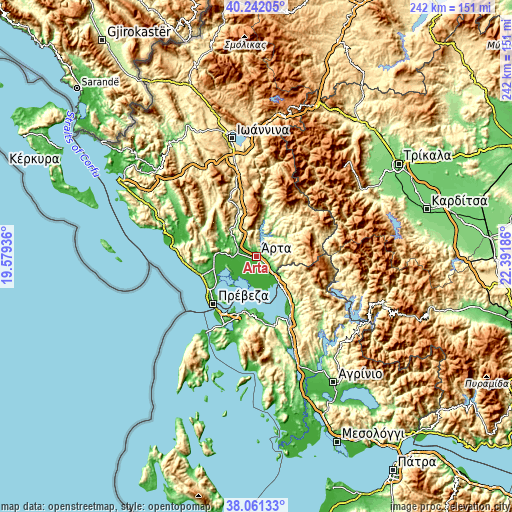
These maps also provides idea of topography and contour of this city, they are displayed at different zoom levels. More info about maps, scale and edge coordinates you can find below images.
| \ | Map #1 | Map #2 | Topo.Map |
| Scale [m] | 4..238 m | -2..551 m | × |
| Scale [ft] | 13..781 ft | -7..1808 ft | × |
| Average | 51.9 m = 170 ft | 86 m = 282 ft | × |
| Width | 7.58 km = 4.7 mi | 15.15 km = 9.4 mi | 242.5 km = 150.7 mi |
| Height | 7.58 km = 4.7 mi | 15.15 km = 9.4 mi | 242.5 km = 150.7 mi |
| ↑Max Latitude | 39.194206° | 39.228256° | 40.24205° |
| Latitude at center | 39.16014° | 39.16014° | 39.16014° |
| ↓Min Latitude | 39.126057° | 39.091958° | 38.06133° |
| ← Min Longitude | 20.941665° | 20.897719° | 19.57936° |
| Longitude center | 20.98561° | 20.98561° | 20.98561° |
| →Max Longitude | 21.029555° | 21.073501° | 22.39186° |
Nearby cities:
Cities around Árta sort by population:
• Filippiáda elevation 25 m
10.2 km,  299°
299°
• Kompóti 75 m
10.6 km,  127°
127°
• Neochóri 3 m
10.4 km,  163°
163°
• Kostakioí 15 m
3.6 km,  222°
222°
• Loúros 9 m
19.8 km,  271°
271°
• Péta 175 m
4.3 km,  80°
80°
• Chalkiádes 15 m
4.5 km, 269°
• Grammenítsa 48 m
2.8 km,  348°
348°
• Anéza 4 m
9.8 km,  213°
213°
• Menídi 19 m
17.4 km,  138°
138°
• Eleoúsa 18 m
2.2 km,  247°
247°
• Kalamiá 14 m
4.7 km,  277°
277°
Multilingual:
 En español:
Arta elevación 52 m.
 En France:
Árta élévation 52 m.


Sources and notes:
- [note 1] Map square and city borders are not equal. Map elevation data is calculated only from area inside that square.
- [src 1] Elevation data from geonames database provided with same terms of usage.
- [src 2] The elevation map of Árta is generated using elevation data from NASA's 3 arcsec (90m) resolution SRTM data.
- [src 3] Base (background) map © OpenStreetMap contributors tiles are generated by Geofabrik and OpenTopoMap.
Copyright & License:
This Árta Elevation Map is licensed under CC BY-SA. You may reuse any part from this page, if you give a proper credit by linking to this URL:
 More info on terms of use page.