Ágios Stéfanos elevation
Ágios Stéfanos (Attica, Nomarchía Anatolikís Attikís), Greece elevation is 368 meters and Ágios Stéfanos elevation in feet is 1207 ft above sea level [src 1]. Ágios Stéfanos is a seat of a third-order administrative division (feature code) with elevation that is 217 meters (712 ft) bigger than average city elevation in Greece.
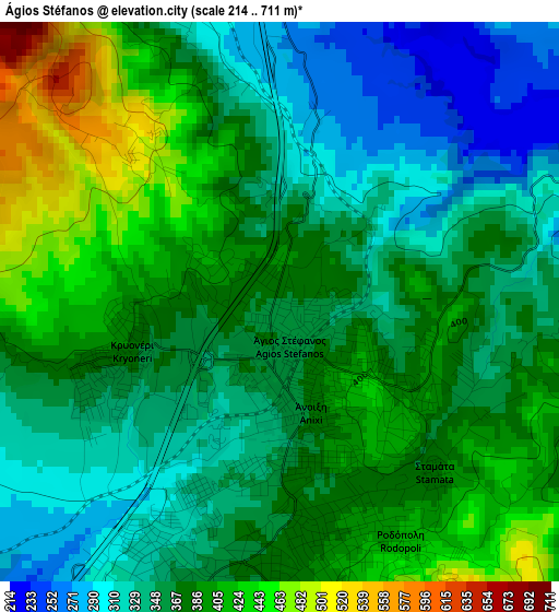
Below is the Elevation map of Ágios Stéfanos, which displays elevation range with different colors. Scale of the first map is from 214 to 711 m (702 to 2333 ft) with average elevation of 369.6 meters (=1213 ft) [note 1]
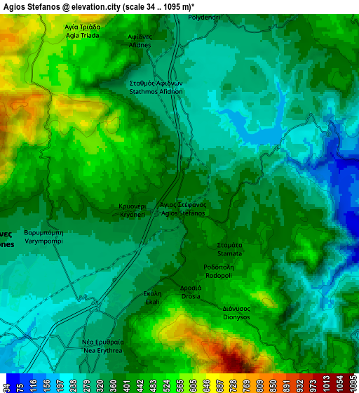
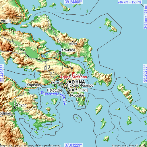
These maps also provides idea of topography and contour of this city, they are displayed at different zoom levels. More info about maps, scale and edge coordinates you can find below images.
| \ | Map #1 | Map #2 | Topo.Map |
| Scale [m] | 214..711 m | 34..1095 m | × |
| Scale [ft] | 702..2333 ft | 112..3593 ft | × |
| Average | 369.6 m = 1213 ft | 384.2 m = 1260 ft | × |
| Width | 7.69 km = 4.8 mi | 15.37 km = 9.6 mi | 245.9 km = 152.8 mi |
| Height | 7.69 km = 4.8 mi | 15.37 km = 9.6 mi | 245.9 km = 152.8 mi |
| ↑Max Latitude | 38.181122° | 38.215657° | 39.24408° |
| Latitude at center | 38.14657° | 38.14657° | 38.14657° |
| ↓Min Latitude | 38.112002° | 38.077417° | 37.03229° |
| ← Min Longitude | 23.812135° | 23.768189° | 22.44983° |
| Longitude center | 23.85608° | 23.85608° | 23.85608° |
| →Max Longitude | 23.900025° | 23.943971° | 25.26233° |
Nearby cities:
Cities around Ágios Stéfanos sort by population:
• Néa Erythraía elevation 321 m
6.7 km,  206°
206°
• Drosiá 377 m
3.1 km,  166°
166°
• Anoixi 359 m
1.6 km, 171°
• Ekáli 323 m
4.4 km,  204°
204°
• Diónysos 482 m
5.1 km,  156°
156°
• Kryonéri 365 m
2.5 km,  244°
244°
• Kapandríti 351 m
8 km,  14°
14°
• Stamáta 382 m
3.2 km,  137°
137°
• Rodópoli 415 m
3.7 km,  152°
152°
• Afidnés 330 m
6.5 km,  347°
347°
• Polydéndri 342 m
7.8 km, 7°
• Varybóbi 298 m
6.4 km,  250°
250°
Multilingual:
 En español:
Ágios Stéfanos elevación 368 m.
 En France:
Ágios Stéfanos élévation 368 m.
 Auf Deutsch:
Ágios Stéfanos höhe über dem Meeresspiegel ist 368 m.

Sources and notes:
- [note 1] Map square and city borders are not equal. Map elevation data is calculated only from area inside that square.
- [src 1] Elevation data from geonames database provided with same terms of usage.
- [src 2] The elevation map of Ágios Stéfanos is generated using elevation data from NASA's 3 arcsec (90m) resolution SRTM data.
- [src 3] Base (background) map © OpenStreetMap contributors tiles are generated by Geofabrik and OpenTopoMap.
Copyright & License:
This Ágios Stéfanos Elevation Map is licensed under CC BY-SA. You may reuse any part from this page, if you give a proper credit by linking to this URL:
 More info on terms of use page.