Irákleion elevation
Irákleion (Crete, Nomós Irakleíou), Greece elevation is 60 meters and Irákleion elevation in feet is 197 ft above sea level [src 1]. Irákleion is a seat of a first-order administrative division (feature code) with elevation that is 91 meters (299 ft) smaller than average city elevation in Greece.
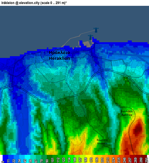
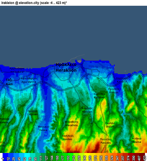
Below is the Elevation map of Irákleion, which displays elevation range with different colors. Scale of the first map is from 0 to 291 m (0 to 955 ft) with average elevation of 73.8 meters (=242 ft) [note 1]
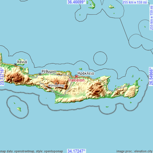
These maps also provides idea of topography and contour of this city, they are displayed at different zoom levels. More info about maps, scale and edge coordinates you can find below images.
| \ | Map #1 | Map #2 | Topo.Map |
| Scale [m] | 0..291 m | -4..423 m | × |
| Scale [ft] | 0..955 ft | -13..1388 ft | × |
| Average | 73.8 m = 242 ft | 118.8 m = 390 ft | × |
| Width | 7.97 km = 5 mi | 15.95 km = 9.9 mi | 255.1 km = 158.5 mi |
| Height | 7.97 km = 5 mi | 15.95 km = 9.9 mi | 255.1 km = 158.5 mi |
| ↑Max Latitude | 35.363715° | 35.399544° | 36.46699° |
| Latitude at center | 35.32787° | 35.32787° | 35.32787° |
| ↓Min Latitude | 35.292009° | 35.256132° | 34.17247° |
| ← Min Longitude | 25.099465° | 25.055519° | 23.73716° |
| Longitude center | 25.14341° | 25.14341° | 25.14341° |
| →Max Longitude | 25.187355° | 25.231301° | 26.54966° |
Nearby cities:
Cities around Irákleion sort by population:
• Gázi elevation 36 m
6.9 km,  267°
267°
• Néa Alikarnassós 24 m
1.9 km,  46°
46°
• Ano Arhanes 461 m
10.7 km,  168°
168°
• Krousón 427 m
18.1 km,  233°
233°
• Káto Goúves 15 m
15.4 km,  89°
89°
• Kokkíni Cháni 12 m
10.4 km, 89°
• Goúrnes 17 m
12.2 km, 90°
• Thrapsanón 350 m
19.9 km,  141°
141°
• Profítis Ilías 345 m
14.2 km,  196°
196°
• Káto Asítai 434 m
19.2 km,  223°
223°
• Tílisos 209 m
12.1 km,  253°
253°
• Skalánion 242 m
6.4 km, 141°
Multilingual:
 En español:
Heraklion elevación 60 m.
 En France:
Héraklion élévation 60 m.
 Auf Deutsch:
Iraklio, Heraklion höhe über dem Meeresspiegel ist 60 m.

Sources and notes:
- [note 1] Map square and city borders are not equal. Map elevation data is calculated only from area inside that square.
- [src 1] Elevation data from geonames database provided with same terms of usage.
- [src 2] The elevation map of Irákleion is generated using elevation data from NASA's 3 arcsec (90m) resolution SRTM data.
- [src 3] Base (background) map © OpenStreetMap contributors tiles are generated by Geofabrik and OpenTopoMap.
Copyright & License:
This Irákleion Elevation Map is licensed under CC BY-SA. You may reuse any part from this page, if you give a proper credit by linking to this URL:
 More info on terms of use page.