Chaniá elevation
Chaniá (Crete, Nomós Chaniás), Greece elevation is 24 meters and Chaniá elevation in feet is 79 ft above sea level [src 1]. Chaniá is a seat of a second-order administrative division (feature code) with elevation that is 127 meters (417 ft) smaller than average city elevation in Greece.
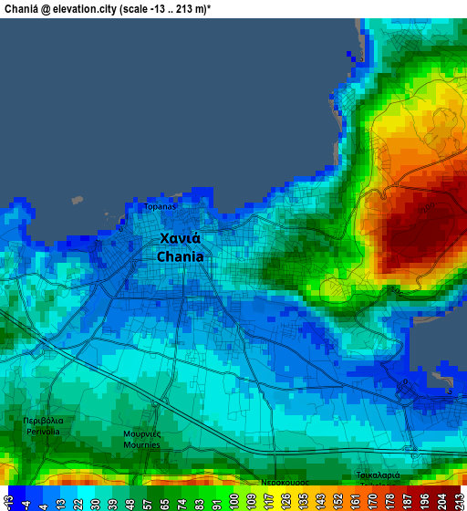
Below is the Elevation map of Chaniá, which displays elevation range with different colors. Scale of the first map is from -13 to 213 m (-43 to 699 ft) with average elevation of 51.7 meters (=170 ft) [note 1]
These maps also provides idea of topography and contour of this city, they are displayed at different zoom levels. More info about maps, scale and edge coordinates you can find below images.
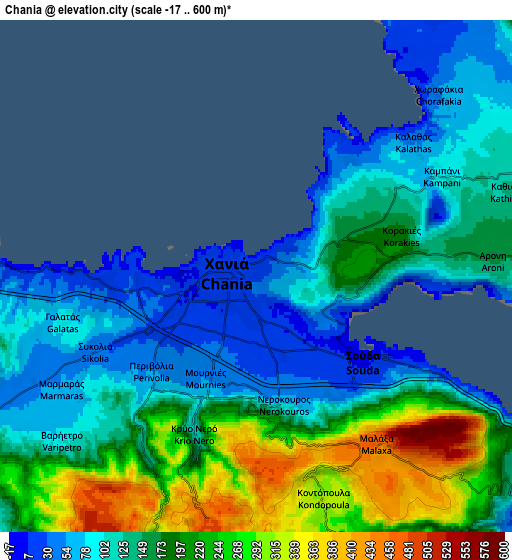
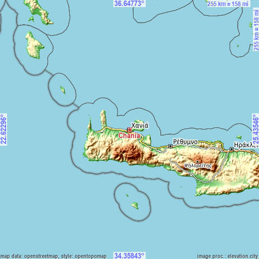
| \ | Map #1 | Map #2 | Topo.Map |
| Scale [m] | -13..213 m | -17..600 m | × |
| Scale [ft] | -43..699 ft | -56..1969 ft | × |
| Average | 51.7 m = 170 ft | 160.8 m = 528 ft | × |
| Width | 7.95 km = 4.9 mi | 15.91 km = 9.9 mi | 254.5 km = 158.1 mi |
| Height | 7.95 km = 4.9 mi | 15.91 km = 9.9 mi | 254.5 km = 158.1 mi |
| ↑Max Latitude | 35.547004° | 35.582751° | 36.64773° |
| Latitude at center | 35.51124° | 35.51124° | 35.51124° |
| ↓Min Latitude | 35.47546° | 35.439665° | 34.35843° |
| ← Min Longitude | 23.985265° | 23.941319° | 22.62296° |
| Longitude center | 24.02921° | 24.02921° | 24.02921° |
| →Max Longitude | 24.073155° | 24.117101° | 25.43546° |
Nearby cities:
Cities around Chaniá sort by population:
• Soúda elevation 8 m
4.8 km,  123°
123°
• Mourniés 51 m
3.6 km,  205°
205°
• Darátsos 67 m
5.1 km,  255°
255°
• Nerokoúros 66 m
4.1 km,  166°
166°
• Perivólia 50 m
4.3 km,  227°
227°
• Galatás 88 m
6.1 km, 256°
• Agía Marína 16 m
9.3 km,  274°
274°
• Tsikalariá 69 m
4.9 km,  142°
142°
• Mouzourás 162 m
11.8 km,  74°
74°
• Kalýves 6 m
14.8 km, 117°
• Pithári 151 m
5.2 km,  83°
83°
• Geráni 11 m
13.7 km, 272°
Multilingual:
 En español:
La Canea elevación 24 m.
 En France:
La Canée élévation 24 m.


Sources and notes:
- [note 1] Map square and city borders are not equal. Map elevation data is calculated only from area inside that square.
- [src 1] Elevation data from geonames database provided with same terms of usage.
- [src 2] The elevation map of Chaniá is generated using elevation data from NASA's 3 arcsec (90m) resolution SRTM data.
- [src 3] Base (background) map © OpenStreetMap contributors tiles are generated by Geofabrik and OpenTopoMap.
Copyright & License:
This Chaniá Elevation Map is licensed under CC BY-SA. You may reuse any part from this page, if you give a proper credit by linking to this URL:
 More info on terms of use page.