Kiáto elevation
Kiáto (Peloponnese, Nomós Korinthías), Greece elevation is 9 meters and Kiáto elevation in feet is 30 ft above sea level [src 1]. Kiáto is a seat of a third-order administrative division (feature code) with elevation that is 142 meters (466 ft) smaller than average city elevation in Greece.
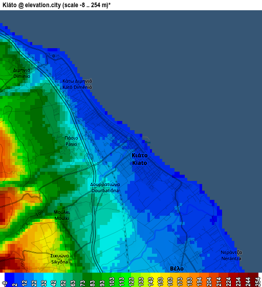
Below is the Elevation map of Kiáto, which displays elevation range with different colors. Scale of the first map is from -8 to 254 m (-26 to 833 ft) with average elevation of 57.7 meters (=189 ft) [note 1]
These maps also provides idea of topography and contour of this city, they are displayed at different zoom levels. More info about maps, scale and edge coordinates you can find below images.
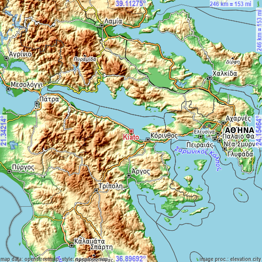
| \ | Map #1 | Map #2 | Topo.Map |
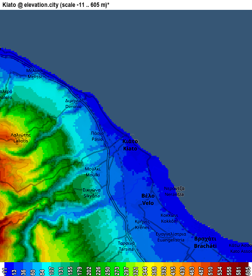
| Scale [m] | -8..254 m | -11..605 m | × |
| Scale [ft] | -26..833 ft | -36..1985 ft | × |
| Average | 57.7 m = 189 ft | 136.2 m = 447 ft | × |
| Width | 7.7 km = 4.8 mi | 15.4 km = 9.6 mi | 246.4 km = 153.1 mi |
| Height | 7.7 km = 4.8 mi | 15.4 km = 9.6 mi | 246.4 km = 153.1 mi |
| ↑Max Latitude | 38.047825° | 38.082424° | 39.11275° |
| Latitude at center | 38.01321° | 38.01321° | 38.01321° |
| ↓Min Latitude | 37.978579° | 37.943931° | 36.89692° |
| ← Min Longitude | 22.704445° | 22.660499° | 21.34214° |
| Longitude center | 22.74839° | 22.74839° | 22.74839° |
| →Max Longitude | 22.792335° | 22.836281° | 24.15464° |
Nearby cities:
Cities around Kiáto sort by population:
• Xylókastro elevation 8 m
12.5 km,  305°
305°
• Zevgolateió 39 m
10 km,  153°
153°
• Vrakháti 9 m
7.9 km,  140°
140°
• Vélo 26 m
4.2 km,  166°
166°
• Ássos 17 m
10.4 km, 141°
• Periyiáli 10 m
11.4 km, 135°
• Moúlki 79 m
3 km,  222°
222°
• Pásion 44 m
1.8 km,  269°
269°
• Káto Dhiminió 4 m
1.9 km, 313°
• Sikyón 137 m
4 km,  211°
211°
• Kokkónion 11 m
5.5 km, 149°
• Vokhaïkó 28 m
8.2 km, 152°
Multilingual:
 En español:
Kiáto elevación 9 m.
 En France:
Kiáto élévation 9 m.


Sources and notes:
- [note 1] Map square and city borders are not equal. Map elevation data is calculated only from area inside that square.
- [src 1] Elevation data from geonames database provided with same terms of usage.
- [src 2] The elevation map of Kiáto is generated using elevation data from NASA's 3 arcsec (90m) resolution SRTM data.
- [src 3] Base (background) map © OpenStreetMap contributors tiles are generated by Geofabrik and OpenTopoMap.
Copyright & License:
This Kiáto Elevation Map is licensed under CC BY-SA. You may reuse any part from this page, if you give a proper credit by linking to this URL:
 More info on terms of use page.