Koropí elevation
Koropí (Attica, Nomarchía Anatolikís Attikís), Greece elevation is 130 meters and Koropí elevation in feet is 427 ft above sea level [src 1]. Koropí is a seat of a third-order administrative division (feature code) with elevation that is 21 meters (69 ft) smaller than average city elevation in Greece.
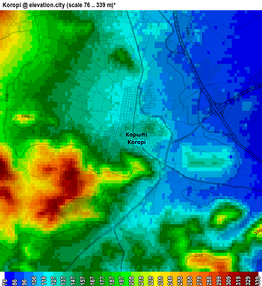
Below is the Elevation map of Koropí, which displays elevation range with different colors. Scale of the first map is from 76 to 339 m (249 to 1112 ft) with average elevation of 152.3 meters (=500 ft) [note 1]
These maps also provides idea of topography and contour of this city, they are displayed at different zoom levels. More info about maps, scale and edge coordinates you can find below images.
| \ | Map #1 | Map #2 | Topo.Map |
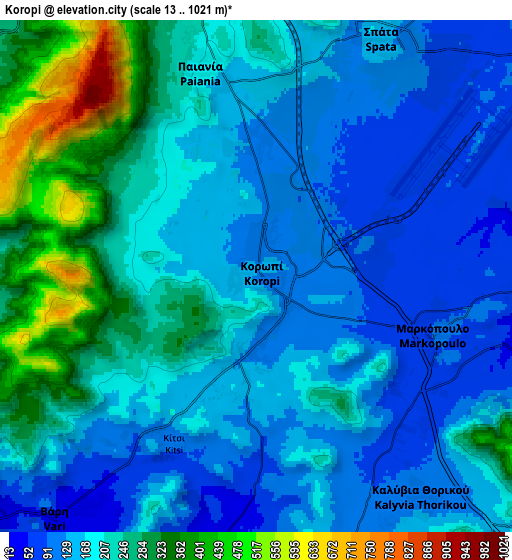
| Scale [m] | 76..339 m | 13..1021 m | × |
| Scale [ft] | 249..1112 ft | 43..3350 ft | × |
| Average | 152.3 m = 500 ft | 197.9 m = 649 ft | × |
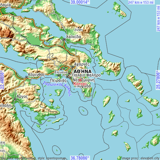
| Width | 7.71 km = 4.8 mi | 15.42 km = 9.6 mi | 246.8 km = 153.4 mi |
| Height | 7.71 km = 4.8 mi | 15.42 km = 9.6 mi | 246.8 km = 153.4 mi |
| ↑Max Latitude | 37.933529° | 37.968181° | 39.00014° |
| Latitude at center | 37.89886° | 37.89886° | 37.89886° |
| ↓Min Latitude | 37.864175° | 37.829473° | 36.78086° |
| ← Min Longitude | 23.827865° | 23.783919° | 22.46556° |
| Longitude center | 23.87181° | 23.87181° | 23.87181° |
| →Max Longitude | 23.915755° | 23.959701° | 25.27806° |
Nearby cities:
Cities around Koropí sort by population:
• Ilioúpoli elevation 308 m
9.8 km,  291°
291°
• Vári 30 m
9.5 km,  219°
219°
• Paianía 183 m
6.5 km,  346°
346°
• Kalývia Thorikoú 116 m
8.1 km,  144°
144°
• Markópoulo 95 m
5.7 km,  107°
107°
• Spáta 142 m
7.9 km,  28°
28°
• Leondárion 207 m
9.9 km, 351°
• Kítsi 98 m
5.9 km,  207°
207°
• Agía Marína 9 m
9.1 km,  195°
195°
• Karellás 134 m
4 km, 351°
• Argithéa 224 m
8.6 km,  8°
8°
• Agios Dimítrios Kropiás 52 m
10.4 km,  186°
186°
Multilingual:
 En español:
Koropí elevación 130 m.
 En France:
Koropí élévation 130 m.


Sources and notes:
- [note 1] Map square and city borders are not equal. Map elevation data is calculated only from area inside that square.
- [src 1] Elevation data from geonames database provided with same terms of usage.
- [src 2] The elevation map of Koropí is generated using elevation data from NASA's 3 arcsec (90m) resolution SRTM data.
- [src 3] Base (background) map © OpenStreetMap contributors tiles are generated by Geofabrik and OpenTopoMap.
Copyright & License:
This Koropí Elevation Map is licensed under CC BY-SA. You may reuse any part from this page, if you give a proper credit by linking to this URL:
 More info on terms of use page.