Livadeiá elevation
Livadeiá (Central Greece, Nomós Voiotías), Greece elevation is 174 meters and Livadeiá elevation in feet is 571 ft above sea level [src 1]. Livadeiá is a seat of a second-order administrative division (feature code) with elevation that is 23 meters (75 ft) bigger than average city elevation in Greece.
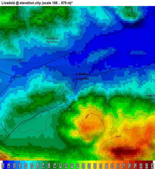
Below is the Elevation map of Livadeiá, which displays elevation range with different colors. Scale of the first map is from 106 to 879 m (348 to 2884 ft) with average elevation of 313.2 meters (=1028 ft) [note 1]
These maps also provides idea of topography and contour of this city, they are displayed at different zoom levels. More info about maps, scale and edge coordinates you can find below images.
| \ | Map #1 | Map #2 | Topo.Map |
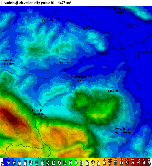
| Scale [m] | 106..879 m | 91..1476 m | × |
| Scale [ft] | 348..2884 ft | 299..4843 ft | × |
| Average | 313.2 m = 1028 ft | 365.1 m = 1198 ft | × |
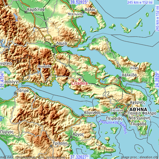
| Width | 7.65 km = 4.8 mi | 15.31 km = 9.5 mi | 244.9 km = 152.2 mi |
| Height | 7.65 km = 4.8 mi | 15.31 km = 9.5 mi | 244.9 km = 152.2 mi |
| ↑Max Latitude | 38.470574° | 38.504972° | 39.52925° |
| Latitude at center | 38.43616° | 38.43616° | 38.43616° |
| ↓Min Latitude | 38.401729° | 38.367282° | 37.32627° |
| ← Min Longitude | 22.832705° | 22.788759° | 21.4704° |
| Longitude center | 22.87665° | 22.87665° | 22.87665° |
| →Max Longitude | 22.920595° | 22.964541° | 24.2829° |
Nearby cities:
Cities around Livadeiá sort by population:
• Orchomenós elevation 104 m
11 km,  54°
54°
• Alíartos 183 m
20.9 km,  111°
111°
• Káto Tithoréa 162 m
23.8 km,  323°
323°
• Eláteia 178 m
23.4 km,  335°
335°
• Kyriáki 762 m
12 km,  219°
219°
• Ágios Geórgios 220 m
6.8 km,  134°
134°
• Antikyra 44 m
22 km,  254°
254°
• Chairóneia 128 m
7.2 km, 336°
• Domvraína 157 m
22.3 km,  155°
155°
• Agía Triáda 402 m
9.4 km, 162°
• Steíri 454 m
14.7 km,  257°
257°
• Dístomo 448 m
18.3 km,  267°
267°
Multilingual:
 En español:
Livadeiá elevación 174 m.
 En France:
Livadiá élévation 174 m.


Sources and notes:
- [note 1] Map square and city borders are not equal. Map elevation data is calculated only from area inside that square.
- [src 1] Elevation data from geonames database provided with same terms of usage.
- [src 2] The elevation map of Livadeiá is generated using elevation data from NASA's 3 arcsec (90m) resolution SRTM data.
- [src 3] Base (background) map © OpenStreetMap contributors tiles are generated by Geofabrik and OpenTopoMap.
Copyright & License:
This Livadeiá Elevation Map is licensed under CC BY-SA. You may reuse any part from this page, if you give a proper credit by linking to this URL:
 More info on terms of use page.