Loutráki elevation
Loutráki (Peloponnese, Nomós Korinthías), Greece elevation is 11 meters and Loutráki elevation in feet is 36 ft above sea level [src 1]. Loutráki is a seat of a third-order administrative division (feature code) with elevation that is 140 meters (459 ft) smaller than average city elevation in Greece.
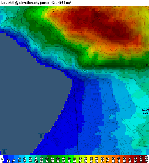
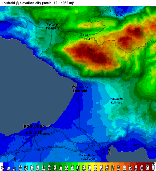
Below is the Elevation map of Loutráki, which displays elevation range with different colors. Scale of the first map is from -12 to 1054 m (-39 to 3458 ft) with average elevation of 336.4 meters (=1104 ft) [note 1]
These maps also provides idea of topography and contour of this city, they are displayed at different zoom levels. More info about maps, scale and edge coordinates you can find below images.
| \ | Map #1 | Map #2 | Topo.Map |
| Scale [m] | -12..1054 m | -12..1062 m | × |
| Scale [ft] | -39..3458 ft | -39..3484 ft | × |
| Average | 336.4 m = 1104 ft | 289.8 m = 951 ft | × |
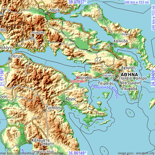
| Width | 7.7 km = 4.8 mi | 15.41 km = 9.6 mi | 246.5 km = 153.2 mi |
| Height | 7.7 km = 4.8 mi | 15.41 km = 9.6 mi | 246.5 km = 153.2 mi |
| ↑Max Latitude | 38.012931° | 38.047547° | 39.07837° |
| Latitude at center | 37.9783° | 37.9783° | 37.9783° |
| ↓Min Latitude | 37.943652° | 37.908988° | 36.86149° |
| ← Min Longitude | 22.933865° | 22.889919° | 21.57156° |
| Longitude center | 22.97781° | 22.97781° | 22.97781° |
| →Max Longitude | 23.021755° | 23.065701° | 24.38406° |
Nearby cities:
Cities around Loutráki sort by population:
• Kórinthos elevation 24 m
4.8 km,  208°
208°
• Ágioi Theódoroi 10 m
15.5 km,  111°
111°
• Vrakháti 9 m
15.2 km,  261°
261°
• Lékhaio 18 m
12.3 km,  245°
245°
• Arkhaía Kórinthos 64 m
11.3 km,  227°
227°
• Ássos 17 m
14.3 km, 252°
• Examília 80 m
10 km, 205°
• Periyiáli 10 m
12.8 km, 250°
• Loutrá Oraías Elénis 10 m
12.7 km,  172°
172°
• Perachóra 274 m
6.3 km,  336°
336°
• Isthmía 12 m
7.6 km,  161°
161°
• Kyrás Vrýsi 72 m
7.3 km, 174°
Multilingual:
 En español:
Loutráki elevación 11 m.
 En France:
Loutráki élévation 11 m.


Sources and notes:
- [note 1] Map square and city borders are not equal. Map elevation data is calculated only from area inside that square.
- [src 1] Elevation data from geonames database provided with same terms of usage.
- [src 2] The elevation map of Loutráki is generated using elevation data from NASA's 3 arcsec (90m) resolution SRTM data.
- [src 3] Base (background) map © OpenStreetMap contributors tiles are generated by Geofabrik and OpenTopoMap.
Copyright & License:
This Loutráki Elevation Map is licensed under CC BY-SA. You may reuse any part from this page, if you give a proper credit by linking to this URL:
 More info on terms of use page.