Mégara elevation
Mégara (Attica, Nomarchía Dytikís Attikís), Greece elevation is 35 meters and Mégara elevation in feet is 115 ft above sea level [src 1]. Mégara is a seat of a third-order administrative division (feature code) with elevation that is 116 meters (381 ft) smaller than average city elevation in Greece.
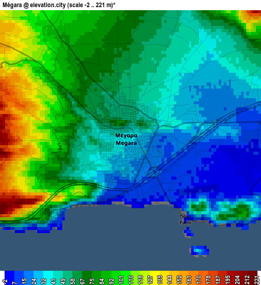
Below is the Elevation map of Mégara, which displays elevation range with different colors. Scale of the first map is from -2 to 221 m (-7 to 725 ft) with average elevation of 62.4 meters (=205 ft) [note 1]
These maps also provides idea of topography and contour of this city, they are displayed at different zoom levels. More info about maps, scale and edge coordinates you can find below images.
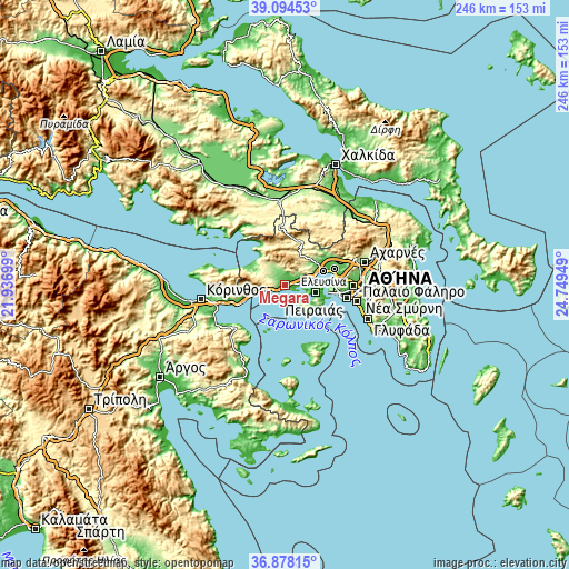
| \ | Map #1 | Map #2 | Topo.Map |
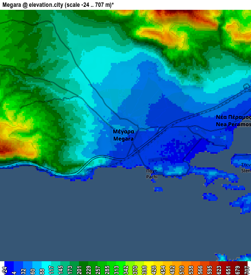
| Scale [m] | -2..221 m | -24..707 m | × |
| Scale [ft] | -7..725 ft | -79..2320 ft | × |
| Average | 62.4 m = 205 ft | 160.3 m = 526 ft | × |
| Width | 7.7 km = 4.8 mi | 15.4 km = 9.6 mi | 246.4 km = 153.1 mi |
| Height | 7.7 km = 4.8 mi | 15.4 km = 9.6 mi | 246.4 km = 153.1 mi |
| ↑Max Latitude | 38.029334° | 38.063941° | 39.09453° |
| Latitude at center | 37.99471° | 37.99471° | 37.99471° |
| ↓Min Latitude | 37.96007° | 37.925414° | 36.87815° |
| ← Min Longitude | 23.299295° | 23.255349° | 21.93699° |
| Longitude center | 23.34324° | 23.34324° | 23.34324° |
| →Max Longitude | 23.387185° | 23.431131° | 24.74949° |
Nearby cities:
Cities around Mégara sort by population:
• Salamína elevation 5 m
13.9 km,  104°
104°
• Elefsína 7 m
18.2 km,  73°
73°
• Mándra 79 m
15.9 km,  59°
59°
• Néa Péramos 14 m
7.2 km,  79°
79°
• Aiánteio 30 m
13 km,  128°
128°
• Magoúla 76 m
18.2 km, 58°
• Ampelákia 19 m
16.9 km,  106°
106°
• Ágioi Theódoroi 10 m
19.1 km,  246°
246°
• Selínia 19 m
17.9 km, 112°
• Vlycháda 80 m
8.9 km, 66°
• Kinéta 4 m
11.7 km,  255°
255°
• Vília 508 m
19.2 km,  358°
358°
Multilingual:
 En español:
Megara elevación 35 m.
 En France:
Mégare élévation 35 m.


Sources and notes:
- [note 1] Map square and city borders are not equal. Map elevation data is calculated only from area inside that square.
- [src 1] Elevation data from geonames database provided with same terms of usage.
- [src 2] The elevation map of Mégara is generated using elevation data from NASA's 3 arcsec (90m) resolution SRTM data.
- [src 3] Base (background) map © OpenStreetMap contributors tiles are generated by Geofabrik and OpenTopoMap.
Copyright & License:
This Mégara Elevation Map is licensed under CC BY-SA. You may reuse any part from this page, if you give a proper credit by linking to this URL:
 More info on terms of use page.