Mytilene elevation
Mytilene (North Aegean, Lesbos), Greece elevation is 14 meters and Mytilene elevation in feet is 46 ft above sea level [src 1]. Mytilene is a seat of a first-order administrative division (feature code) with elevation that is 137 meters (449 ft) smaller than average city elevation in Greece.
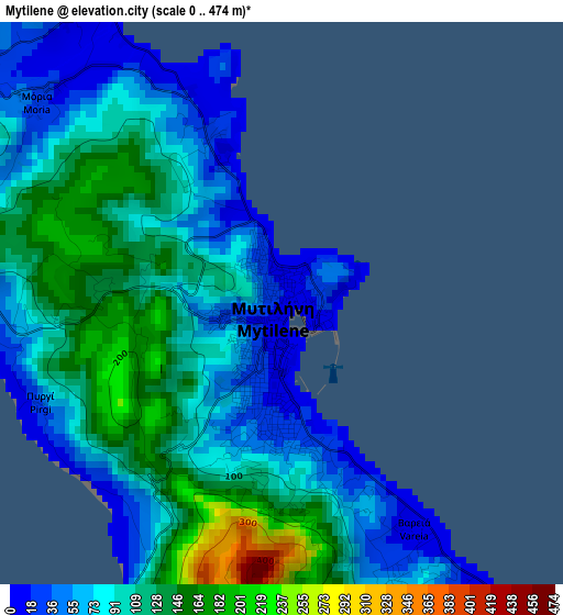
Below is the Elevation map of Mytilene, which displays elevation range with different colors. Scale of the first map is from 0 to 474 m (0 to 1555 ft) with average elevation of 96.3 meters (=316 ft) [note 1]
These maps also provides idea of topography and contour of this city, they are displayed at different zoom levels. More info about maps, scale and edge coordinates you can find below images.
| \ | Map #1 | Map #2 | Topo.Map |
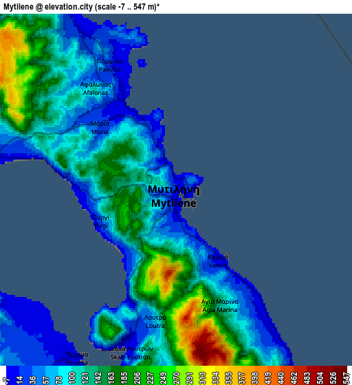
| Scale [m] | 0..474 m | -7..547 m | × |
| Scale [ft] | 0..1555 ft | -23..1795 ft | × |
| Average | 96.3 m = 316 ft | 117.3 m = 385 ft | × |
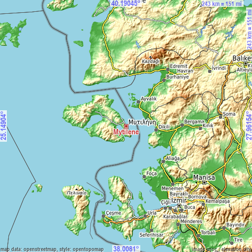
| Width | 7.58 km = 4.7 mi | 15.17 km = 9.4 mi | 242.7 km = 150.8 mi |
| Height | 7.58 km = 4.7 mi | 15.17 km = 9.4 mi | 242.6 km = 150.7 mi |
| ↑Max Latitude | 39.141812° | 39.175887° | 40.19045° |
| Latitude at center | 39.10772° | 39.10772° | 39.10772° |
| ↓Min Latitude | 39.073612° | 39.039487° | 38.0081° |
| ← Min Longitude | 26.511345° | 26.467399° | 25.14904° |
| Longitude center | 26.55529° | 26.55529° | 26.55529° |
| →Max Longitude | 26.599235° | 26.643181° | 27.96154° |
Nearby cities:
Cities around Mytilene sort by population:
• Plomári elevation 35 m
21.7 km,  227°
227°
• Polichnítos 112 m
32.4 km,  264°
264°
• Agiásos 442 m
16 km, 260°
• Agía Paraskeví 103 m
29 km,  302°
302°
• Pappádos 75 m
11.5 km, 228°
• Skópelos 146 m
12.7 km, 226°
• Pámfila 21 m
6.2 km,  332°
332°
• Palaiókipos 76 m
10.7 km,  237°
237°
• Mória 34 m
4.3 km,  309°
309°
• Vareiá 8 m
3.7 km,  148°
148°
• Mantamádos 151 m
29.4 km,  320°
320°
• Loutrá 72 m
5.7 km,  189°
189°
Multilingual:
 En español:
Mitilene elevación 14 m.
 En France:
Mytilène élévation 14 m.


Sources and notes:
- [note 1] Map square and city borders are not equal. Map elevation data is calculated only from area inside that square.
- [src 1] Elevation data from geonames database provided with same terms of usage.
- [src 2] The elevation map of Mytilene is generated using elevation data from NASA's 3 arcsec (90m) resolution SRTM data.
- [src 3] Base (background) map © OpenStreetMap contributors tiles are generated by Geofabrik and OpenTopoMap.
Copyright & License:
This Mytilene Elevation Map is licensed under CC BY-SA. You may reuse any part from this page, if you give a proper credit by linking to this URL:
 More info on terms of use page.