Papágou elevation
Papágou (Attica, Nomarchía Athínas), Greece elevation is 222 meters and Papágou elevation in feet is 728 ft above sea level [src 1]. Papágou is a populated place (feature code) with elevation that is 71 meters (233 ft) bigger than average city elevation in Greece.
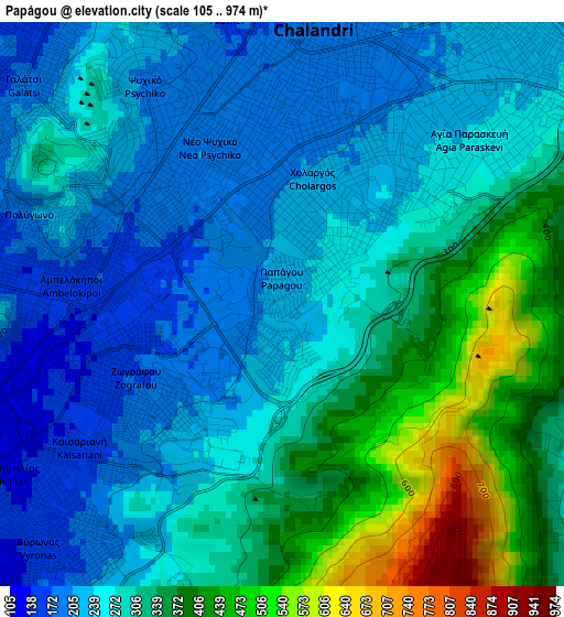
Below is the Elevation map of Papágou, which displays elevation range with different colors. Scale of the first map is from 105 to 974 m (344 to 3196 ft) with average elevation of 292.4 meters (=959 ft) [note 1]
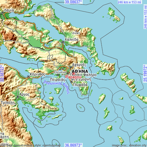
These maps also provides idea of topography and contour of this city, they are displayed at different zoom levels. More info about maps, scale and edge coordinates you can find below images.
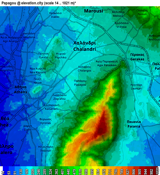
| \ | Map #1 | Map #2 | Topo.Map |
| Scale [m] | 105..974 m | 14..1021 m | × |
| Scale [ft] | 344..3196 ft | 46..3350 ft | × |
| Average | 292.4 m = 959 ft | 232.4 m = 762 ft | × |
| Width | 7.7 km = 4.8 mi | 15.4 km = 9.6 mi | 246.5 km = 153.2 mi |
| Height | 7.7 km = 4.8 mi | 15.4 km = 9.6 mi | 246.5 km = 153.2 mi |
| ↑Max Latitude | 38.021048° | 38.055659° | 39.08637° |
| Latitude at center | 37.98642° | 37.98642° | 37.98642° |
| ↓Min Latitude | 37.951776° | 37.917116° | 36.86973° |
| ← Min Longitude | 23.749525° | 23.705579° | 22.38722° |
| Longitude center | 23.79347° | 23.79347° | 23.79347° |
| →Max Longitude | 23.837415° | 23.881361° | 25.19972° |
Nearby cities:
Cities around Papágou sort by population:
• Khalándrion elevation 194 m
4.2 km,  8°
8°
• Zográfos 176 m
2.4 km,  240°
240°
• Výronas 143 m
4.5 km,  231°
231°
• Agía Paraskeví 216 m
4.8 km,  46°
46°
• Galátsi 177 m
5.1 km,  311°
311°
• Cholargós 219 m
1.6 km,  20°
20°
• Kaisarianí 191 m
3.6 km,  224°
224°
• Néo Psychikó 195 m
2.4 km,  338°
338°
• Psychikó 197 m
3.5 km,  328°
328°
• Filothéi 162 m
4.4 km,  347°
347°
• Leondárion 207 m
5.4 km,  89°
89°
• Kipséli 126 m
5.2 km,  290°
290°
Multilingual:
 En español:
Papágou elevación 222 m.
 En France:
Papágou élévation 222 m.


Sources and notes:
- [note 1] Map square and city borders are not equal. Map elevation data is calculated only from area inside that square.
- [src 1] Elevation data from geonames database provided with same terms of usage.
- [src 2] The elevation map of Papágou is generated using elevation data from NASA's 3 arcsec (90m) resolution SRTM data.
- [src 3] Base (background) map © OpenStreetMap contributors tiles are generated by Geofabrik and OpenTopoMap.
Copyright & License:
This Papágou Elevation Map is licensed under CC BY-SA. You may reuse any part from this page, if you give a proper credit by linking to this URL:
 More info on terms of use page.