Labé elevation
Labé (Labe, Labe Prefecture), Guinea elevation is 1026 meters and Labé elevation in feet is 3366 ft above sea level [src 1]. Labé is a seat of a second-order administrative division (feature code) with elevation that is 593 meters (1946 ft) bigger than average city elevation in Guinea.
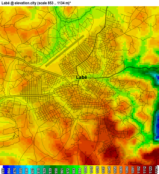
Below is the Elevation map of Labé, which displays elevation range with different colors. Scale of the first map is from 853 to 1134 m (2799 to 3720 ft) with average elevation of 1035.9 meters (=3399 ft) [note 1]
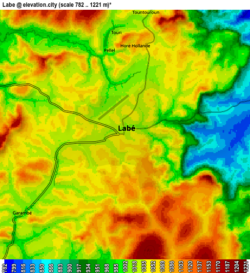
These maps also provides idea of topography and contour of this city, they are displayed at different zoom levels. More info about maps, scale and edge coordinates you can find below images.
| \ | Map #1 | Map #2 | Topo.Map |
| Scale [m] | 853..1134 m | 782..1221 m | × |
| Scale [ft] | 2799..3720 ft | 2566..4006 ft | × |
| Average | 1035.9 m = 3399 ft | 1026.6 m = 3368 ft | × |
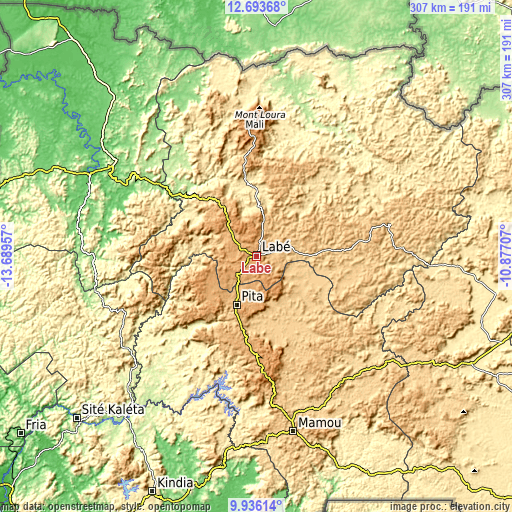
| Width | 9.58 km = 6 mi | 19.17 km = 11.9 mi | 306.6 km = 190.5 mi |
| Height | 9.58 km = 6 mi | 19.16 km = 11.9 mi | 306.6 km = 190.5 mi |
| ↑Max Latitude | 11.361317° | 11.404398° | 12.69368° |
| Latitude at center | 11.31823° | 11.31823° | 11.31823° |
| ↓Min Latitude | 11.275136° | 11.232036° | 9.93614° |
| ← Min Longitude | -12.327265° | -12.371211° | -13.68957° |
| Longitude center | -12.28332° | -12.28332° | -12.28332° |
| →Max Longitude | -12.239375° | -12.195429° | -10.87707° |
Nearby cities:
Cities around Labé sort by population:
• Kindia elevation 415 m
154 km,  204°
204°
• Mamou 720 m
106.9 km,  168°
168°
• Télimélé 610 m
94.1 km,  240°
240°
• Tougué 805 m
68.9 km,  78°
78°
• Pita 973 m
31.3 km, 202°
• Dabola 434 m
143.3 km,  116°
116°
• Tondon 113 m
157.4 km,  227°
227°
• Koubia 750 m
51.8 km,  54°
54°
• Gaoual 79 m
110.8 km,  295°
295°
• Dalaba 1240 m
69.7 km,  176°
176°
• Mali 1440 m
84.6 km,  358°
358°
• Lélouma 955 m
45 km,  285°
285°
Multilingual:
 En español:
Labé elevación 1026 m.
 En France:
Labé élévation 1026 m.


Sources and notes:
- [note 1] Map square and city borders are not equal. Map elevation data is calculated only from area inside that square.
- [src 1] Elevation data from geonames database provided with same terms of usage.
- [src 2] The elevation map of Labé is generated using elevation data from NASA's 3 arcsec (90m) resolution SRTM data.
- [src 3] Base (background) map © OpenStreetMap contributors tiles are generated by Geofabrik and OpenTopoMap.
Copyright & License:
This Labé Elevation Map is licensed under CC BY-SA. You may reuse any part from this page, if you give a proper credit by linking to this URL:
 More info on terms of use page.