Koina elevation
Koina (Upper River), Gambia elevation is 17 meters and Koina elevation in feet is 56 ft above sea level [src 1]. Koina is a populated place (feature code) with elevation that is 4 meters (13 ft) smaller than average city elevation in Gambia.
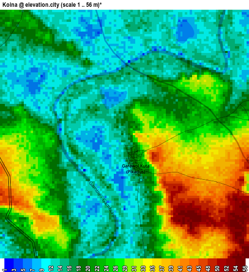
Below is the Elevation map of Koina, which displays elevation range with different colors. Scale of the first map is from 1 to 56 m (3 to 184 ft) with average elevation of 21.5 meters (=71 ft) [note 1]
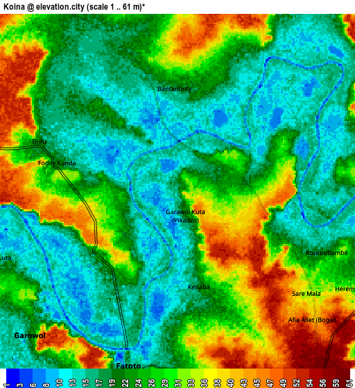
These maps also provides idea of topography and contour of this city, they are displayed at different zoom levels. More info about maps, scale and edge coordinates you can find below images.
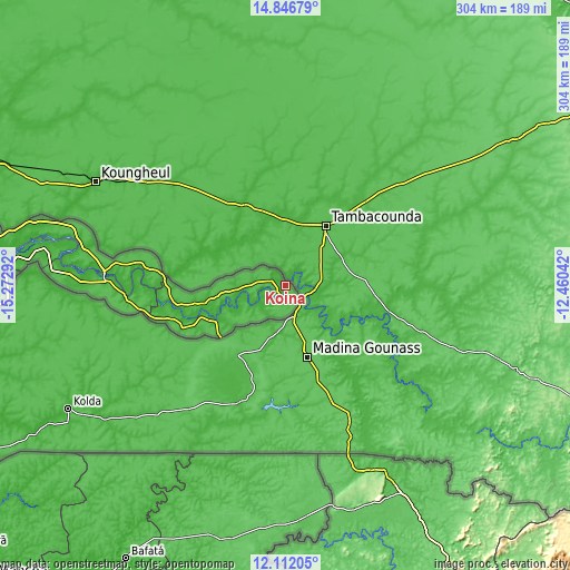
| \ | Map #1 | Map #2 | Topo.Map |
| Scale [m] | 1..56 m | 1..61 m | × |
| Scale [ft] | 3..184 ft | 3..200 ft | × |
| Average | 21.5 m = 71 ft | 24.4 m = 80 ft | × |
| Width | 9.5 km = 5.9 mi | 19.01 km = 11.8 mi | 304.1 km = 189 mi |
| Height | 9.5 km = 5.9 mi | 19.01 km = 11.8 mi | 304.1 km = 189 mi |
| ↑Max Latitude | 13.52606° | 13.568783° | 14.84679° |
| Latitude at center | 13.48333° | 13.48333° | 13.48333° |
| ↓Min Latitude | 13.440592° | 13.397847° | 12.11205° |
| ← Min Longitude | -13.910615° | -13.954561° | -15.27292° |
| Longitude center | -13.86667° | -13.86667° | -13.86667° |
| →Max Longitude | -13.822725° | -13.778779° | -12.46042° |
Nearby cities:
Cities around Koina sort by population:
• Basse Santa Su elevation 15 m
42.2 km,  242°
242°
• Sabi 39 m
45.5 km,  232°
232°
• Sutukoba 29 m
16.3 km,  276°
276°
• Nyamanari 48 m
16.7 km,  180°
180°
• Kumbija 38 m
41.9 km, 234°
• Gunjur Kuta 48 m
27.6 km, 281°
• Sudowol 23 m
16.9 km,  219°
219°
• Sun Kunda 29 m
11.3 km,  170°
170°
• Daba Kunda 20 m
50.4 km,  248°
248°
• Brifu 27 m
7.4 km, 284°
• Diabugu Basilla 19 m
19 km,  208°
208°
• Perai 14 m
21.2 km, 238°
Multilingual:
 En español:
Koina elevación 17 m.
 En France:
Koina élévation 17 m.


Sources and notes:
- [note 1] Map square and city borders are not equal. Map elevation data is calculated only from area inside that square.
- [src 1] Elevation data from geonames database provided with same terms of usage.
- [src 2] The elevation map of Koina is generated using elevation data from NASA's 3 arcsec (90m) resolution SRTM data.
- [src 3] Base (background) map © OpenStreetMap contributors tiles are generated by Geofabrik and OpenTopoMap.
Copyright & License:
This Koina Elevation Map is licensed under CC BY-SA. You may reuse any part from this page, if you give a proper credit by linking to this URL:
 More info on terms of use page.