Kauhajoki elevation
Kauhajoki (Southern Ostrobothnia, Suupohja), Finland elevation is 101 meters and Kauhajoki elevation in feet is 331 ft above sea level [src 1]. Kauhajoki is a seat of a third-order administrative division (feature code) with elevation that is 24 meters (79 ft) bigger than average city elevation in Finland.
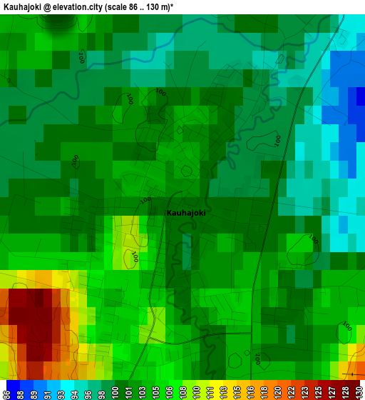
Below is the Elevation map of Kauhajoki, which displays elevation range with different colors. Scale of the first map is from 86 to 130 m (282 to 427 ft) with average elevation of 102 meters (=335 ft) [note 1]
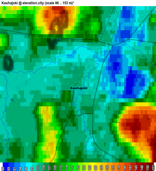
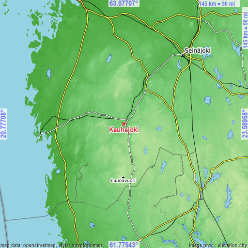
These maps also provides idea of topography and contour of this city, they are displayed at different zoom levels. More info about maps, scale and edge coordinates you can find below images.
| \ | Map #1 | Map #2 | Topo.Map |
| Scale [m] | 86..130 m | 86..153 m | × |
| Scale [ft] | 282..427 ft | 282..502 ft | × |
| Average | 102 m = 335 ft | 107.3 m = 352 ft | × |
| Width | 4.52 km = 2.8 mi | 9.05 km = 5.6 mi | 144.7 km = 89.9 mi |
| Height | 4.52 km = 2.8 mi | 9.05 km = 5.6 mi | 144.7 km = 89.9 mi |
| ↑Max Latitude | 62.45366° | 62.473976° | 63.07707° |
| Latitude at center | 62.43333° | 62.43333° | 62.43333° |
| ↓Min Latitude | 62.412986° | 62.392628° | 61.77543° |
| ← Min Longitude | 22.139385° | 22.095439° | 20.77708° |
| Longitude center | 22.18333° | 22.18333° | 22.18333° |
| →Max Longitude | 22.227275° | 22.271221° | 23.58958° |
Nearby cities:
Cities around Kauhajoki sort by population:
• Ilmajoki elevation 41 m
38.7 km,  30°
30°
• Kurikka 62 m
23.6 km, 30°
• Jalasjärvi 94 m
30.1 km,  75°
75°
• Kristinestad 11 m
45.3 km,  246°
246°
• Teuva 63 m
23.3 km,  283°
283°
• Jurva 96 m
29.6 km,  339°
339°
• Karvia 139 m
38.8 km,  149°
149°
• Isojoki 114 m
37.4 km,  198°
198°
• Karijoki 52 m
28.1 km,  240°
240°
• Kaskinen 4 m
49.7 km,  263°
263°
• Närpes 14 m
43.7 km, 275°
• Karvia 151 m
35.4 km,  137°
137°
Multilingual:
 En español:
Kauhajoki elevación 101 m.
 En France:
Kauhajoki élévation 101 m.
 Auf Deutsch:
Kauhajoki höhe über dem Meeresspiegel ist 101 m.

Sources and notes:
- [note 1] Map square and city borders are not equal. Map elevation data is calculated only from area inside that square.
- [src 1] Elevation data from geonames database provided with same terms of usage.
- [src 2] The elevation map of Kauhajoki is generated using GMTED2010 database with 7.5 arcsec (225m) resolution.
- [src 3] Base (background) map © OpenStreetMap contributors tiles are generated by Geofabrik and OpenTopoMap.
Copyright & License:
This Kauhajoki Elevation Map is licensed under CC BY-SA. You may reuse any part from this page, if you give a proper credit by linking to this URL:
 More info on terms of use page.