Lieksa elevation
Lieksa (North Karelia, Pielisen Karjala), Finland elevation is 95 meters and Lieksa elevation in feet is 312 ft above sea level [src 1]. Lieksa is a seat of a third-order administrative division (feature code) with elevation that is 18 meters (59 ft) bigger than average city elevation in Finland.
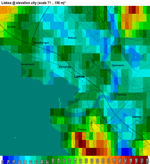
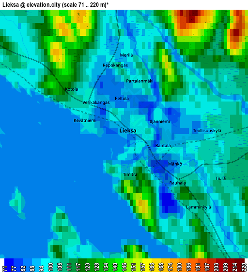
Below is the Elevation map of Lieksa, which displays elevation range with different colors. Scale of the first map is from 71 to 156 m (233 to 512 ft) with average elevation of 95.6 meters (=314 ft) [note 1]
These maps also provides idea of topography and contour of this city, they are displayed at different zoom levels. More info about maps, scale and edge coordinates you can find below images.
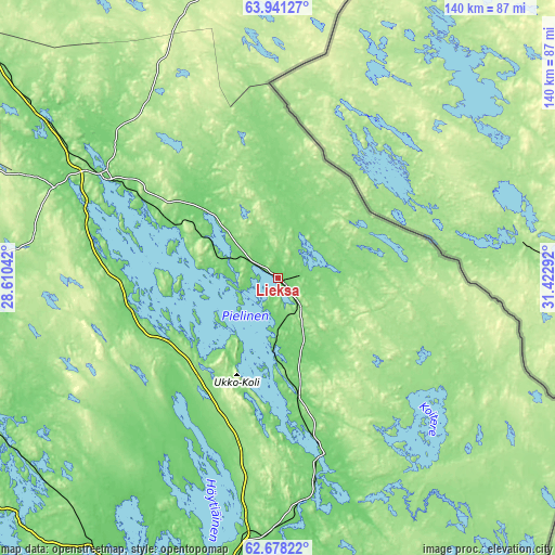
| \ | Map #1 | Map #2 | Topo.Map |
| Scale [m] | 71..156 m | 71..220 m | × |
| Scale [ft] | 233..512 ft | 233..722 ft | × |
| Average | 95.6 m = 314 ft | 103.8 m = 341 ft | × |
| Width | 4.39 km = 2.7 mi | 8.78 km = 5.5 mi | 140.4 km = 87.2 mi |
| Height | 4.39 km = 2.7 mi | 8.78 km = 5.5 mi | 140.4 km = 87.2 mi |
| ↑Max Latitude | 63.336397° | 63.356111° | 63.94127° |
| Latitude at center | 63.31667° | 63.31667° | 63.31667° |
| ↓Min Latitude | 63.296929° | 63.277175° | 62.67822° |
| ← Min Longitude | 29.972725° | 29.928779° | 28.61042° |
| Longitude center | 30.01667° | 30.01667° | 30.01667° |
| →Max Longitude | 30.060615° | 30.104561° | 31.42292° |
Nearby cities:
Cities around Lieksa sort by population:
• Joensuu elevation 72 m
80.6 km,  189°
189°
• Kontiolahti 138 m
62.5 km, 187°
• Nurmes 91 m
50.3 km,  299°
299°
• Outokumpu 116 m
82.8 km,  217°
217°
• Eno 90 m
57.3 km,  173°
173°
• Ilomantsi 149 m
85.3 km,  147°
147°
• Juuka 115 m
39.4 km,  256°
256°
• Juankoski 98 m
88.1 km,  251°
251°
• Polvijärvi 97 m
61.3 km,  212°
212°
• Kaavi 114 m
84.7 km,  244°
244°
• Valtimo 100 m
71.8 km, 302°
• Rautavaara 139 m
87.4 km,  282°
282°
Multilingual:
 En español:
Lieksa elevación 95 m.
 En France:
Lieksa élévation 95 m.


Sources and notes:
- [note 1] Map square and city borders are not equal. Map elevation data is calculated only from area inside that square.
- [src 1] Elevation data from geonames database provided with same terms of usage.
- [src 2] The elevation map of Lieksa is generated using GMTED2010 database with 7.5 arcsec (225m) resolution.
- [src 3] Base (background) map © OpenStreetMap contributors tiles are generated by Geofabrik and OpenTopoMap.
Copyright & License:
This Lieksa Elevation Map is licensed under CC BY-SA. You may reuse any part from this page, if you give a proper credit by linking to this URL:
 More info on terms of use page.