Nivala elevation
Nivala (Northern Ostrobothnia, Nivala-Haapajärvi), Finland elevation is 91 meters and Nivala elevation in feet is 299 ft above sea level [src 1]. Nivala is a seat of a third-order administrative division (feature code) with elevation that is 14 meters (46 ft) bigger than average city elevation in Finland.
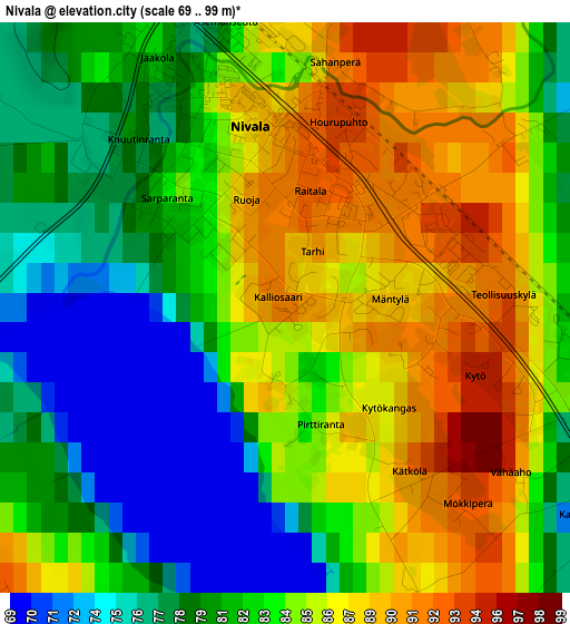
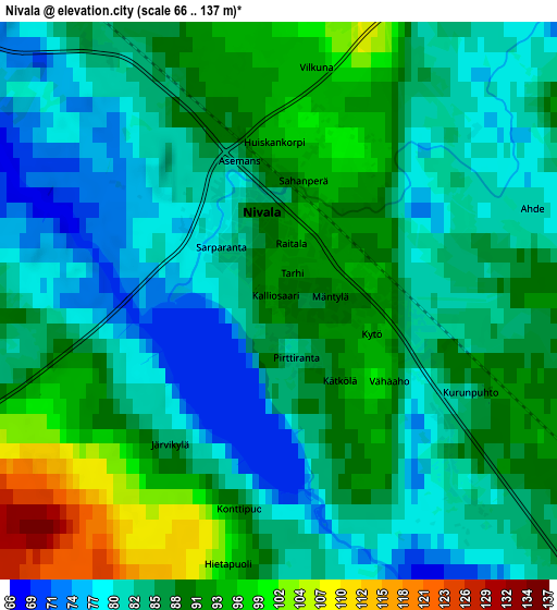
Below is the Elevation map of Nivala, which displays elevation range with different colors. Scale of the first map is from 69 to 99 m (226 to 325 ft) with average elevation of 83 meters (=272 ft) [note 1]
These maps also provides idea of topography and contour of this city, they are displayed at different zoom levels. More info about maps, scale and edge coordinates you can find below images.
| \ | Map #1 | Map #2 | Topo.Map |
| Scale [m] | 69..99 m | 66..137 m | × |
| Scale [ft] | 226..325 ft | 217..449 ft | × |
| Average | 83 m = 272 ft | 86.1 m = 282 ft | × |
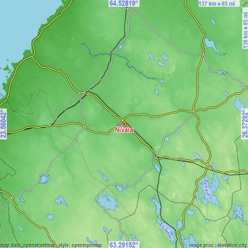
| Width | 4.3 km = 2.7 mi | 8.59 km = 5.3 mi | 137.5 km = 85.4 mi |
| Height | 4.3 km = 2.7 mi | 8.59 km = 5.3 mi | 137.5 km = 85.4 mi |
| ↑Max Latitude | 63.935985° | 63.955287° | 64.52819° |
| Latitude at center | 63.91667° | 63.91667° | 63.91667° |
| ↓Min Latitude | 63.897342° | 63.878° | 63.29152° |
| ← Min Longitude | 24.922725° | 24.878779° | 23.56042° |
| Longitude center | 24.96667° | 24.96667° | 24.96667° |
| →Max Longitude | 25.010615° | 25.054561° | 26.37292° |
Nearby cities:
Cities around Nivala sort by population:
• Ylivieska elevation 57 m
27.5 km,  312°
312°
• Oulainen 72 m
39.7 km,  348°
348°
• Haapavesi 84 m
31 km,  38°
38°
• Haapajärvi 102 m
25.8 km,  135°
135°
• Kannus 62 m
52.2 km,  267°
267°
• Sievi 98 m
22.9 km, 265°
• Toholampi 94 m
38.9 km,  244°
244°
• Reisjärvi 119 m
33.5 km,  185°
185°
• Kärsämäki 112 m
39.5 km,  81°
81°
• Alavieska 49 m
42.7 km, 310°
• Merijärvi 49 m
49.5 km,  329°
329°
• Lestijärvi 155 m
45.4 km,  200°
200°
Multilingual:
 En español:
Nivala elevación 91 m.
 En France:
Nivala élévation 91 m.


Sources and notes:
- [note 1] Map square and city borders are not equal. Map elevation data is calculated only from area inside that square.
- [src 1] Elevation data from geonames database provided with same terms of usage.
- [src 2] The elevation map of Nivala is generated using GMTED2010 database with 7.5 arcsec (225m) resolution.
- [src 3] Base (background) map © OpenStreetMap contributors tiles are generated by Geofabrik and OpenTopoMap.
Copyright & License:
This Nivala Elevation Map is licensed under CC BY-SA. You may reuse any part from this page, if you give a proper credit by linking to this URL:
 More info on terms of use page.