Pyhäjoki elevation
Pyhäjoki (Northern Ostrobothnia, Raahe), Finland elevation is 3 meters and Pyhäjoki elevation in feet is 10 ft above sea level [src 1]. Pyhäjoki is a seat of a third-order administrative division (feature code) with elevation that is 74 meters (243 ft) smaller than average city elevation in Finland.
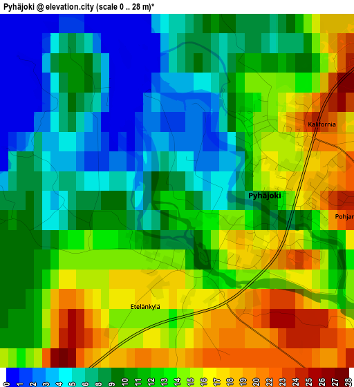
Below is the Elevation map of Pyhäjoki, which displays elevation range with different colors. Scale of the first map is from 0 to 28 m (0 to 92 ft) with average elevation of 11.6 meters (=38 ft) [note 1]
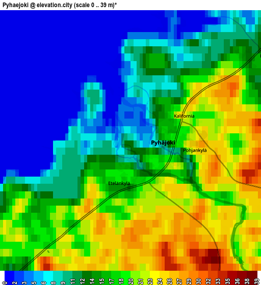
These maps also provides idea of topography and contour of this city, they are displayed at different zoom levels. More info about maps, scale and edge coordinates you can find below images.
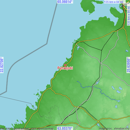
| \ | Map #1 | Map #2 | Topo.Map |
| Scale [m] | 0..28 m | 0..39 m | × |
| Scale [ft] | 0..92 ft | 0..128 ft | × |
| Average | 11.6 m = 38 ft | 13.2 m = 43 ft | × |
| Width | 4.21 km = 2.6 mi | 8.42 km = 5.2 mi | 134.8 km = 83.8 mi |
| Height | 4.21 km = 2.6 mi | 8.42 km = 5.2 mi | 134.8 km = 83.8 mi |
| ↑Max Latitude | 64.485605° | 64.504528° | 65.06614° |
| Latitude at center | 64.46667° | 64.46667° | 64.46667° |
| ↓Min Latitude | 64.447721° | 64.42876° | 63.85378° |
| ← Min Longitude | 24.189385° | 24.145439° | 22.82708° |
| Longitude center | 24.23333° | 24.23333° | 24.23333° |
| →Max Longitude | 24.277275° | 24.321221° | 25.63958° |
Nearby cities:
Cities around Pyhäjoki sort by population:
• Raahe elevation 5 m
26.9 km,  26°
26°
• Ylivieska 57 m
45.3 km,  160°
160°
• Kalajoki 16 m
27.7 km,  209°
209°
• Oulainen 72 m
35.2 km,  129°
129°
• Ruukki 48 m
47 km,  61°
61°
• Vihanti 99 m
36.4 km,  86°
86°
• Himanka 14 m
53 km, 211°
• Lohtaja 13 m
60.4 km,  215°
215°
• Alavieska 49 m
33.5 km,  174°
174°
• Lumijoki 8 m
61.3 km,  47°
47°
• Merijärvi 49 m
21.3 km,  150°
150°
• Siikajoki 18 m
46.1 km, 32°
Multilingual:
 En español:
Pyhäjoki elevación 3 m.
 En France:
Pyhäjoki élévation 3 m.


Sources and notes:
- [note 1] Map square and city borders are not equal. Map elevation data is calculated only from area inside that square.
- [src 1] Elevation data from geonames database provided with same terms of usage.
- [src 2] The elevation map of Pyhäjoki is generated using GMTED2010 database with 7.5 arcsec (225m) resolution.
- [src 3] Base (background) map © OpenStreetMap contributors tiles are generated by Geofabrik and OpenTopoMap.
Copyright & License:
This Pyhäjoki Elevation Map is licensed under CC BY-SA. You may reuse any part from this page, if you give a proper credit by linking to this URL:
 More info on terms of use page.