Suodenniemi elevation
Suodenniemi (Pirkanmaa, Lounais-Pirkanmaa), Finland elevation is 92 meters and Suodenniemi elevation in feet is 302 ft above sea level [src 1]. Suodenniemi is a populated place (feature code) with elevation that is 15 meters (49 ft) bigger than average city elevation in Finland.
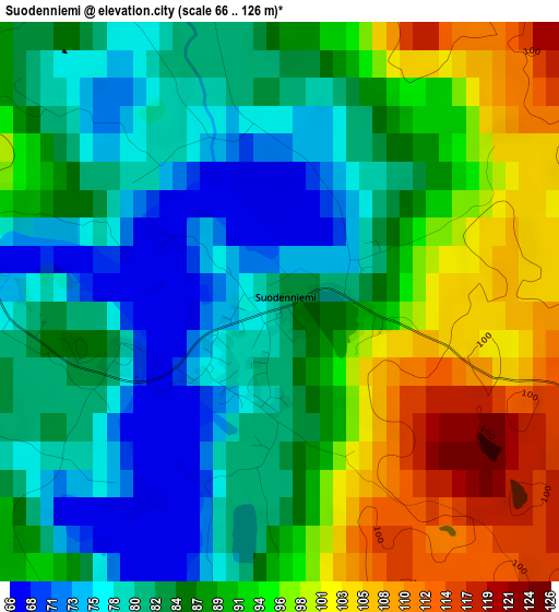
Below is the Elevation map of Suodenniemi, which displays elevation range with different colors. Scale of the first map is from 66 to 126 m (217 to 413 ft) with average elevation of 87.9 meters (=288 ft) [note 1]
These maps also provides idea of topography and contour of this city, they are displayed at different zoom levels. More info about maps, scale and edge coordinates you can find below images.
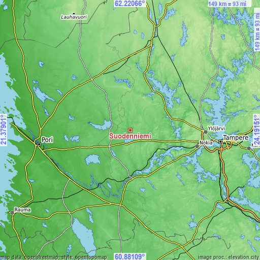
| \ | Map #1 | Topo.Map |
| Scale [m] | 66..126 m | × |
| Scale [ft] | 217..413 ft | × |
| Average | 87.9 m = 288 ft | × |
| Width | 4.65 km = 2.9 mi | 148.9 km = 92.5 mi |
| Height | 4.65 km = 2.9 mi | 148.9 km = 92.5 mi |
| ↑Max Latitude | 61.579023° | 62.22066° |
| Latitude at center | 61.5581° | 61.5581° |
| ↓Min Latitude | 61.537163° | 60.88109° |
| ← Min Longitude | 22.741315° | 21.37901° |
| Longitude center | 22.78526° | 22.78526° |
| →Max Longitude | 22.829205° | 24.19151° |
Nearby cities:
Cities around Suodenniemi sort by population:
• Vammala elevation 68 m
25.7 km,  166°
166°
• Kankaanpää 105 m
33.2 km,  324°
324°
• Hämeenkyrö 65 m
23.5 km,  67°
67°
• Ikaalinen 101 m
27.8 km,  32°
32°
• Äetsä 55 m
31 km,  190°
190°
• Mouhijärvi 121 m
13.9 km,  117°
117°
• Jämijärvi 115 m
29.1 km,  351°
351°
• Viljakkala 96 m
30.3 km,  57°
57°
• Lavia 85 m
10.9 km,  295°
295°
• Längelmäki 52 m
37.6 km,  285°
285°
• Kullaa 35 m
34.5 km,  253°
253°
• Kiikoinen 54 m
16 km,  223°
223°
Multilingual:
 En español:
Suodenniemi elevación 92 m.
 En France:
Suodenniemi élévation 92 m.
 Auf Deutsch:
Suodenniemi höhe über dem Meeresspiegel ist 92 m.

Sources and notes:
- [note 1] Map square and city borders are not equal. Map elevation data is calculated only from area inside that square.
- [src 1] Elevation data from geonames database provided with same terms of usage.
- [src 2] The elevation map of Suodenniemi is generated using GMTED2010 database with 7.5 arcsec (225m) resolution.
- [src 3] Base (background) map © OpenStreetMap contributors tiles are generated by Geofabrik and OpenTopoMap.
Copyright & License:
This Suodenniemi Elevation Map is licensed under CC BY-SA. You may reuse any part from this page, if you give a proper credit by linking to this URL:
 More info on terms of use page.