Tervola elevation
Tervola (Lapland, Kemi-Tornio), Finland elevation is 46 meters and Tervola elevation in feet is 151 ft above sea level [src 1]. Tervola is a seat of a third-order administrative division (feature code) with elevation that is 31 meters (102 ft) smaller than average city elevation in Finland.
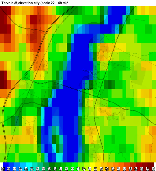
Below is the Elevation map of Tervola, which displays elevation range with different colors. Scale of the first map is from 22 to 69 m (72 to 226 ft) with average elevation of 43.1 meters (=141 ft) [note 1]
These maps also provides idea of topography and contour of this city, they are displayed at different zoom levels. More info about maps, scale and edge coordinates you can find below images.
| \ | Map #1 | Map #2 | Topo.Map |
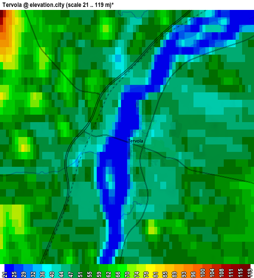
| Scale [m] | 22..69 m | 21..119 m | × |
| Scale [ft] | 72..226 ft | 69..390 ft | × |
| Average | 43.1 m = 141 ft | 49.9 m = 164 ft | × |
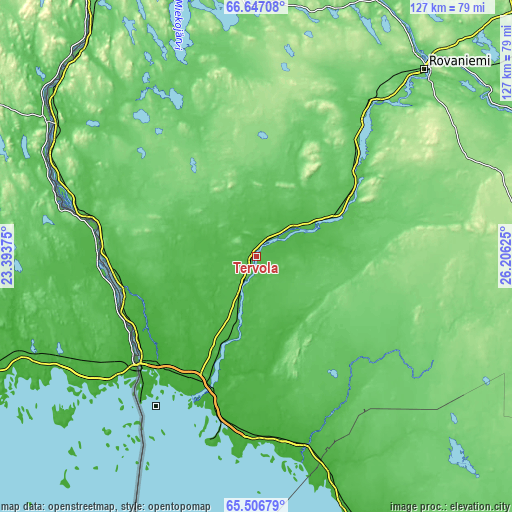
| Width | 3.96 km = 2.5 mi | 7.92 km = 4.9 mi | 126.8 km = 78.8 mi |
| Height | 3.96 km = 2.5 mi | 7.92 km = 4.9 mi | 126.8 km = 78.8 mi |
| ↑Max Latitude | 66.10114° | 66.118937° | 66.64708° |
| Latitude at center | 66.08333° | 66.08333° | 66.08333° |
| ↓Min Latitude | 66.065508° | 66.047673° | 65.50679° |
| ← Min Longitude | 24.756055° | 24.712109° | 23.39375° |
| Longitude center | 24.8° | 24.8° | 24.8° |
| →Max Longitude | 24.843945° | 24.887891° | 26.20625° |
Nearby cities:
Cities around Tervola sort by population:
• Rovaniemi elevation 92 m
61.9 km,  41°
41°
• Kemi 16 m
40 km,  195°
195°
• Tornio 6 m
39.5 km,  228°
228°
• Haukipudas 12 m
104 km,  165°
165°
• Keminmaa 13 m
33.4 km, 200°
• Ii 12 m
89.1 km,  162°
162°
• Ylitornio 143 m
56.3 km,  296°
296°
• Ranua 152 m
80.5 km,  103°
103°
• Pello 61 m
85.3 km,  334°
334°
• Simo 19 m
47.7 km, 166°
• Yli-Ii 51 m
92.4 km,  148°
148°
• Kuivaniemi 11 m
58.9 km, 162°
Multilingual:
 En español:
Tervola elevación 46 m.
 En France:
Tervola élévation 46 m.


Sources and notes:
- [note 1] Map square and city borders are not equal. Map elevation data is calculated only from area inside that square.
- [src 1] Elevation data from geonames database provided with same terms of usage.
- [src 2] The elevation map of Tervola is generated using GMTED2010 database with 7.5 arcsec (225m) resolution.
- [src 3] Base (background) map © OpenStreetMap contributors tiles are generated by Geofabrik and OpenTopoMap.
Copyright & License:
This Tervola Elevation Map is licensed under CC BY-SA. You may reuse any part from this page, if you give a proper credit by linking to this URL:
 More info on terms of use page.