Toijala elevation
Toijala (Pirkanmaa, Etelä-Pirkanmaa), Finland elevation is 103 meters and Toijala elevation in feet is 338 ft above sea level [src 1]. Toijala is a section of populated place (feature code) with elevation that is 26 meters (85 ft) bigger than average city elevation in Finland.
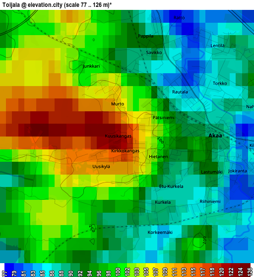
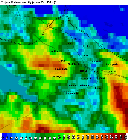
Below is the Elevation map of Toijala, which displays elevation range with different colors. Scale of the first map is from 77 to 126 m (253 to 413 ft) with average elevation of 97 meters (=318 ft) [note 1]
These maps also provides idea of topography and contour of this city, they are displayed at different zoom levels. More info about maps, scale and edge coordinates you can find below images.
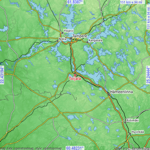
| \ | Map #1 | Map #2 | Topo.Map |
| Scale [m] | 77..126 m | 73..134 m | × |
| Scale [ft] | 253..413 ft | 240..440 ft | × |
| Average | 97 m = 318 ft | 94.6 m = 310 ft | × |
| Width | 4.71 km = 2.9 mi | 9.43 km = 5.9 mi | 150.8 km = 93.7 mi |
| Height | 4.71 km = 2.9 mi | 9.43 km = 5.9 mi | 150.8 km = 93.7 mi |
| ↑Max Latitude | 61.188985° | 61.210156° | 61.8387° |
| Latitude at center | 61.1678° | 61.1678° | 61.1678° |
| ↓Min Latitude | 61.1466° | 61.125387° | 60.48231° |
| ← Min Longitude | 23.794245° | 23.750299° | 22.43194° |
| Longitude center | 23.83819° | 23.83819° | 23.83819° |
| →Max Longitude | 23.882135° | 23.926081° | 25.24444° |
Nearby cities:
Cities around Toijala sort by population:
• Kangasala elevation 100 m
35.3 km,  21°
21°
• Valkeakoski 98 m
14.9 km,  43°
43°
• Lempäälä 85 m
17.2 km,  344°
344°
• Pirkkala 101 m
34.4 km, 341°
• Akaa 84 m
1.5 km,  94°
94°
• Urjala 111 m
18.9 km,  240°
240°
• Viiala 78 m
6.1 km,  321°
321°
• Pälkäne 93 m
29.7 km,  51°
51°
• Vesilahti 93 m
20.4 km, 324°
• Kalvola 137 m
16.9 km,  116°
116°
• Kylmäkoski 85 m
8.2 km,  259°
259°
• Parola 119 m
30.9 km, 115°
Multilingual:
 En español:
Toijala elevación 103 m.
 En France:
Toijala élévation 103 m.


Sources and notes:
- [note 1] Map square and city borders are not equal. Map elevation data is calculated only from area inside that square.
- [src 1] Elevation data from geonames database provided with same terms of usage.
- [src 2] The elevation map of Toijala is generated using GMTED2010 database with 7.5 arcsec (225m) resolution.
- [src 3] Base (background) map © OpenStreetMap contributors tiles are generated by Geofabrik and OpenTopoMap.
Copyright & License:
This Toijala Elevation Map is licensed under CC BY-SA. You may reuse any part from this page, if you give a proper credit by linking to this URL:
 More info on terms of use page.