Abnūb elevation
Abnūb (Asyut), Egypt elevation is 57 meters and Abnūb elevation in feet is 187 ft above sea level [src 1]. Abnūb is a populated place (feature code) with elevation that is 13 meters (43 ft) bigger than average city elevation in Egypt.
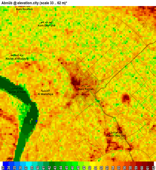
Below is the Elevation map of Abnūb, which displays elevation range with different colors. Scale of the first map is from 33 to 62 m (108 to 203 ft) with average elevation of 51.1 meters (=168 ft) [note 1]
These maps also provides idea of topography and contour of this city, they are displayed at different zoom levels. More info about maps, scale and edge coordinates you can find below images.
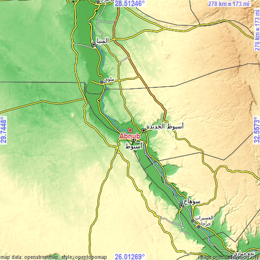
| \ | Map #1 | Map #2 | Topo.Map |
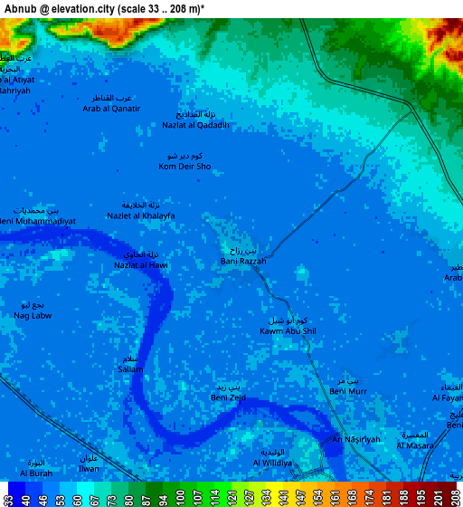
| Scale [m] | 33..62 m | 33..208 m | × |
| Scale [ft] | 108..203 ft | 108..682 ft | × |
| Average | 51.1 m = 168 ft | 58 m = 190 ft | × |
| Width | 8.69 km = 5.4 mi | 17.37 km = 10.8 mi | 277.9 km = 172.7 mi |
| Height | 8.69 km = 5.4 mi | 17.37 km = 10.8 mi | 278 km = 172.7 mi |
| ↑Max Latitude | 27.308654° | 27.347695° | 28.51246° |
| Latitude at center | 27.2696° | 27.2696° | 27.2696° |
| ↓Min Latitude | 27.230532° | 27.19145° | 26.01269° |
| ← Min Longitude | 31.107105° | 31.063159° | 29.7448° |
| Longitude center | 31.15105° | 31.15105° | 31.15105° |
| →Max Longitude | 31.194995° | 31.238941° | 32.5573° |
Nearby cities:
Cities around Abnūb sort by population:
• Asyūţ elevation 56 m
10.4 km,  161°
161°
• Sohag 67 m
95.8 km,  145°
145°
• Mallawī 52 m
59.7 km,  329°
329°
• Ţahţā 66 m
65.6 km, 147°
• Manfalūţ 53 m
18.5 km,  284°
284°
• Abū Tīj 65 m
30.1 km, 146°
• Al Qūşīyah 54 m
37.9 km,  300°
300°
• Dayrūţ 52 m
46.5 km,  313°
313°
• Abū Qurqāş 54 m
79.8 km,  337°
337°
• Juhaynah 64 m
74.7 km, 152°
• Al Badārī 63 m
40.4 km,  139°
139°
• Dayr Mawās 48 m
51.1 km,  324°
324°
Multilingual:
 En español:
Abnūb elevación 57 m.
 En France:
Abnūb élévation 57 m.


Sources and notes:
- [note 1] Map square and city borders are not equal. Map elevation data is calculated only from area inside that square.
- [src 1] Elevation data from geonames database provided with same terms of usage.
- [src 2] The elevation map of Abnūb is generated using elevation data from NASA's 3 arcsec (90m) resolution SRTM data.
- [src 3] Base (background) map © OpenStreetMap contributors tiles are generated by Geofabrik and OpenTopoMap.
Copyright & License:
This Abnūb Elevation Map is licensed under CC BY-SA. You may reuse any part from this page, if you give a proper credit by linking to this URL:
 More info on terms of use page.