Arish elevation
Arish (North Sinai), Egypt elevation is 15 meters and Arish elevation in feet is 49 ft above sea level [src 1]. Arish is a seat of a first-order administrative division (feature code) with elevation that is 29 meters (95 ft) smaller than average city elevation in Egypt.
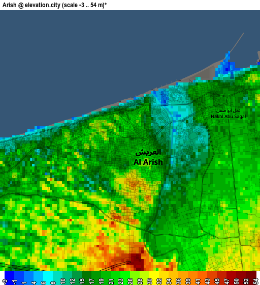
Below is the Elevation map of Arish, which displays elevation range with different colors. Scale of the first map is from -3 to 54 m (-10 to 177 ft) with average elevation of 21.7 meters (=71 ft) [note 1]
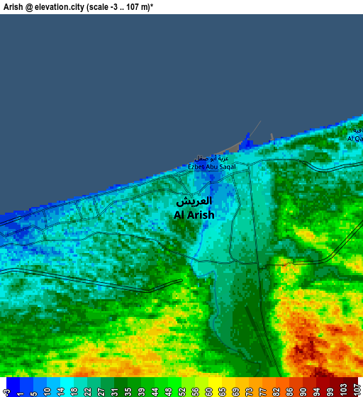
These maps also provides idea of topography and contour of this city, they are displayed at different zoom levels. More info about maps, scale and edge coordinates you can find below images.
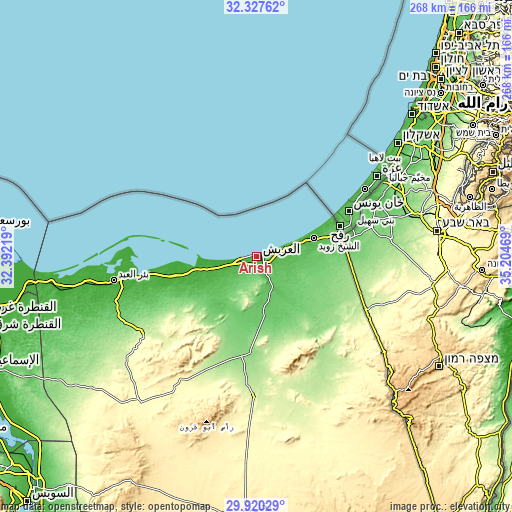
| \ | Map #1 | Map #2 | Topo.Map |
| Scale [m] | -3..54 m | -3..107 m | × |
| Scale [ft] | -10..177 ft | -10..351 ft | × |
| Average | 21.7 m = 71 ft | 35.5 m = 116 ft | × |
| Width | 8.37 km = 5.2 mi | 16.73 km = 10.4 mi | 267.7 km = 166.3 mi |
| Height | 8.37 km = 5.2 mi | 16.73 km = 10.4 mi | 267.7 km = 166.3 mi |
| ↑Max Latitude | 31.169199° | 31.206793° | 32.32762° |
| Latitude at center | 31.13159° | 31.13159° | 31.13159° |
| ↓Min Latitude | 31.093966° | 31.056327° | 29.92029° |
| ← Min Longitude | 33.754495° | 33.710549° | 32.39219° |
| Longitude center | 33.79844° | 33.79844° | 33.79844° |
| →Max Longitude | 33.842385° | 33.886331° | 35.20469° |
Nearby cities:
Cities around Arish sort by population:
• Port Said elevation 6 m
144.7 km,  275°
275°
• Suez 11 m
177.2 km,  223°
223°
• Ismailia 14 m
157 km,  248°
248°
• Al Maţarīyah 10 m
168.3 km,  271°
271°
• Damietta 16 m
191.3 km, 279°
• Al Jammālīyah 11 m
184.1 km, 271°
• Al Manzalah 9 m
177.3 km, 270°
• Fāqūs 15 m
196.1 km,  256°
256°
• ‘Izbat al Burj 8 m
190.6 km, 282°
• Bi’r al ‘Abd 12 m
76.1 km, 260°
• Rafaḩ 60 m
45.1 km,  68°
68°
• Ash Shaykh Zuwayd 24 m
31.2 km, 72°
Multilingual:
 En español:
El Arish elevación 15 m.
 En France:
El-Arich élévation 15 m.
 Auf Deutsch:
Al-Arisch höhe über dem Meeresspiegel ist 15 m.

Sources and notes:
- [note 1] Map square and city borders are not equal. Map elevation data is calculated only from area inside that square.
- [src 1] Elevation data from geonames database provided with same terms of usage.
- [src 2] The elevation map of Arish is generated using elevation data from NASA's 3 arcsec (90m) resolution SRTM data.
- [src 3] Base (background) map © OpenStreetMap contributors tiles are generated by Geofabrik and OpenTopoMap.
Copyright & License:
This Arish Elevation Map is licensed under CC BY-SA. You may reuse any part from this page, if you give a proper credit by linking to this URL:
 More info on terms of use page.