Paide elevation
Paide (Järvamaa, Paide linn), Estonia elevation is 66 meters and Paide elevation in feet is 217 ft above sea level [src 1]. Paide is a seat of a first-order administrative division (feature code) with elevation that is 15 meters (49 ft) bigger than average city elevation in Estonia.
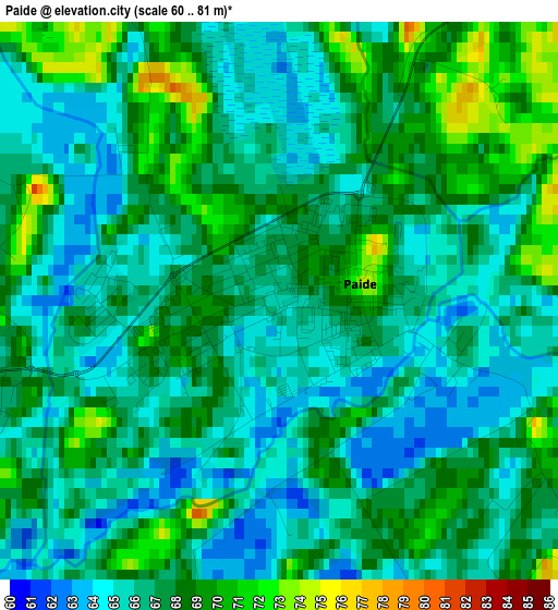
Below is the Elevation map of Paide, which displays elevation range with different colors. Scale of the first map is from 60 to 81 m (197 to 266 ft) with average elevation of 66.7 meters (=219 ft) [note 1]
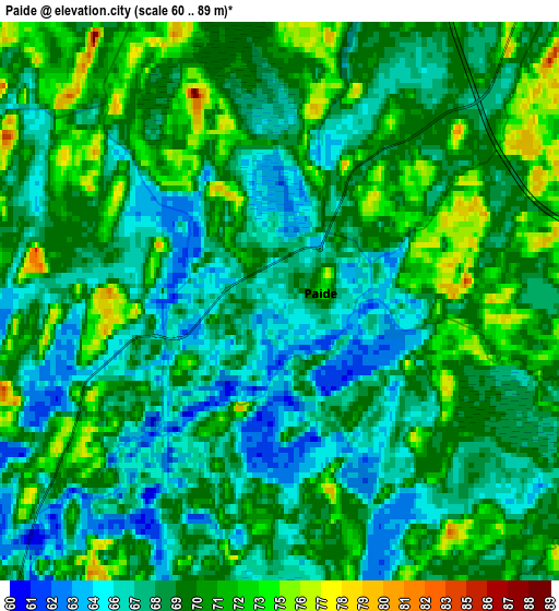
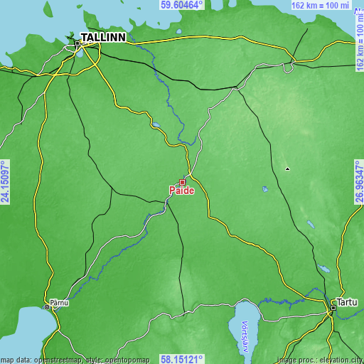
These maps also provides idea of topography and contour of this city, they are displayed at different zoom levels. More info about maps, scale and edge coordinates you can find below images.
| \ | Map #1 | Map #2 | Topo.Map |
| Scale [m] | 60..81 m | 60..89 m | × |
| Scale [ft] | 197..266 ft | 197..292 ft | × |
| Average | 66.7 m = 219 ft | 68.9 m = 226 ft | × |
| Width | 5.05 km = 3.1 mi | 10.1 km = 6.3 mi | 161.6 km = 100.4 mi |
| Height | 5.05 km = 3.1 mi | 10.1 km = 6.3 mi | 161.6 km = 100.4 mi |
| ↑Max Latitude | 58.908261° | 58.930948° | 59.60464° |
| Latitude at center | 58.88556° | 58.88556° | 58.88556° |
| ↓Min Latitude | 58.862844° | 58.840113° | 58.15121° |
| ← Min Longitude | 25.513275° | 25.469329° | 24.15097° |
| Longitude center | 25.55722° | 25.55722° | 25.55722° |
| →Max Longitude | 25.601165° | 25.645111° | 26.96347° |
Nearby cities:
Cities around Paide sort by population:
• Türi elevation 67 m
11.2 km,  219°
219°
• Põltsamaa 69 m
35.2 km,  137°
137°
• Vändra 42 m
40 km,  228°
228°
• Kehtna 65 m
39.3 km,  277°
277°
• Võhma 57 m
28.6 km,  181°
181°
• Järvakandi 65 m
43.7 km,  254°
254°
• Koeru 102 m
28.5 km,  72°
72°
• Suure-Jaani 78 m
39.2 km,  187°
187°
• Järva-Jaani 103 m
25.4 km,  47°
47°
• Rakke 104 m
41.4 km,  75°
75°
• Särevere 62 m
13 km,  214°
214°
• Kose 64 m
39.3 km,  326°
326°
Multilingual:
 En español:
Paide elevación 66 m.
 En France:
Paide élévation 66 m.
 Auf Deutsch:
Weissenstein, Paide höhe über dem Meeresspiegel ist 66 m.

Sources and notes:
- [note 1] Map square and city borders are not equal. Map elevation data is calculated only from area inside that square.
- [src 1] Elevation data from geonames database provided with same terms of usage.
- [src 2] The elevation map of Paide is generated using elevation data from NASA's 3 arcsec (90m) resolution SRTM data.
- [src 3] Base (background) map © OpenStreetMap contributors tiles are generated by Geofabrik and OpenTopoMap.
Copyright & License:
This Paide Elevation Map is licensed under CC BY-SA. You may reuse any part from this page, if you give a proper credit by linking to this URL:
 More info on terms of use page.