Paldiski elevation
Paldiski (Harjumaa, Lääne-Harju vald), Estonia elevation is 22 meters and Paldiski elevation in feet is 72 ft above sea level [src 1]. Paldiski is a seat of a second-order administrative division (feature code) with elevation that is 29 meters (95 ft) smaller than average city elevation in Estonia.
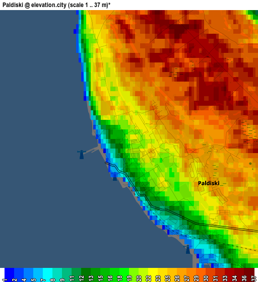
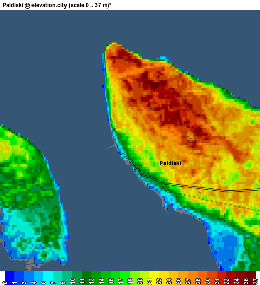
Below is the Elevation map of Paldiski, which displays elevation range with different colors. Scale of the first map is from 1 to 37 m (3 to 121 ft) with average elevation of 24.6 meters (=81 ft) [note 1]
These maps also provides idea of topography and contour of this city, they are displayed at different zoom levels. More info about maps, scale and edge coordinates you can find below images.
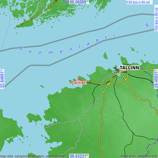
| \ | Map #1 | Map #2 | Topo.Map |
| Scale [m] | 1..37 m | 0..37 m | × |
| Scale [ft] | 3..121 ft | 0..121 ft | × |
| Average | 24.6 m = 81 ft | 19.9 m = 65 ft | × |
| Width | 4.98 km = 3.1 mi | 9.96 km = 6.2 mi | 159.4 km = 99 mi |
| Height | 4.98 km = 3.1 mi | 9.96 km = 6.2 mi | 159.4 km = 99 mi |
| ↑Max Latitude | 59.379061° | 59.401438° | 60.06589° |
| Latitude at center | 59.35667° | 59.35667° | 59.35667° |
| ↓Min Latitude | 59.334264° | 59.311843° | 58.63231° |
| ← Min Longitude | 24.009115° | 23.965169° | 22.64681° |
| Longitude center | 24.05306° | 24.05306° | 24.05306° |
| →Max Longitude | 24.097005° | 24.140951° | 25.45931° |
Nearby cities:
Cities around Paldiski sort by population:
• Tallinn elevation 12 m
40.6 km,  77°
77°
• Keila 41 m
21.3 km,  106°
106°
• Saue 41 m
28.4 km,  97°
97°
• Saku 43 m
35.1 km, 99°
• Laagri 40 m
31.8 km,  91°
91°
• Kohila 58 m
45.2 km,  117°
117°
• Tabasalu 41 m
29.4 km,  74°
74°
• Kiili 51 m
44.8 km, 96°
• Turba 51 m
32 km,  162°
162°
• Riisipere 54 m
30.7 km,  151°
151°
• Pringi 15 m
46.5 km,  64°
64°
• Harku 49 m
29.6 km, 83°
Multilingual:
 En español:
Paldiski elevación 22 m.
 En France:
Paldiski élévation 22 m.
 Auf Deutsch:
Baltischport, Paldiski höhe über dem Meeresspiegel ist 22 m.

Sources and notes:
- [note 1] Map square and city borders are not equal. Map elevation data is calculated only from area inside that square.
- [src 1] Elevation data from geonames database provided with same terms of usage.
- [src 2] The elevation map of Paldiski is generated using elevation data from NASA's 3 arcsec (90m) resolution SRTM data.
- [src 3] Base (background) map © OpenStreetMap contributors tiles are generated by Geofabrik and OpenTopoMap.
Copyright & License:
This Paldiski Elevation Map is licensed under CC BY-SA. You may reuse any part from this page, if you give a proper credit by linking to this URL:
 More info on terms of use page.