Rapla elevation
Rapla (Raplamaa, Rapla vald), Estonia elevation is 67 meters and Rapla elevation in feet is 220 ft above sea level [src 1]. Rapla is a seat of a first-order administrative division (feature code) with elevation that is 16 meters (52 ft) bigger than average city elevation in Estonia.
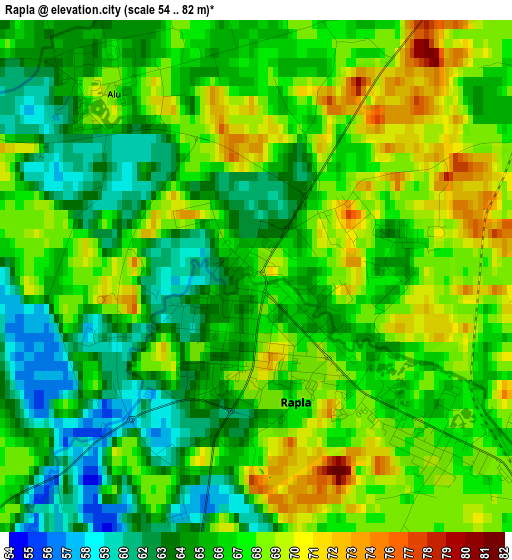
Below is the Elevation map of Rapla, which displays elevation range with different colors. Scale of the first map is from 54 to 82 m (177 to 269 ft) with average elevation of 66.3 meters (=218 ft) [note 1]
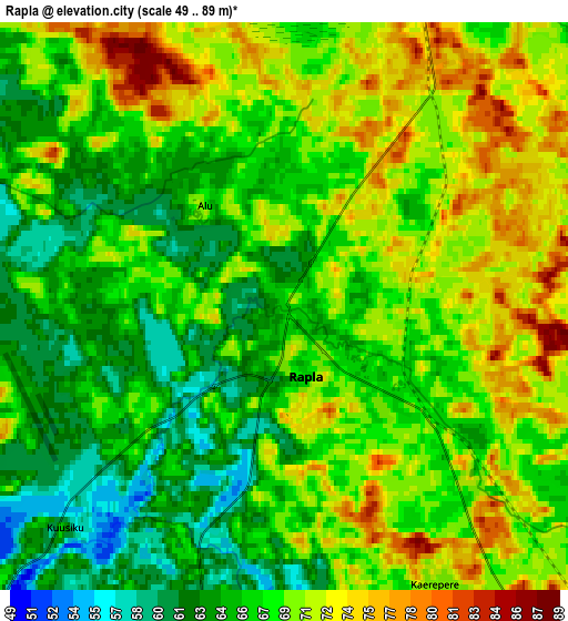
These maps also provides idea of topography and contour of this city, they are displayed at different zoom levels. More info about maps, scale and edge coordinates you can find below images.
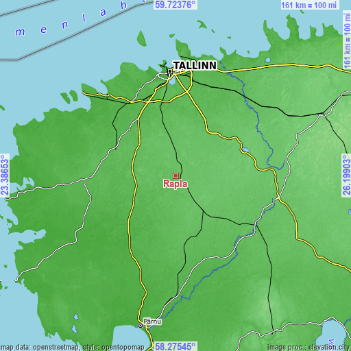
| \ | Map #1 | Map #2 | Topo.Map |
| Scale [m] | 54..82 m | 49..89 m | × |
| Scale [ft] | 177..269 ft | 161..292 ft | × |
| Average | 66.3 m = 218 ft | 68.2 m = 224 ft | × |
| Width | 5.03 km = 3.1 mi | 10.06 km = 6.3 mi | 161 km = 100 mi |
| Height | 5.03 km = 3.1 mi | 10.06 km = 6.3 mi | 161 km = 100 mi |
| ↑Max Latitude | 59.029841° | 59.052448° | 59.72376° |
| Latitude at center | 59.00722° | 59.00722° | 59.00722° |
| ↓Min Latitude | 58.984584° | 58.961933° | 58.27545° |
| ← Min Longitude | 24.748835° | 24.704889° | 23.38653° |
| Longitude center | 24.79278° | 24.79278° | 24.79278° |
| →Max Longitude | 24.836725° | 24.880671° | 26.19903° |
Nearby cities:
Cities around Rapla sort by population:
• Saue elevation 41 m
37.7 km,  338°
338°
• Saku 43 m
33.8 km,  347°
347°
• Kohila 58 m
18 km, 353°
• Märjamaa 46 m
23.7 km,  241°
241°
• Jüri 55 m
39 km,  8°
8°
• Kehtna 65 m
9.9 km,  150°
150°
• Järvakandi 65 m
25.5 km,  175°
175°
• Kiili 51 m
33.5 km,  4°
4°
• Turba 51 m
33.5 km,  284°
284°
• Riisipere 54 m
30 km,  293°
293°
• Vaida 52 m
32.7 km,  18°
18°
• Kose 64 m
28.9 km,  48°
48°
Multilingual:
 En español:
Rapla elevación 67 m.
 En France:
Rapla élévation 67 m.


Sources and notes:
- [note 1] Map square and city borders are not equal. Map elevation data is calculated only from area inside that square.
- [src 1] Elevation data from geonames database provided with same terms of usage.
- [src 2] The elevation map of Rapla is generated using elevation data from NASA's 3 arcsec (90m) resolution SRTM data.
- [src 3] Base (background) map © OpenStreetMap contributors tiles are generated by Geofabrik and OpenTopoMap.
Copyright & License:
This Rapla Elevation Map is licensed under CC BY-SA. You may reuse any part from this page, if you give a proper credit by linking to this URL:
 More info on terms of use page.