Portoviejo elevation
Portoviejo (Manabí, Cantón Portoviejo), Ecuador elevation is 44 meters and Portoviejo elevation in feet is 144 ft above sea level [src 1]. Portoviejo is a seat of a first-order administrative division (feature code) with elevation that is 901 meters (2956 ft) smaller than average city elevation in Ecuador.
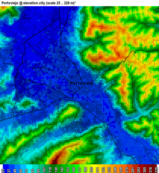
Below is the Elevation map of Portoviejo, which displays elevation range with different colors. Scale of the first map is from 25 to 328 m (82 to 1076 ft) with average elevation of 100.1 meters (=328 ft) [note 1]
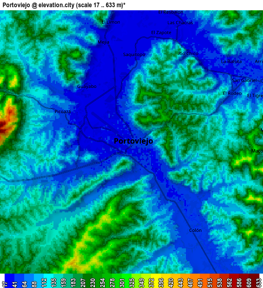
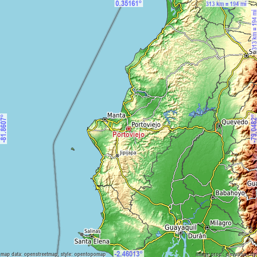
These maps also provides idea of topography and contour of this city, they are displayed at different zoom levels. More info about maps, scale and edge coordinates you can find below images.
| \ | Map #1 | Map #2 | Topo.Map |
| Scale [m] | 25..328 m | 17..633 m | × |
| Scale [ft] | 82..1076 ft | 56..2077 ft | × |
| Average | 100.1 m = 328 ft | 127.4 m = 418 ft | × |
| Width | 9.77 km = 6.1 mi | 19.54 km = 12.1 mi | 312.6 km = 194.2 mi |
| Height | 9.77 km = 6.1 mi | 19.54 km = 12.1 mi | 312.7 km = 194.3 mi |
| ↑Max Latitude | -1.010642° | -0.966703° | 0.35161° |
| Latitude at center | -1.05458° | -1.05458° | -1.05458° |
| ↓Min Latitude | -1.098518° | -1.142454° | -2.46013° |
| ← Min Longitude | -80.498395° | -80.542341° | -81.8607° |
| Longitude center | -80.45445° | -80.45445° | -80.45445° |
| →Max Longitude | -80.410505° | -80.366559° | -79.0482° |
Nearby cities:
Cities around Portoviejo sort by population:
• Manta elevation 23 m
30.5 km,  289°
289°
• Bahía de Caráquez 8 m
50.9 km,  3°
3°
• Jipijapa 287 m
35.5 km,  202°
202°
• Montecristi 135 m
22.7 km,  272°
272°
• Calceta 23 m
39.8 km,  54°
54°
• Sucre 121 m
25.3 km,  171°
171°
• Tosagua 15 m
38.5 km,  39°
39°
• Santa Ana 61 m
19.3 km,  151°
151°
• Rocafuerte 25 m
14.6 km, 2°
• Paján 125 m
55.4 km,  177°
177°
• Junín 49 m
31 km,  62°
62°
• San Vicente 8 m
51.9 km,  5°
5°
Multilingual:
 En español:
Portoviejo elevación 44 m.
 En France:
Portoviejo élévation 44 m.
 Auf Deutsch:
Portoviejo höhe über dem Meeresspiegel ist 44 m.

Sources and notes:
- [note 1] Map square and city borders are not equal. Map elevation data is calculated only from area inside that square.
- [src 1] Elevation data from geonames database provided with same terms of usage.
- [src 2] The elevation map of Portoviejo is generated using elevation data from NASA's 3 arcsec (90m) resolution SRTM data.
- [src 3] Base (background) map © OpenStreetMap contributors tiles are generated by Geofabrik and OpenTopoMap.
Copyright & License:
This Portoviejo Elevation Map is licensed under CC BY-SA. You may reuse any part from this page, if you give a proper credit by linking to this URL:
 More info on terms of use page.