Puerto Baquerizo Moreno elevation
Puerto Baquerizo Moreno (Galápagos, Cantón San Cristóbal), Ecuador elevation is 54 meters and Puerto Baquerizo Moreno elevation in feet is 177 ft above sea level [src 1]. Puerto Baquerizo Moreno is a seat of a first-order administrative division (feature code) with elevation that is 891 meters (2923 ft) smaller than average city elevation in Ecuador.
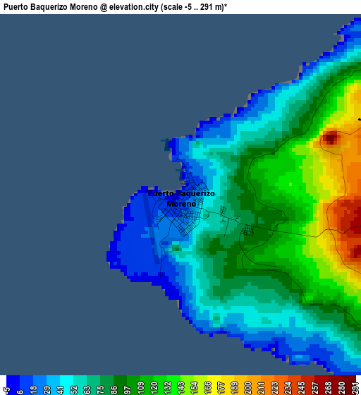
Below is the Elevation map of Puerto Baquerizo Moreno, which displays elevation range with different colors. Scale of the first map is from -5 to 291 m (-16 to 955 ft) with average elevation of 83.7 meters (=275 ft) [note 1]
These maps also provides idea of topography and contour of this city, they are displayed at different zoom levels. More info about maps, scale and edge coordinates you can find below images.
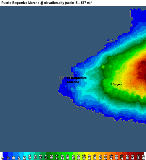
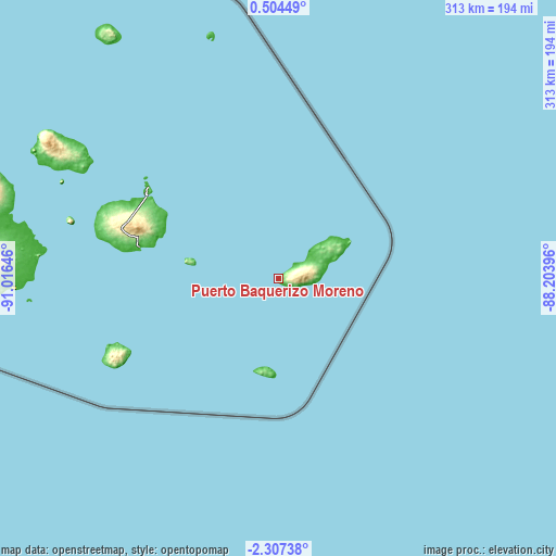
| \ | Map #1 | Map #2 | Topo.Map |
| Scale [m] | -5..291 m | -5..567 m | × |
| Scale [ft] | -16..955 ft | -16..1860 ft | × |
| Average | 83.7 m = 275 ft | 157.9 m = 518 ft | × |
| Width | 9.77 km = 6.1 mi | 19.54 km = 12.1 mi | 312.7 km = 194.3 mi |
| Height | 9.77 km = 6.1 mi | 19.54 km = 12.1 mi | 312.7 km = 194.3 mi |
| ↑Max Latitude | -0.85778° | -0.813839° | 0.50449° |
| Latitude at center | -0.90172° | -0.90172° | -0.90172° |
| ↓Min Latitude | -0.94566° | -0.989599° | -2.30738° |
| ← Min Longitude | -89.654155° | -89.698101° | -91.01646° |
| Longitude center | -89.61021° | -89.61021° | -89.61021° |
| →Max Longitude | -89.566265° | -89.522319° | -88.20396° |
Nearby cities:
Cities around Puerto Baquerizo Moreno sort by population:
• Puerto Ayora elevation 15 m
80.3 km,  282°
282°
• Puerto Villamil 8 m
150.9 km,  267°
267°
Multilingual:
 En español:
Puerto Baquerizo Moreno elevación 54 m.
 En France:
Puerto Baquerizo Moreno élévation 54 m.
 Auf Deutsch:
Puerto Baquerizo Moreno höhe über dem Meeresspiegel ist 54 m.
 На русском:
Пуэрто-Бакерисо-Морено высота над уровнем моря 54 м
Sources and notes:
- [note 1] Map square and city borders are not equal. Map elevation data is calculated only from area inside that square.
- [src 1] Elevation data from geonames database provided with same terms of usage.
- [src 2] The elevation map of Puerto Baquerizo Moreno is generated using elevation data from NASA's 3 arcsec (90m) resolution SRTM data.
- [src 3] Base (background) map © OpenStreetMap contributors tiles are generated by Geofabrik and OpenTopoMap.
Copyright & License:
This Puerto Baquerizo Moreno Elevation Map is licensed under CC BY-SA. You may reuse any part from this page, if you give a proper credit by linking to this URL:
 More info on terms of use page.