Santa Rosa elevation
Santa Rosa (El Oro, Cantón Santa Rosa), Ecuador elevation is 11 meters and Santa Rosa elevation in feet is 36 ft above sea level [src 1]. Santa Rosa is a populated place (feature code) with elevation that is 934 meters (3064 ft) smaller than average city elevation in Ecuador.
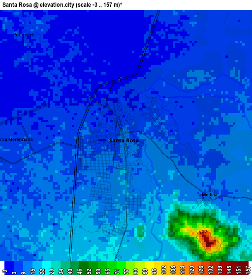
Below is the Elevation map of Santa Rosa, which displays elevation range with different colors. Scale of the first map is from -3 to 157 m (-10 to 515 ft) with average elevation of 11.4 meters (=37 ft) [note 1]
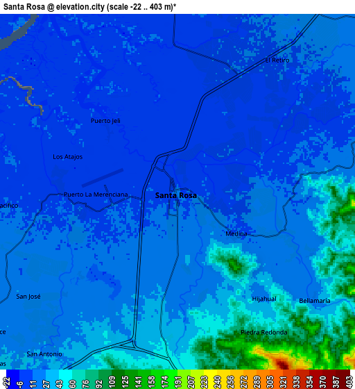
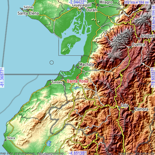
These maps also provides idea of topography and contour of this city, they are displayed at different zoom levels. More info about maps, scale and edge coordinates you can find below images.
| \ | Map #1 | Map #2 | Topo.Map |
| Scale [m] | -3..157 m | -22..403 m | × |
| Scale [ft] | -10..515 ft | -72..1322 ft | × |
| Average | 11.4 m = 37 ft | 23.5 m = 77 ft | × |
| Width | 9.75 km = 6.1 mi | 19.51 km = 12.1 mi | 312.1 km = 193.9 mi |
| Height | 9.75 km = 6.1 mi | 19.51 km = 12.1 mi | 312.2 km = 194 mi |
| ↑Max Latitude | -3.404953° | -3.361085° | -2.04422° |
| Latitude at center | -3.44882° | -3.44882° | -3.44882° |
| ↓Min Latitude | -3.492685° | -3.536547° | -4.85135° |
| ← Min Longitude | -80.003465° | -80.047411° | -81.36577° |
| Longitude center | -79.95952° | -79.95952° | -79.95952° |
| →Max Longitude | -79.915575° | -79.871629° | -78.55327° |
Nearby cities:
Cities around Santa Rosa sort by population:
• Machala elevation 15 m
21.1 km,  359°
359°
• Pasaje 30 m
21.8 km,  51°
51°
• Huaquillas 9 m
30.3 km,  264°
264°
• Naranjal 25 m
94.2 km,  23°
23°
• Catamayo 1268 m
89.5 km,  131°
131°
• Piñas 1017 m
40.3 km, 129°
• Zaruma 1198 m
47.1 km,  124°
124°
• Baláo 5 m
61.9 km, 15°
• Catacocha 1874 m
75.2 km,  152°
152°
• Portovelo 621 m
48.2 km, 128°
• Puerto Bolívar 6 m
20.7 km,  348°
348°
• Celica 2003 m
72.7 km,  179°
179°
Multilingual:
 En español:
Santa Rosa elevación 11 m.
 En France:
Santa Rosa élévation 11 m.
 Auf Deutsch:
Santa Rosa höhe über dem Meeresspiegel ist 11 m.

Sources and notes:
- [note 1] Map square and city borders are not equal. Map elevation data is calculated only from area inside that square.
- [src 1] Elevation data from geonames database provided with same terms of usage.
- [src 2] The elevation map of Santa Rosa is generated using elevation data from NASA's 3 arcsec (90m) resolution SRTM data.
- [src 3] Base (background) map © OpenStreetMap contributors tiles are generated by Geofabrik and OpenTopoMap.
Copyright & License:
This Santa Rosa Elevation Map is licensed under CC BY-SA. You may reuse any part from this page, if you give a proper credit by linking to this URL:
 More info on terms of use page.