Akbou elevation
Akbou (Béjaïa), Algeria elevation is 215 meters and Akbou elevation in feet is 705 ft above sea level [src 1]. Akbou is a populated place (feature code) with elevation that is 223 meters (732 ft) smaller than average city elevation in Algeria.
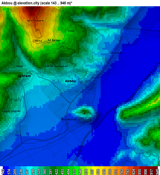
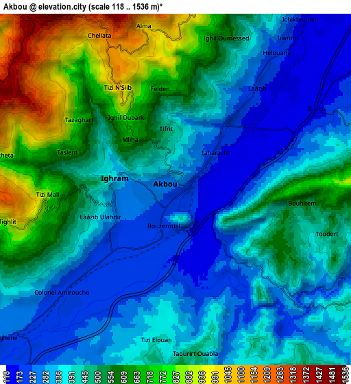
Below is the Elevation map of Akbou, which displays elevation range with different colors. Scale of the first map is from 143 to 948 m (469 to 3110 ft) with average elevation of 294.7 meters (=967 ft) [note 1]
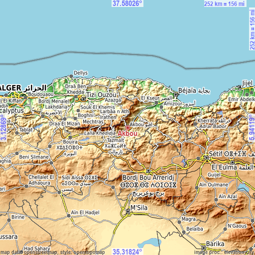
These maps also provides idea of topography and contour of this city, they are displayed at different zoom levels. More info about maps, scale and edge coordinates you can find below images.
| \ | Map #1 | Map #2 | Topo.Map |
| Scale [m] | 143..948 m | 118..1536 m | × |
| Scale [ft] | 469..3110 ft | 387..5039 ft | × |
| Average | 294.7 m = 967 ft | 467.5 m = 1534 ft | × |
| Width | 7.86 km = 4.9 mi | 15.72 km = 9.8 mi | 251.5 km = 156.3 mi |
| Height | 7.86 km = 4.9 mi | 15.72 km = 9.8 mi | 251.5 km = 156.3 mi |
| ↑Max Latitude | 36.492837° | 36.528158° | 37.58026° |
| Latitude at center | 36.4575° | 36.4575° | 36.4575° |
| ↓Min Latitude | 36.422147° | 36.386778° | 35.31824° |
| ← Min Longitude | 4.490995° | 4.447049° | 3.12869° |
| Longitude center | 4.53494° | 4.53494° | 4.53494° |
| →Max Longitude | 4.578885° | 4.622831° | 5.94119° |
Nearby cities:
Cities around Akbou sort by population:
• Azazga elevation 435 m
35.1 km,  335°
335°
• el hed 94 m
30.2 km,  44°
44°
• L’Arbaa Naït Irathen 710 m
35.7 km,  302°
302°
• Mekla 325 m
34.8 km,  315°
315°
• ’Aïn el Hammam 841 m
23.7 km, 300°
• Feraoun 652 m
30.8 km,  68°
68°
• Chemini 852 m
17.4 km,  24°
24°
• Chorfa 342 m
21.3 km,  241°
241°
• Seddouk 353 m
16.8 km,  53°
53°
• Bordj Zemoura 1043 m
35.3 km,  125°
125°
• Ighram 334 m
2.7 km,  282°
282°
• Ait Yahia 1023 m
23.1 km,  309°
309°
Multilingual:
 En español:
Akbou elevación 215 m.
 En France:
Akbou élévation 215 m.


Sources and notes:
- [note 1] Map square and city borders are not equal. Map elevation data is calculated only from area inside that square.
- [src 1] Elevation data from geonames database provided with same terms of usage.
- [src 2] The elevation map of Akbou is generated using elevation data from NASA's 3 arcsec (90m) resolution SRTM data.
- [src 3] Base (background) map © OpenStreetMap contributors tiles are generated by Geofabrik and OpenTopoMap.
Copyright & License:
This Akbou Elevation Map is licensed under CC BY-SA. You may reuse any part from this page, if you give a proper credit by linking to this URL:
 More info on terms of use page.