Baraki elevation
Baraki (Tipaza), Algeria elevation is 22 meters and Baraki elevation in feet is 72 ft above sea level [src 1]. Baraki is a populated place (feature code) with elevation that is 416 meters (1365 ft) smaller than average city elevation in Algeria.
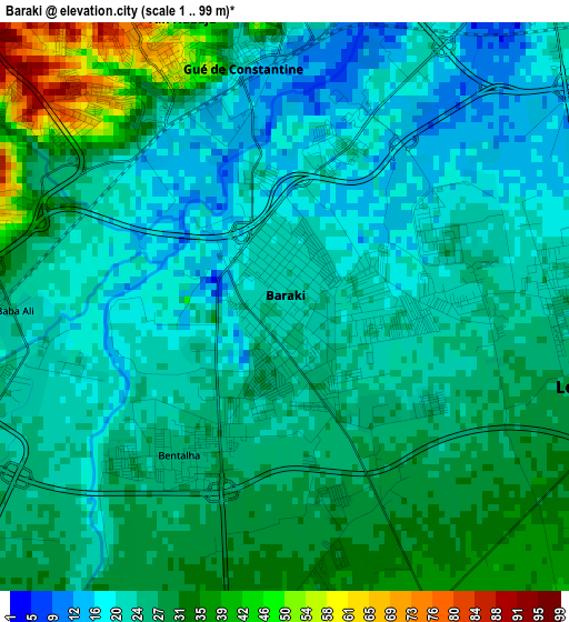
Below is the Elevation map of Baraki, which displays elevation range with different colors. Scale of the first map is from 1 to 99 m (3 to 325 ft) with average elevation of 25.8 meters (=85 ft) [note 1]
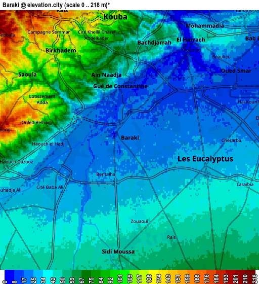
These maps also provides idea of topography and contour of this city, they are displayed at different zoom levels. More info about maps, scale and edge coordinates you can find below images.
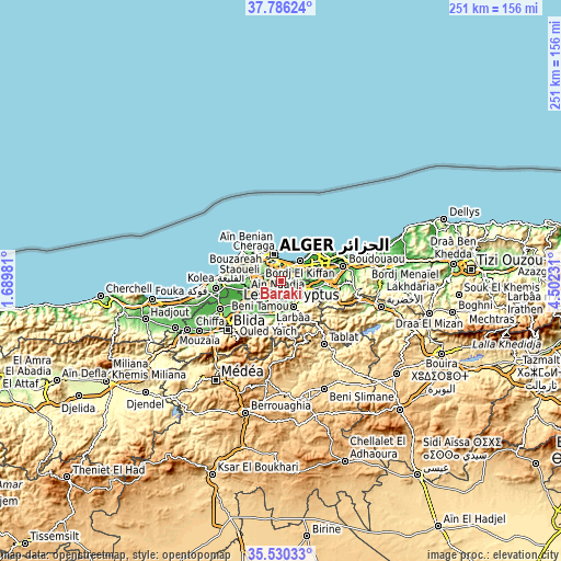
| \ | Map #1 | Map #2 | Topo.Map |
| Scale [m] | 1..99 m | 0..218 m | × |
| Scale [ft] | 3..325 ft | 0..715 ft | × |
| Average | 25.8 m = 85 ft | 48.3 m = 158 ft | × |
| Width | 7.84 km = 4.9 mi | 15.68 km = 9.7 mi | 250.8 km = 155.8 mi |
| Height | 7.84 km = 4.9 mi | 15.68 km = 9.7 mi | 250.8 km = 155.8 mi |
| ↑Max Latitude | 36.701792° | 36.737017° | 37.78624° |
| Latitude at center | 36.66655° | 36.66655° | 36.66655° |
| ↓Min Latitude | 36.631292° | 36.596019° | 35.53033° |
| ← Min Longitude | 3.052115° | 3.008169° | 1.68981° |
| Longitude center | 3.09606° | 3.09606° | 3.09606° |
| →Max Longitude | 3.140005° | 3.183951° | 4.50231° |
Nearby cities:
Cities around Baraki sort by population:
• Algiers elevation 113 m
7.3 km,  354°
354°
• Bab Ezzouar 20 m
10.2 km,  49°
49°
• Bordj el Kiffan 11 m
12.5 km,  43°
43°
• Birkhadem 94 m
6.8 km,  322°
322°
• Larbaâ 100 m
12.5 km,  155°
155°
• Bougara 110 m
13.9 km,  185°
185°
• Meftah 78 m
12.4 km,  114°
114°
• Sidi Moussa 46 m
6.7 km, 186°
• Dar el Beïda 17 m
11.6 km,  63°
63°
• Douera 178 m
13.5 km,  271°
271°
• Chebli 56 m
12.6 km,  217°
217°
• Saoula 105 m
7.6 km,  303°
303°
Multilingual:
 En español:
Baraki elevación 22 m.
 En France:
Baraki élévation 22 m.


Sources and notes:
- [note 1] Map square and city borders are not equal. Map elevation data is calculated only from area inside that square.
- [src 1] Elevation data from geonames database provided with same terms of usage.
- [src 2] The elevation map of Baraki is generated using elevation data from NASA's 3 arcsec (90m) resolution SRTM data.
- [src 3] Base (background) map © OpenStreetMap contributors tiles are generated by Geofabrik and OpenTopoMap.
Copyright & License:
This Baraki Elevation Map is licensed under CC BY-SA. You may reuse any part from this page, if you give a proper credit by linking to this URL:
 More info on terms of use page.