Bayaguana elevation
Bayaguana (Monte Plata), Dominican Republic elevation is 59 meters and Bayaguana elevation in feet is 194 ft above sea level [src 1]. Bayaguana is a populated place (feature code) with elevation that is 104 meters (341 ft) smaller than average city elevation in Dominican Republic.
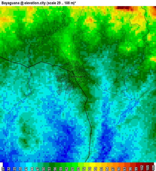
Below is the Elevation map of Bayaguana, which displays elevation range with different colors. Scale of the first map is from 29 to 108 m (95 to 354 ft) with average elevation of 51.5 meters (=169 ft) [note 1]
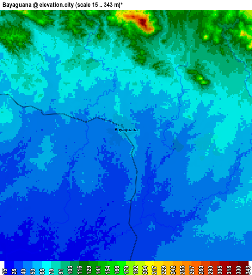
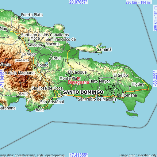
These maps also provides idea of topography and contour of this city, they are displayed at different zoom levels. More info about maps, scale and edge coordinates you can find below images.
| \ | Map #1 | Map #2 | Topo.Map |
| Scale [m] | 29..108 m | 15..343 m | × |
| Scale [ft] | 95..354 ft | 49..1125 ft | × |
| Average | 51.5 m = 169 ft | 64.3 m = 211 ft | × |
| Width | 9.25 km = 5.7 mi | 18.51 km = 11.5 mi | 296.1 km = 184 mi |
| Height | 9.25 km = 5.7 mi | 18.51 km = 11.5 mi | 296.1 km = 184 mi |
| ↑Max Latitude | 18.791918° | 18.833516° | 20.07657° |
| Latitude at center | 18.75031° | 18.75031° | 18.75031° |
| ↓Min Latitude | 18.708692° | 18.667063° | 17.41355° |
| ← Min Longitude | -69.679195° | -69.723141° | -71.0415° |
| Longitude center | -69.63525° | -69.63525° | -69.63525° |
| →Max Longitude | -69.591305° | -69.547359° | -68.229° |
Nearby cities:
Cities around Bayaguana sort by population:
• Santo Domingo Este elevation 46 m
37.3 km,  218°
218°
• Boca Chica 12 m
33.6 km,  173°
173°
• Quisqueya 30 m
32.3 km,  132°
132°
• Sabana Grande de Boyá 291 m
27.3 km,  322°
322°
• Monte Plata 55 m
16.9 km,  291°
291°
• El Valle 42 m
36.9 km,  47°
47°
• Los Llanos 45 m
20.6 km, 134°
• Los Botados 59 m
38 km,  266°
266°
• El Puerto 122 m
18.1 km,  78°
78°
• Don Juan 59 m
33.9 km,  284°
284°
• Gonzalo 286 m
25.5 km,  331°
331°
• Guerra 29 m
22.4 km,  198°
198°
Multilingual:
 En español:
Bayaguana elevación 59 m.
 En France:
Bayaguana élévation 59 m.
 Auf Deutsch:
Bayaguana höhe über dem Meeresspiegel ist 59 m.

Sources and notes:
- [note 1] Map square and city borders are not equal. Map elevation data is calculated only from area inside that square.
- [src 1] Elevation data from geonames database provided with same terms of usage.
- [src 2] The elevation map of Bayaguana is generated using elevation data from NASA's 3 arcsec (90m) resolution SRTM data.
- [src 3] Base (background) map © OpenStreetMap contributors tiles are generated by Geofabrik and OpenTopoMap.
Copyright & License:
This Bayaguana Elevation Map is licensed under CC BY-SA. You may reuse any part from this page, if you give a proper credit by linking to this URL:
 More info on terms of use page.