El Peñón elevation
El Peñón (Barahona), Dominican Republic elevation is 14 meters and El Peñón elevation in feet is 46 ft above sea level [src 1]. El Peñón is a populated place (feature code) with elevation that is 149 meters (489 ft) smaller than average city elevation in Dominican Republic.
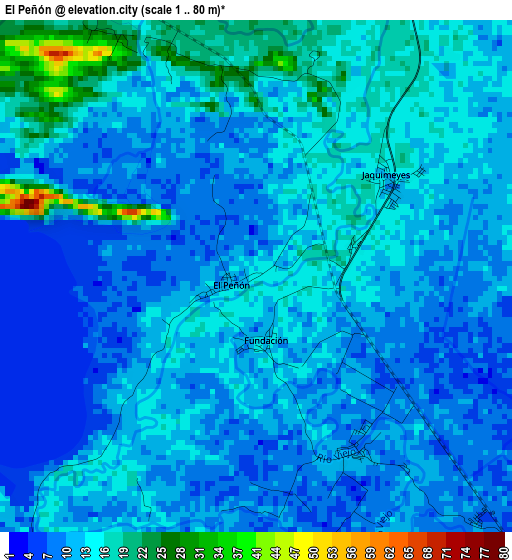
Below is the Elevation map of El Peñón, which displays elevation range with different colors. Scale of the first map is from 1 to 80 m (3 to 262 ft) with average elevation of 12.8 meters (=42 ft) [note 1]
These maps also provides idea of topography and contour of this city, they are displayed at different zoom levels. More info about maps, scale and edge coordinates you can find below images.
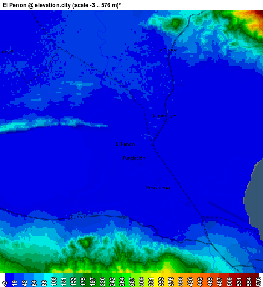
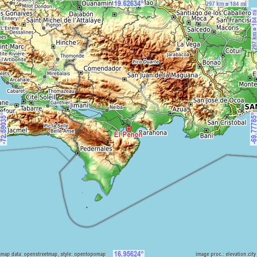
| \ | Map #1 | Map #2 | Topo.Map |
| Scale [m] | 1..80 m | -3..576 m | × |
| Scale [ft] | 3..262 ft | -10..1890 ft | × |
| Average | 12.8 m = 42 ft | 40.4 m = 133 ft | × |
| Width | 9.28 km = 5.8 mi | 18.56 km = 11.5 mi | 296.9 km = 184.5 mi |
| Height | 9.28 km = 5.8 mi | 18.56 km = 11.5 mi | 296.9 km = 184.5 mi |
| ↑Max Latitude | 18.338149° | 18.379857° | 19.62634° |
| Latitude at center | 18.29643° | 18.29643° | 18.29643° |
| ↓Min Latitude | 18.254701° | 18.212963° | 16.95624° |
| ← Min Longitude | -71.228045° | -71.271991° | -72.59035° |
| Longitude center | -71.1841° | -71.1841° | -71.1841° |
| →Max Longitude | -71.140155° | -71.096209° | -69.77785° |
Nearby cities:
Cities around El Peñón sort by population:
• Santa Cruz de Barahona elevation 39 m
13.2 km,  137°
137°
• Cabral 21 m
6.2 km,  213°
213°
• Vicente Noble 36 m
9.8 km,  2°
2°
• Tamayo 32 m
11.1 km,  349°
349°
• Las Salinas 31 m
14.1 km,  260°
260°
• Jaquimeyes 12 m
2.9 km,  54°
54°
• Cristóbal 14 m
11.5 km,  268°
268°
• Fundación 16 m
1.1 km,  165°
165°
• Canoa 22 m
7 km,  22°
22°
• La Uvilla 26 m
7.8 km,  339°
339°
• Pescadería 10 m
3.7 km,  149°
149°
• Cachón 22 m
5.4 km,  185°
185°
Multilingual:
 En español:
El Peñón elevación 14 m.
 En France:
El Peñón élévation 14 m.


Sources and notes:
- [note 1] Map square and city borders are not equal. Map elevation data is calculated only from area inside that square.
- [src 1] Elevation data from geonames database provided with same terms of usage.
- [src 2] The elevation map of El Peñón is generated using elevation data from NASA's 3 arcsec (90m) resolution SRTM data.
- [src 3] Base (background) map © OpenStreetMap contributors tiles are generated by Geofabrik and OpenTopoMap.
Copyright & License:
This El Peñón Elevation Map is licensed under CC BY-SA. You may reuse any part from this page, if you give a proper credit by linking to this URL:
 More info on terms of use page.