Brande elevation
Brande (Central Jutland, Ikast-Brande Kommune), Denmark elevation is 50 meters and Brande elevation in feet is 164 ft above sea level [src 1]. Brande is a populated place (feature code) with elevation that is 23 meters (75 ft) bigger than average city elevation in Denmark.
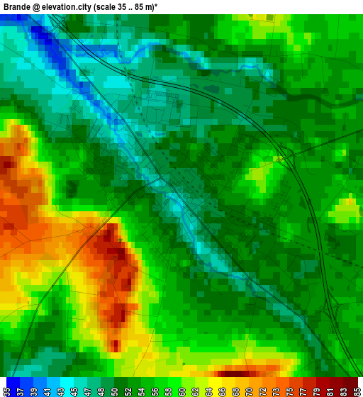
Below is the Elevation map of Brande, which displays elevation range with different colors. Scale of the first map is from 35 to 85 m (115 to 279 ft) with average elevation of 54.9 meters (=180 ft) [note 1]
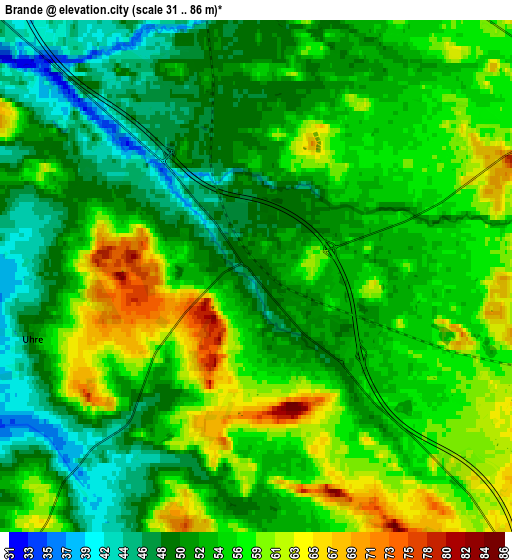
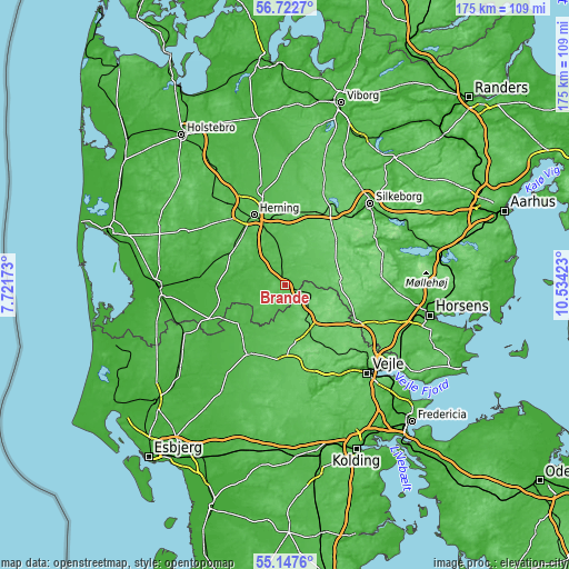
These maps also provides idea of topography and contour of this city, they are displayed at different zoom levels. More info about maps, scale and edge coordinates you can find below images.
| \ | Map #1 | Map #2 | Topo.Map |
| Scale [m] | 35..85 m | 31..86 m | × |
| Scale [ft] | 115..279 ft | 102..282 ft | × |
| Average | 54.9 m = 180 ft | 54.2 m = 178 ft | × |
| Width | 5.47 km = 3.4 mi | 10.95 km = 6.8 mi | 175.1 km = 108.8 mi |
| Height | 5.47 km = 3.4 mi | 10.95 km = 6.8 mi | 175.1 km = 108.8 mi |
| ↑Max Latitude | 55.967762° | 55.992349° | 56.7227° |
| Latitude at center | 55.94316° | 55.94316° | 55.94316° |
| ↓Min Latitude | 55.918542° | 55.893909° | 55.1476° |
| ← Min Longitude | 9.084035° | 9.040089° | 7.72173° |
| Longitude center | 9.12798° | 9.12798° | 9.12798° |
| →Max Longitude | 9.171925° | 9.215871° | 10.53423° |
Nearby cities:
Cities around Brande sort by population:
• Herning elevation 48 m
23.4 km,  336°
336°
• Ikast 81 m
21.8 km,  4°
4°
• Grindsted 42 m
24.2 km,  211°
211°
• Billund 58 m
23.3 km,  183°
183°
• Give 88 m
12.9 km,  147°
147°
• Lind 63 m
20.3 km,  332°
332°
• Gjellerup 63 m
23 km,  348°
348°
• Snejbjerg 50 m
25.3 km, 326°
• Hammerum 60 m
21.6 km, 348°
• Kibæk 40 m
19.5 km,  300°
300°
• Tørring 58 m
24.5 km,  115°
115°
• Bording Kirkeby 87 m
26.1 km,  16°
16°
Multilingual:
 En español:
Brande elevación 50 m.
 En France:
Brande élévation 50 m.


Sources and notes:
- [note 1] Map square and city borders are not equal. Map elevation data is calculated only from area inside that square.
- [src 1] Elevation data from geonames database provided with same terms of usage.
- [src 2] The elevation map of Brande is generated using elevation data from NASA's 3 arcsec (90m) resolution SRTM data.
- [src 3] Base (background) map © OpenStreetMap contributors tiles are generated by Geofabrik and OpenTopoMap.
Copyright & License:
This Brande Elevation Map is licensed under CC BY-SA. You may reuse any part from this page, if you give a proper credit by linking to this URL:
 More info on terms of use page.