Ebeltoft elevation
Ebeltoft (Central Jutland, Syddjurs Kommune), Denmark elevation is 28 meters and Ebeltoft elevation in feet is 92 ft above sea level [src 1]. Ebeltoft is a populated place (feature code) with elevation that is 1 meters (3 ft) bigger than average city elevation in Denmark.
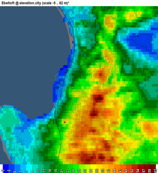
Below is the Elevation map of Ebeltoft, which displays elevation range with different colors. Scale of the first map is from -5 to 62 m (-16 to 203 ft) with average elevation of 23.1 meters (=76 ft) [note 1]
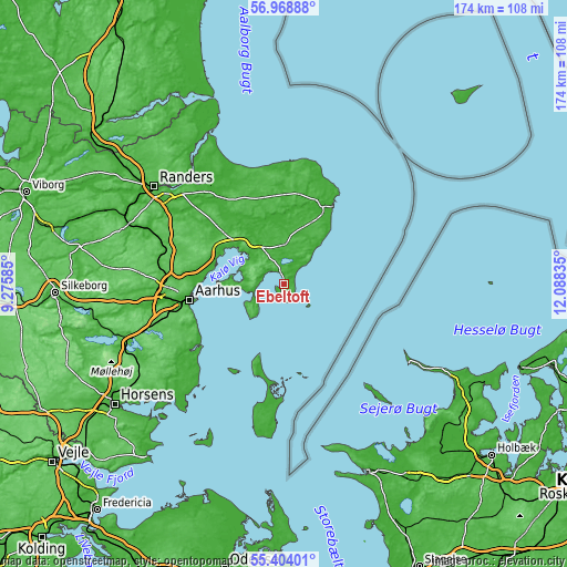
These maps also provides idea of topography and contour of this city, they are displayed at different zoom levels. More info about maps, scale and edge coordinates you can find below images.
| \ | Map #1 | Map #2 | Topo.Map |
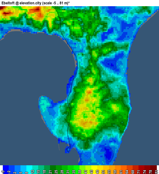
| Scale [m] | -5..62 m | -5..81 m | × |
| Scale [ft] | -16..203 ft | -16..266 ft | × |
| Average | 23.1 m = 76 ft | 19.4 m = 64 ft | × |
| Width | 5.44 km = 3.4 mi | 10.87 km = 6.8 mi | 174 km = 108.1 mi |
| Height | 5.44 km = 3.4 mi | 10.87 km = 6.8 mi | 174 km = 108.1 mi |
| ↑Max Latitude | 56.218862° | 56.243289° | 56.96888° |
| Latitude at center | 56.19442° | 56.19442° | 56.19442° |
| ↓Min Latitude | 56.169962° | 56.145489° | 55.40401° |
| ← Min Longitude | 10.638155° | 10.594209° | 9.27585° |
| Longitude center | 10.6821° | 10.6821° | 10.6821° |
| →Max Longitude | 10.726045° | 10.769991° | 12.08835° |
Nearby cities:
Cities around Ebeltoft sort by population:
• Århus elevation 10 m
29.5 km,  261°
261°
• Grenaa 5 m
27.4 km,  26°
26°
• Lystrup 48 m
27.9 km,  279°
279°
• Løgten 69 m
24.6 km,  291°
291°
• Hornslet 28 m
26.1 km,  301°
301°
• Beder 46 m
32.7 km,  242°
242°
• Malling 57 m
34.9 km, 239°
• Hjortshøj 50 m
26.4 km, 283°
• Auning 11 m
32.3 km,  324°
324°
• Trige 76 m
33.6 km, 281°
• Rønde 46 m
17.5 km,  312°
312°
• Ryomgård 29 m
23.8 km,  332°
332°
Multilingual:
 En español:
Ebeltoft elevación 28 m.
 En France:
Ebeltoft élévation 28 m.


Sources and notes:
- [note 1] Map square and city borders are not equal. Map elevation data is calculated only from area inside that square.
- [src 1] Elevation data from geonames database provided with same terms of usage.
- [src 2] The elevation map of Ebeltoft is generated using elevation data from NASA's 3 arcsec (90m) resolution SRTM data.
- [src 3] Base (background) map © OpenStreetMap contributors tiles are generated by Geofabrik and OpenTopoMap.
Copyright & License:
This Ebeltoft Elevation Map is licensed under CC BY-SA. You may reuse any part from this page, if you give a proper credit by linking to this URL:
 More info on terms of use page.