Løgstør elevation
Løgstør (North Denmark, Vesthimmerland Kommune), Denmark elevation is 21 meters and Løgstør elevation in feet is 69 ft above sea level [src 1]. Løgstør is a populated place (feature code) with elevation that is 6 meters (20 ft) smaller than average city elevation in Denmark.
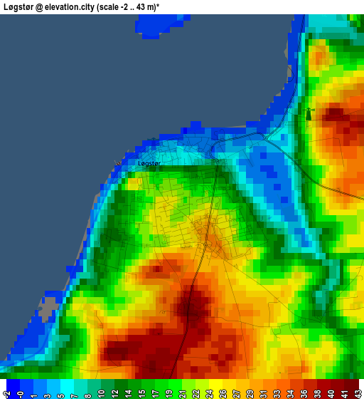
Below is the Elevation map of Løgstør, which displays elevation range with different colors. Scale of the first map is from -2 to 43 m (-7 to 141 ft) with average elevation of 19.9 meters (=65 ft) [note 1]
These maps also provides idea of topography and contour of this city, they are displayed at different zoom levels. More info about maps, scale and edge coordinates you can find below images.
| \ | Map #1 | Map #2 | Topo.Map |
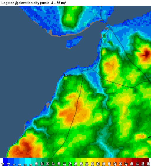
| Scale [m] | -2..43 m | -4..56 m | × |
| Scale [ft] | -7..141 ft | -13..184 ft | × |
| Average | 19.9 m = 65 ft | 18.8 m = 62 ft | × |
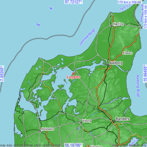
| Width | 5.33 km = 3.3 mi | 10.66 km = 6.6 mi | 170.5 km = 105.9 mi |
| Height | 5.33 km = 3.3 mi | 10.66 km = 6.6 mi | 170.5 km = 105.9 mi |
| ↑Max Latitude | 56.986401° | 57.010336° | 57.72127° |
| Latitude at center | 56.96245° | 56.96245° | 56.96245° |
| ↓Min Latitude | 56.938484° | 56.914502° | 56.18786° |
| ← Min Longitude | 9.214355° | 9.170409° | 7.85205° |
| Longitude center | 9.2583° | 9.2583° | 9.2583° |
| →Max Longitude | 9.302245° | 9.346191° | 10.66455° |
Nearby cities:
Cities around Løgstør sort by population:
• Thisted elevation 4 m
34.2 km,  268°
268°
• Nykøbing Mors 5 m
31 km,  232°
232°
• Aars 36 m
23.5 km,  138°
138°
• Åbybro 6 m
36.2 km,  52°
52°
• Svenstrup 15 m
35.8 km,  88°
88°
• Nibe 10 m
23.2 km,  84°
84°
• Fjerritslev 16 m
14 km,  1°
1°
• Farsø 32 m
21.7 km,  166°
166°
• Ålestrup 26 m
33 km,  154°
154°
• Brovst 14 m
21.9 km, 46°
• Frejlev 34 m
34.2 km, 81°
• Kås 12 m
36.2 km,  43°
43°
Multilingual:
 En español:
Løgstør elevación 21 m.
 En France:
Løgstør élévation 21 m.


Sources and notes:
- [note 1] Map square and city borders are not equal. Map elevation data is calculated only from area inside that square.
- [src 1] Elevation data from geonames database provided with same terms of usage.
- [src 2] The elevation map of Løgstør is generated using elevation data from NASA's 3 arcsec (90m) resolution SRTM data.
- [src 3] Base (background) map © OpenStreetMap contributors tiles are generated by Geofabrik and OpenTopoMap.
Copyright & License:
This Løgstør Elevation Map is licensed under CC BY-SA. You may reuse any part from this page, if you give a proper credit by linking to this URL:
 More info on terms of use page.