Stavnsholt elevation
Stavnsholt (Capital Region, Furesø Kommune), Denmark elevation is 35 meters and Stavnsholt elevation in feet is 115 ft above sea level [src 1]. Stavnsholt is a populated place (feature code) with elevation that is 8 meters (26 ft) bigger than average city elevation in Denmark.
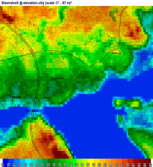
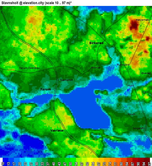
Below is the Elevation map of Stavnsholt, which displays elevation range with different colors. Scale of the first map is from 17 to 67 m (56 to 220 ft) with average elevation of 35.4 meters (=116 ft) [note 1]
These maps also provides idea of topography and contour of this city, they are displayed at different zoom levels. More info about maps, scale and edge coordinates you can find below images.
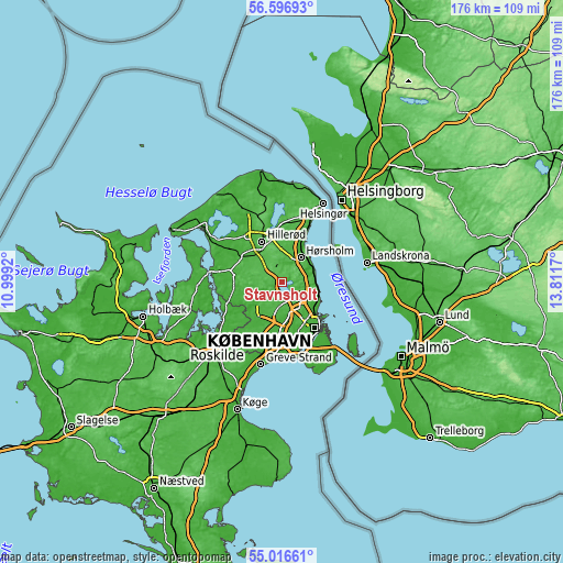
| \ | Map #1 | Map #2 | Topo.Map |
| Scale [m] | 17..67 m | 10..97 m | × |
| Scale [ft] | 56..220 ft | 33..318 ft | × |
| Average | 35.4 m = 116 ft | 40.3 m = 132 ft | × |
| Width | 5.49 km = 3.4 mi | 10.98 km = 6.8 mi | 175.7 km = 109.2 mi |
| Height | 5.49 km = 3.4 mi | 10.98 km = 6.8 mi | 175.7 km = 109.2 mi |
| ↑Max Latitude | 55.839474° | 55.864142° | 56.59693° |
| Latitude at center | 55.81479° | 55.81479° | 55.81479° |
| ↓Min Latitude | 55.790091° | 55.765376° | 55.01661° |
| ← Min Longitude | 12.361505° | 12.317559° | 10.9992° |
| Longitude center | 12.40545° | 12.40545° | 12.40545° |
| →Max Longitude | 12.449395° | 12.493341° | 13.8117° |
Nearby cities:
Cities around Stavnsholt sort by population:
• Birkerød elevation 53 m
3.9 km,  21°
21°
• Farum 33 m
2.9 km,  256°
256°
• Lillerød 45 m
7.7 km,  330°
330°
• Værløse 47 m
4.3 km,  212°
212°
• Kongens Lyngby 25 m
7.9 km,  128°
128°
• Trørød 21 m
9.1 km,  72°
72°
• Måløv 36 m
8.4 km,  217°
217°
• Lynge 56 m
8.5 km,  288°
288°
• Ganløse 37 m
9.2 km,  253°
253°
• Blovstrød 53 m
6.3 km,  349°
349°
• Buddinge 33 m
9.3 km,  142°
142°
• Holte 45 m
3.8 km,  86°
86°
Multilingual:
 En español:
Stavnsholt elevación 35 m.
 En France:
Stavnsholt élévation 35 m.
 Auf Deutsch:
Stavnsholt höhe über dem Meeresspiegel ist 35 m.

Sources and notes:
- [note 1] Map square and city borders are not equal. Map elevation data is calculated only from area inside that square.
- [src 1] Elevation data from geonames database provided with same terms of usage.
- [src 2] The elevation map of Stavnsholt is generated using elevation data from NASA's 3 arcsec (90m) resolution SRTM data.
- [src 3] Base (background) map © OpenStreetMap contributors tiles are generated by Geofabrik and OpenTopoMap.
Copyright & License:
This Stavnsholt Elevation Map is licensed under CC BY-SA. You may reuse any part from this page, if you give a proper credit by linking to this URL:
 More info on terms of use page.