Brandýs nad Orlicí elevation
Brandýs nad Orlicí (Pardubický, Okres Ústí nad Orlicí), Czech Republic elevation is 306 meters and Brandýs nad Orlicí elevation in feet is 1004 ft above sea level [src 1]. Brandýs nad Orlicí is a populated place (feature code) with elevation that is 39 meters (128 ft) smaller than average city elevation in Czech Republic.
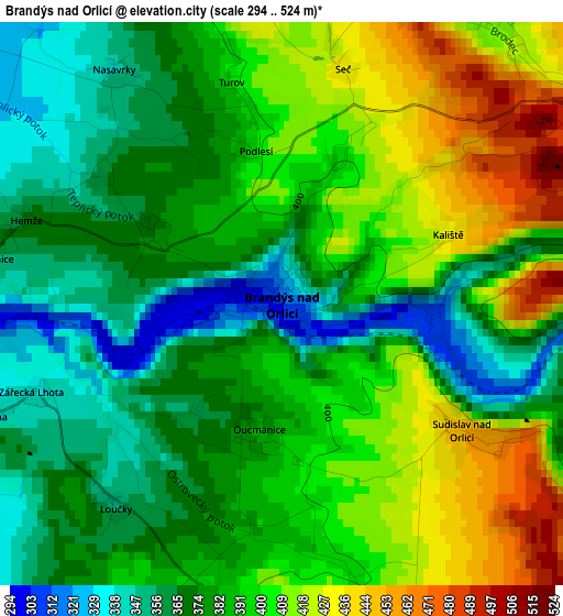
Below is the Elevation map of Brandýs nad Orlicí, which displays elevation range with different colors. Scale of the first map is from 294 to 524 m (965 to 1719 ft) with average elevation of 388.2 meters (=1274 ft) [note 1]
These maps also provides idea of topography and contour of this city, they are displayed at different zoom levels. More info about maps, scale and edge coordinates you can find below images.
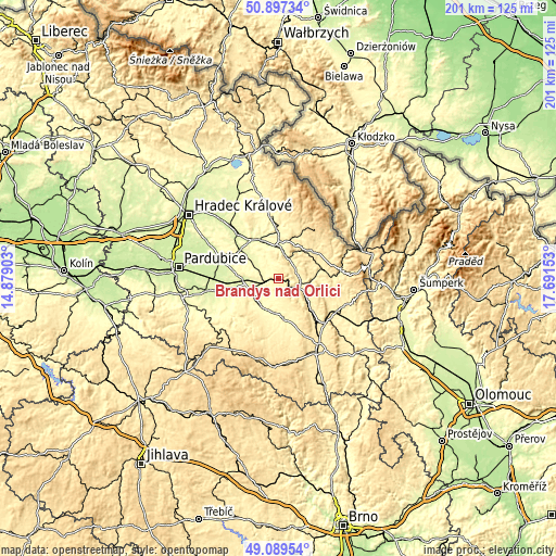
| \ | Map #1 | Topo.Map |
| Scale [m] | 294..524 m | × |
| Scale [ft] | 965..1719 ft | × |
| Average | 388.2 m = 1274 ft | × |
| Width | 6.28 km = 3.9 mi | 201 km = 124.9 mi |
| Height | 6.28 km = 3.9 mi | 201 km = 124.9 mi |
| ↑Max Latitude | 50.030178° | 50.89734° |
| Latitude at center | 50.00194° | 50.00194° |
| ↓Min Latitude | 49.973685° | 49.08954° |
| ← Min Longitude | 16.241335° | 14.87903° |
| Longitude center | 16.28528° | 16.28528° |
| →Max Longitude | 16.329225° | 17.69153° |
Nearby cities:
Cities around Brandýs nad Orlicí sort by population:
• Ústí nad Orlicí elevation 346 m
8.3 km,  111°
111°
• Vysoké Mýto 291 m
10.4 km,  238°
238°
• Litomyšl 334 m
15 km,  172°
172°
• Choceň 291 m
4.4 km,  269°
269°
• Kostelec nad Orlicí 294 m
14.4 km,  339°
339°
• Vamberk 319 m
12.9 km,  1°
1°
• Dolní Dobrouč 364 m
15.2 km,  93°
93°
• Doudleby nad Orlicí 284 m
11.9 km,  351°
351°
• Horní Jelení 307 m
15.3 km,  289°
289°
• Horní Sloupnice 423 m
9.8 km,  156°
156°
• Dolní Sloupnice 365 m
8.3 km,  175°
175°
• Dlouhá Třebová 341 m
12 km,  124°
124°
Multilingual:
 En español:
Brandýs nad Orlicí elevación 306 m.
 En France:
Brandýs nad Orlicí élévation 306 m.
 Auf Deutsch:
Brandýs nad Orlicí höhe über dem Meeresspiegel ist 306 m.
 На русском:
Brandýs nad Orlicí высота над уровнем моря 306 м
Sources and notes:
- [note 1] Map square and city borders are not equal. Map elevation data is calculated only from area inside that square.
- [src 1] Elevation data from geonames database provided with same terms of usage.
- [src 2] The elevation map of Brandýs nad Orlicí is generated using elevation data from NASA's 3 arcsec (90m) resolution SRTM data.
- [src 3] Base (background) map © OpenStreetMap contributors tiles are generated by Geofabrik and OpenTopoMap.
Copyright & License:
This Brandýs nad Orlicí Elevation Map is licensed under CC BY-SA. You may reuse any part from this page, if you give a proper credit by linking to this URL:
 More info on terms of use page.