Hlubočky elevation
Hlubočky (Olomoucký, Okres Olomouc), Czech Republic elevation is 271 meters and Hlubočky elevation in feet is 889 ft above sea level [src 1]. Hlubočky is a populated place (feature code) with elevation that is 74 meters (243 ft) smaller than average city elevation in Czech Republic.
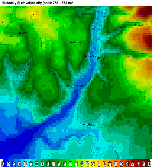
Below is the Elevation map of Hlubočky, which displays elevation range with different colors. Scale of the first map is from 239 to 573 m (784 to 1880 ft) with average elevation of 345.7 meters (=1134 ft) [note 1]
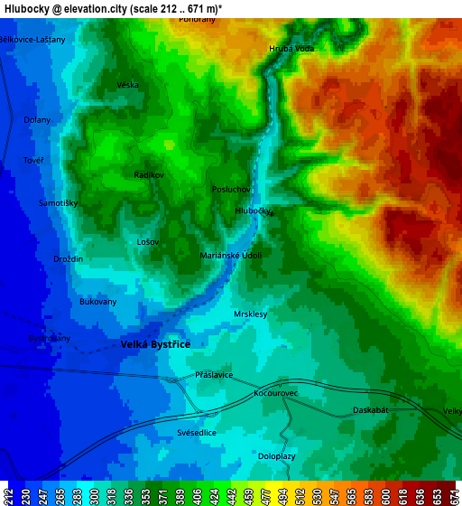
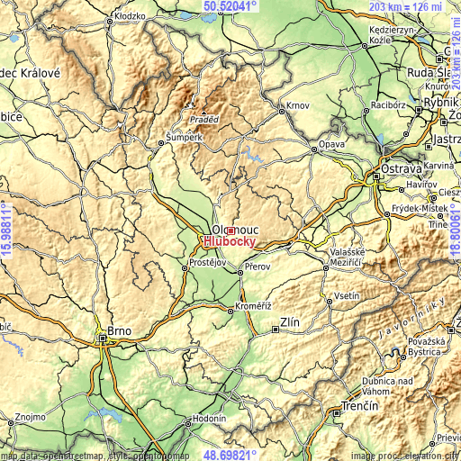
These maps also provides idea of topography and contour of this city, they are displayed at different zoom levels. More info about maps, scale and edge coordinates you can find below images.
| \ | Map #1 | Map #2 | Topo.Map |
| Scale [m] | 239..573 m | 212..671 m | × |
| Scale [ft] | 784..1880 ft | 696..2201 ft | × |
| Average | 345.7 m = 1134 ft | 367.1 m = 1204 ft | × |
| Width | 6.33 km = 3.9 mi | 12.66 km = 7.9 mi | 202.6 km = 125.9 mi |
| Height | 6.33 km = 3.9 mi | 12.66 km = 7.9 mi | 202.6 km = 125.9 mi |
| ↑Max Latitude | 49.646293° | 49.67474° | 50.52041° |
| Latitude at center | 49.61783° | 49.61783° | 49.61783° |
| ↓Min Latitude | 49.58935° | 49.560854° | 48.69821° |
| ← Min Longitude | 17.350415° | 17.306469° | 15.98811° |
| Longitude center | 17.39436° | 17.39436° | 17.39436° |
| →Max Longitude | 17.438305° | 17.482251° | 18.80061° |
Nearby cities:
Cities around Hlubočky sort by population:
• Olomouc elevation 223 m
10.6 km,  256°
256°
• Velká Bystřice 253 m
3.3 km,  219°
219°
• Bohuňovice 230 m
9.2 km,  303°
303°
• Dolany 251 m
6.3 km, 304°
• Velký Týnec 235 m
8.7 km,  210°
210°
• Tršice 267 m
8.7 km,  165°
165°
• Grygov 204 m
10.8 km, 214°
• Přáslavice 300 m
3.7 km,  193°
193°
• Doloplazy 299 m
5.6 km, 165°
• Dolní Újezd 289 m
12.9 km,  128°
128°
• Samotíšky 275 m
5 km,  286°
286°
• Velký Újezd 372 m
7.8 km,  124°
124°
Multilingual:
 En español:
Hlubočky elevación 271 m.
 En France:
Hlubočky élévation 271 m.
 Auf Deutsch:
Hlubočky höhe über dem Meeresspiegel ist 271 m.

Sources and notes:
- [note 1] Map square and city borders are not equal. Map elevation data is calculated only from area inside that square.
- [src 1] Elevation data from geonames database provided with same terms of usage.
- [src 2] The elevation map of Hlubočky is generated using elevation data from NASA's 3 arcsec (90m) resolution SRTM data.
- [src 3] Base (background) map © OpenStreetMap contributors tiles are generated by Geofabrik and OpenTopoMap.
Copyright & License:
This Hlubočky Elevation Map is licensed under CC BY-SA. You may reuse any part from this page, if you give a proper credit by linking to this URL:
 More info on terms of use page.