Jaroměř elevation
Jaroměř (Královéhradecký kraj, Okres Náchod), Czech Republic elevation is 258 meters and Jaroměř elevation in feet is 846 ft above sea level [src 1]. Jaroměř is a populated place (feature code) with elevation that is 87 meters (285 ft) smaller than average city elevation in Czech Republic.
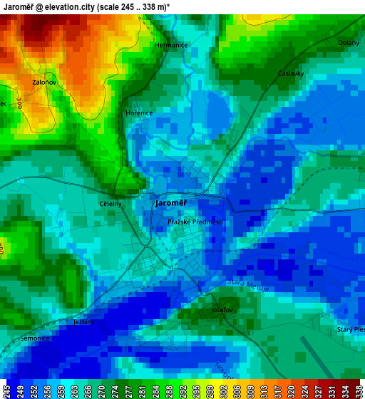
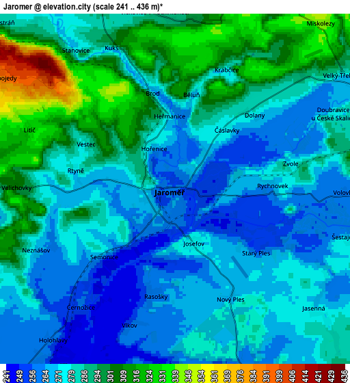
Below is the Elevation map of Jaroměř, which displays elevation range with different colors. Scale of the first map is from 245 to 338 m (804 to 1109 ft) with average elevation of 268.5 meters (=881 ft) [note 1]
These maps also provides idea of topography and contour of this city, they are displayed at different zoom levels. More info about maps, scale and edge coordinates you can find below images.
| \ | Map #1 | Map #2 | Topo.Map |
| Scale [m] | 245..338 m | 241..436 m | × |
| Scale [ft] | 804..1109 ft | 791..1430 ft | × |
| Average | 268.5 m = 881 ft | 282.3 m = 926 ft | × |
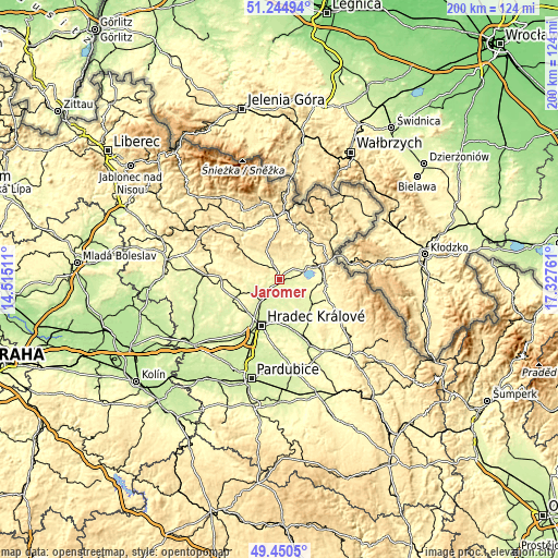
| Width | 6.23 km = 3.9 mi | 12.47 km = 7.7 mi | 199.5 km = 124 mi |
| Height | 6.23 km = 3.9 mi | 12.47 km = 7.7 mi | 199.5 km = 124 mi |
| ↑Max Latitude | 50.384229° | 50.412242° | 51.24494° |
| Latitude at center | 50.3562° | 50.3562° | 50.3562° |
| ↓Min Latitude | 50.328154° | 50.300092° | 49.4505° |
| ← Min Longitude | 15.877415° | 15.833469° | 14.51511° |
| Longitude center | 15.92136° | 15.92136° | 15.92136° |
| →Max Longitude | 15.965305° | 16.009251° | 17.32761° |
Nearby cities:
Cities around Jaroměř sort by population:
• Dvůr Králové nad Labem elevation 300 m
11.3 km,  317°
317°
• Nové Město nad Metují 334 m
16.4 km,  94°
94°
• Česká Skalice 291 m
9.6 km,  63°
63°
• Smiřice 243 m
7.4 km,  212°
212°
• Dolní Černilov 258 m
10.9 km,  165°
165°
• Černilov 254 m
10.4 km,  179°
179°
• Předměřice nad Labem 242 m
13.4 km, 214°
• České Meziříčí 258 m
11.6 km,  131°
131°
• Všestary 270 m
15.9 km,  226°
226°
• Bílá Třemešná 352 m
16.1 km,  307°
307°
• Černožice 256 m
5.4 km,  218°
218°
• Provodov-Šonov 294 m
13.7 km,  75°
75°
Multilingual:
 En español:
Jaroměř elevación 258 m.
 En France:
Jaroměř élévation 258 m.


Sources and notes:
- [note 1] Map square and city borders are not equal. Map elevation data is calculated only from area inside that square.
- [src 1] Elevation data from geonames database provided with same terms of usage.
- [src 2] The elevation map of Jaroměř is generated using elevation data from NASA's 3 arcsec (90m) resolution SRTM data.
- [src 3] Base (background) map © OpenStreetMap contributors tiles are generated by Geofabrik and OpenTopoMap.
Copyright & License:
This Jaroměř Elevation Map is licensed under CC BY-SA. You may reuse any part from this page, if you give a proper credit by linking to this URL:
 More info on terms of use page.