Kolín elevation
Kolín (Central Bohemia, Okres Kolín), Czech Republic elevation is 215 meters and Kolín elevation in feet is 705 ft above sea level [src 1]. Kolín is a populated place (feature code) with elevation that is 130 meters (427 ft) smaller than average city elevation in Czech Republic.
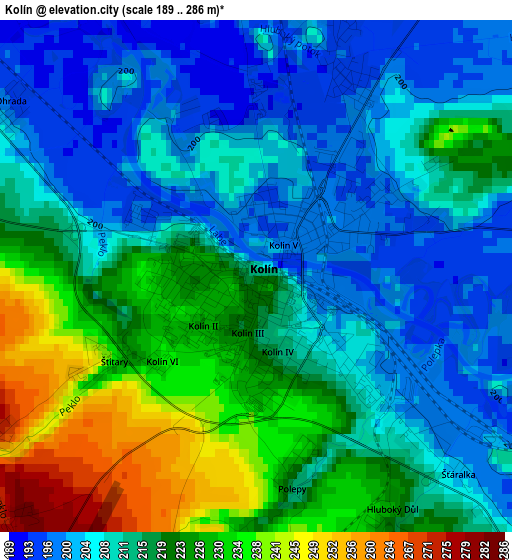
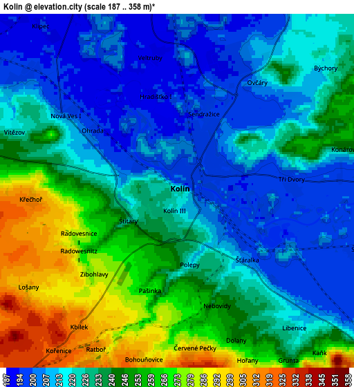
Below is the Elevation map of Kolín, which displays elevation range with different colors. Scale of the first map is from 189 to 286 m (620 to 938 ft) with average elevation of 215.1 meters (=706 ft) [note 1]
These maps also provides idea of topography and contour of this city, they are displayed at different zoom levels. More info about maps, scale and edge coordinates you can find below images.
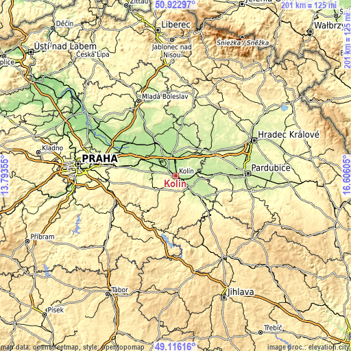
| \ | Map #1 | Map #2 | Topo.Map |
| Scale [m] | 189..286 m | 187..358 m | × |
| Scale [ft] | 620..938 ft | 614..1175 ft | × |
| Average | 215.1 m = 706 ft | 232.3 m = 762 ft | × |
| Width | 6.28 km = 3.9 mi | 12.56 km = 7.8 mi | 200.9 km = 124.8 mi |
| Height | 6.28 km = 3.9 mi | 12.56 km = 7.8 mi | 200.9 km = 124.8 mi |
| ↑Max Latitude | 50.056283° | 50.084489° | 50.92297° |
| Latitude at center | 50.02806° | 50.02806° | 50.02806° |
| ↓Min Latitude | 49.999821° | 49.971565° | 49.11616° |
| ← Min Longitude | 15.155855° | 15.111909° | 13.79355° |
| Longitude center | 15.1998° | 15.1998° | 15.1998° |
| →Max Longitude | 15.243745° | 15.287691° | 16.60605° |
Nearby cities:
Cities around Kolín sort by population:
• Kutná Hora elevation 255 m
10.1 km,  151°
151°
• Velký Osek 191 m
7.9 km,  352°
352°
• Velim 207 m
7.5 km,  297°
297°
• Týnec nad Labem 240 m
11.4 km,  82°
82°
• Červené Pečky 290 m
5.6 km,  173°
173°
• Starý Kolín 201 m
7 km,  106°
106°
• Cerhenice 211 m
10.3 km, 297°
• Plaňany 217 m
12.4 km,  281°
281°
• Libice nad Cidlinou 192 m
11.1 km, 352°
• Veltruby 192 m
4.9 km, 347°
• Sedlec 232 m
9.5 km,  138°
138°
• Suchdol 370 m
8.7 km,  195°
195°
Multilingual:
 En español:
Kolín elevación 215 m.
 En France:
Kolín élévation 215 m.
 Auf Deutsch:
Kolín, Köln an der Elbe höhe über dem Meeresspiegel ist 215 m.

Sources and notes:
- [note 1] Map square and city borders are not equal. Map elevation data is calculated only from area inside that square.
- [src 1] Elevation data from geonames database provided with same terms of usage.
- [src 2] The elevation map of Kolín is generated using elevation data from NASA's 3 arcsec (90m) resolution SRTM data.
- [src 3] Base (background) map © OpenStreetMap contributors tiles are generated by Geofabrik and OpenTopoMap.
Copyright & License:
This Kolín Elevation Map is licensed under CC BY-SA. You may reuse any part from this page, if you give a proper credit by linking to this URL:
 More info on terms of use page.