Kopřivnice elevation
Kopřivnice (Moravskoslezský, Okres Nový Jičín), Czech Republic elevation is 321 meters and Kopřivnice elevation in feet is 1053 ft above sea level [src 1]. Kopřivnice is a populated place (feature code) with elevation that is 24 meters (79 ft) smaller than average city elevation in Czech Republic.
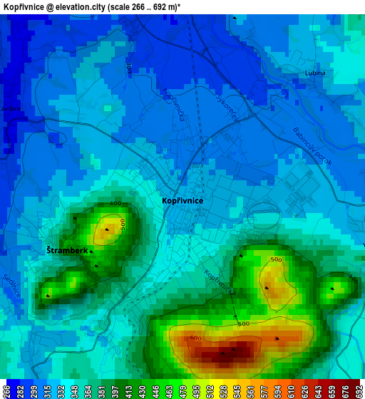
Below is the Elevation map of Kopřivnice, which displays elevation range with different colors. Scale of the first map is from 266 to 692 m (873 to 2270 ft) with average elevation of 352.4 meters (=1156 ft) [note 1]
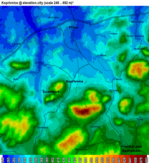
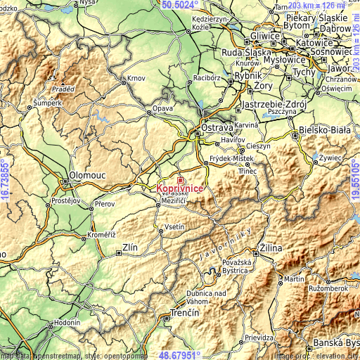
These maps also provides idea of topography and contour of this city, they are displayed at different zoom levels. More info about maps, scale and edge coordinates you can find below images.
| \ | Map #1 | Map #2 | Topo.Map |
| Scale [m] | 266..692 m | 248..692 m | × |
| Scale [ft] | 873..2270 ft | 814..2270 ft | × |
| Average | 352.4 m = 1156 ft | 358.7 m = 1177 ft | × |
| Width | 6.33 km = 3.9 mi | 12.67 km = 7.9 mi | 202.7 km = 126 mi |
| Height | 6.33 km = 3.9 mi | 12.67 km = 7.9 mi | 202.7 km = 126 mi |
| ↑Max Latitude | 49.627944° | 49.656401° | 50.5024° |
| Latitude at center | 49.59947° | 49.59947° | 49.59947° |
| ↓Min Latitude | 49.57098° | 49.542472° | 48.67951° |
| ← Min Longitude | 18.100855° | 18.056909° | 16.73855° |
| Longitude center | 18.1448° | 18.1448° | 18.1448° |
| →Max Longitude | 18.188745° | 18.232691° | 19.55105° |
Nearby cities:
Cities around Kopřivnice sort by population:
• Frenštát pod Radhoštěm elevation 393 m
7.4 km,  140°
140°
• Příbor 285 m
4.6 km,  0°
0°
• Štramberk 418 m
2.1 km,  246°
246°
• Kozlovice 373 m
8.1 km,  97°
97°
• Mořkov 361 m
9.3 km,  221°
221°
• Fryčovice 263 m
9.4 km,  37°
37°
• Veřovice 415 m
7.1 km,  198°
198°
• Hukvaldy 343 m
6.2 km,  64°
64°
• Tichá 359 m
6.4 km,  120°
120°
• Lichnov (o. Nový Jičín) 361 m
4.3 km,  156°
156°
• Sedlnice 249 m
7.7 km,  327°
327°
• Rybí 318 m
5 km,  271°
271°
Multilingual:
 En español:
Kopřivnice elevación 321 m.
 En France:
Kopřivnice élévation 321 m.
 Auf Deutsch:
Nesselsdorf höhe über dem Meeresspiegel ist 321 m.
 На русском:
Копршивницах, Копршивнице высота над уровнем моря 321 м
Sources and notes:
- [note 1] Map square and city borders are not equal. Map elevation data is calculated only from area inside that square.
- [src 1] Elevation data from geonames database provided with same terms of usage.
- [src 2] The elevation map of Kopřivnice is generated using elevation data from NASA's 3 arcsec (90m) resolution SRTM data.
- [src 3] Base (background) map © OpenStreetMap contributors tiles are generated by Geofabrik and OpenTopoMap.
Copyright & License:
This Kopřivnice Elevation Map is licensed under CC BY-SA. You may reuse any part from this page, if you give a proper credit by linking to this URL:
 More info on terms of use page.