Ledeč nad Sázavou elevation
Ledeč nad Sázavou (Vysočina, Okres Havlíčkův Brod), Czech Republic elevation is 358 meters and Ledeč nad Sázavou elevation in feet is 1175 ft above sea level [src 1]. Ledeč nad Sázavou is a populated place (feature code) with elevation that is 13 meters (43 ft) bigger than average city elevation in Czech Republic.
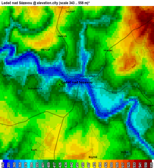
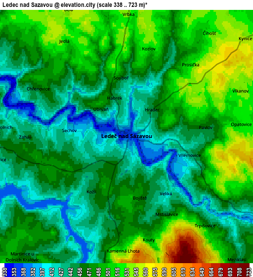
Below is the Elevation map of Ledeč nad Sázavou, which displays elevation range with different colors. Scale of the first map is from 343 to 558 m (1125 to 1831 ft) with average elevation of 431.8 meters (=1417 ft) [note 1]
These maps also provides idea of topography and contour of this city, they are displayed at different zoom levels. More info about maps, scale and edge coordinates you can find below images.
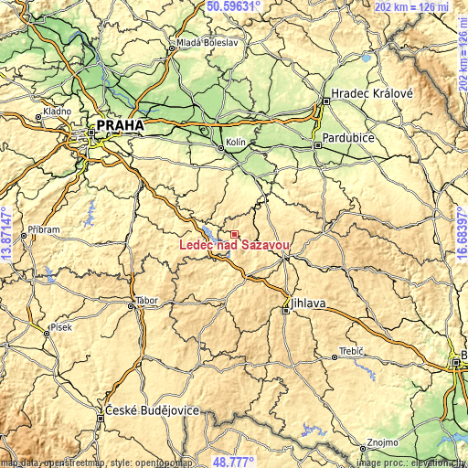
| \ | Map #1 | Map #2 | Topo.Map |
| Scale [m] | 343..558 m | 338..723 m | × |
| Scale [ft] | 1125..1831 ft | 1109..2372 ft | × |
| Average | 431.8 m = 1417 ft | 473.3 m = 1553 ft | × |
| Width | 6.32 km = 3.9 mi | 12.64 km = 7.9 mi | 202.3 km = 125.7 mi |
| Height | 6.32 km = 3.9 mi | 12.64 km = 7.9 mi | 202.3 km = 125.7 mi |
| ↑Max Latitude | 49.723588° | 49.751989° | 50.59631° |
| Latitude at center | 49.69517° | 49.69517° | 49.69517° |
| ↓Min Latitude | 49.666735° | 49.638284° | 48.777° |
| ← Min Longitude | 15.233775° | 15.189829° | 13.87147° |
| Longitude center | 15.27772° | 15.27772° | 15.27772° |
| →Max Longitude | 15.321665° | 15.365611° | 16.68397° |
Nearby cities:
Cities around Ledeč nad Sázavou sort by population:
• Humpolec elevation 530 m
18.1 km,  161°
161°
• Světlá nad Sázavou 403 m
9.6 km,  108°
108°
• Zruč nad Sázavou 337 m
13.3 km,  292°
292°
• Golčův Jeníkov 379 m
19.6 km,  46°
46°
• Čechtice 477 m
18.3 km,  244°
244°
• Zbraslavice 504 m
14.6 km,  332°
332°
• Habry 471 m
16.4 km,  65°
65°
• Trhový Štěpánov 416 m
19.1 km,  275°
275°
• Okrouhlice 409 m
17 km,  115°
115°
• Želiv 407 m
18.8 km,  192°
192°
• Herálec 564 m
22.4 km,  144°
144°
• Vilémov 598 m
19.3 km, 156°
Multilingual:
 En español:
Ledeč nad Sázavou elevación 358 m.
 En France:
Ledeč nad Sázavou élévation 358 m.
 Auf Deutsch:
Ledeč nad Sázavou höhe über dem Meeresspiegel ist 358 m.

Sources and notes:
- [note 1] Map square and city borders are not equal. Map elevation data is calculated only from area inside that square.
- [src 1] Elevation data from geonames database provided with same terms of usage.
- [src 2] The elevation map of Ledeč nad Sázavou is generated using elevation data from NASA's 3 arcsec (90m) resolution SRTM data.
- [src 3] Base (background) map © OpenStreetMap contributors tiles are generated by Geofabrik and OpenTopoMap.
Copyright & License:
This Ledeč nad Sázavou Elevation Map is licensed under CC BY-SA. You may reuse any part from this page, if you give a proper credit by linking to this URL:
 More info on terms of use page.