Loučeň elevation
Loučeň (Central Bohemia, Okres Nymburk), Czech Republic elevation is 256 meters and Loučeň elevation in feet is 840 ft above sea level [src 1]. Loučeň is a populated place (feature code) with elevation that is 89 meters (292 ft) smaller than average city elevation in Czech Republic.
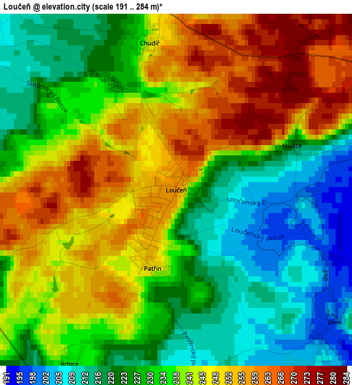
Below is the Elevation map of Loučeň, which displays elevation range with different colors. Scale of the first map is from 191 to 284 m (627 to 932 ft) with average elevation of 236.2 meters (=775 ft) [note 1]
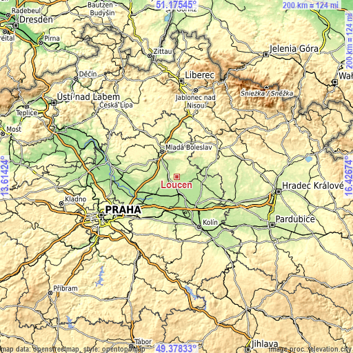
These maps also provides idea of topography and contour of this city, they are displayed at different zoom levels. More info about maps, scale and edge coordinates you can find below images.
| \ | Map #1 | Topo.Map |
| Scale [m] | 191..284 m | × |
| Scale [ft] | 627..932 ft | × |
| Average | 236.2 m = 775 ft | × |
| Width | 6.24 km = 3.9 mi | 199.8 km = 124.1 mi |
| Height | 6.24 km = 3.9 mi | 199.8 km = 124.1 mi |
| ↑Max Latitude | 50.313441° | 51.17545° |
| Latitude at center | 50.28537° | 50.28537° |
| ↓Min Latitude | 50.257282° | 49.37833° |
| ← Min Longitude | 14.976545° | 13.61424° |
| Longitude center | 15.02049° | 15.02049° |
| →Max Longitude | 15.064435° | 16.42674° |
Nearby cities:
Cities around Loučeň sort by population:
• Mladá Boleslav elevation 241 m
16.3 km,  329°
329°
• Nymburk 192 m
11.1 km,  172°
172°
• Poděbrady 195 m
17.4 km,  156°
156°
• Lysá nad Labem 189 m
16.3 km,  235°
235°
• Benátky nad Jizerou 241 m
14 km,  272°
272°
• Milovice 190 m
11.5 km,  234°
234°
• Sadská 188 m
16.8 km,  188°
188°
• Dobrovice 243 m
10.2 km,  336°
336°
• Libáň 242 m
17.2 km,  54°
54°
• Rožďalovice 202 m
10.8 km,  78°
78°
• Luštěnice 209 m
7.3 km,  305°
305°
• Křinec 194 m
8.7 km,  105°
105°
Multilingual:
 En español:
Loučeň elevación 256 m.
 En France:
Loučeň élévation 256 m.


Sources and notes:
- [note 1] Map square and city borders are not equal. Map elevation data is calculated only from area inside that square.
- [src 1] Elevation data from geonames database provided with same terms of usage.
- [src 2] The elevation map of Loučeň is generated using elevation data from NASA's 3 arcsec (90m) resolution SRTM data.
- [src 3] Base (background) map © OpenStreetMap contributors tiles are generated by Geofabrik and OpenTopoMap.
Copyright & License:
This Loučeň Elevation Map is licensed under CC BY-SA. You may reuse any part from this page, if you give a proper credit by linking to this URL:
 More info on terms of use page.