Měčín elevation
Měčín (Plzeňský kraj, Okres Klatovy), Czech Republic elevation is 476 meters and Měčín elevation in feet is 1562 ft above sea level [src 1]. Měčín is a populated place (feature code) with elevation that is 131 meters (430 ft) bigger than average city elevation in Czech Republic.
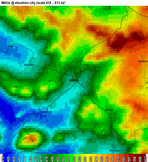
Below is the Elevation map of Měčín, which displays elevation range with different colors. Scale of the first map is from 418 to 613 m (1371 to 2011 ft) with average elevation of 501.9 meters (=1647 ft) [note 1]
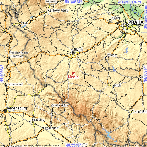
These maps also provides idea of topography and contour of this city, they are displayed at different zoom levels. More info about maps, scale and edge coordinates you can find below images.
| \ | Map #1 | Topo.Map |
| Scale [m] | 418..613 m | × |
| Scale [ft] | 1371..2011 ft | × |
| Average | 501.9 m = 1647 ft | × |
| Width | 6.35 km = 3.9 mi | 203.2 km = 126.3 mi |
| Height | 6.35 km = 3.9 mi | 203.2 km = 126.3 mi |
| ↑Max Latitude | 49.508633° | 50.38524° |
| Latitude at center | 49.48009° | 49.48009° |
| ↓Min Latitude | 49.45153° | 48.5579° |
| ← Min Longitude | 13.358945° | 11.99664° |
| Longitude center | 13.40289° | 13.40289° |
| →Max Longitude | 13.446835° | 14.80914° |
Nearby cities:
Cities around Měčín sort by population:
• Klatovy elevation 416 m
12.2 km,  219°
219°
• Přeštice 353 m
11.5 km,  334°
334°
• Blovice 389 m
15.1 km,  41°
41°
• Nepomuk 451 m
13 km,  87°
87°
• Spálené Poříčí 415 m
20.8 km, 44°
• Chlumčany 392 m
18.1 km,  339°
339°
• Janovice nad Úhlavou 417 m
20.1 km, 221°
• Plánice 559 m
11.2 km,  153°
153°
• Švihov 375 m
8.6 km,  270°
270°
• Kolinec 536 m
20.3 km,  172°
172°
• Nezvěstice 377 m
19.7 km,  25°
25°
• Merklín 381 m
17.3 km,  301°
301°
Multilingual:
 En español:
Měčín elevación 476 m.
 En France:
Měčín élévation 476 m.


Sources and notes:
- [note 1] Map square and city borders are not equal. Map elevation data is calculated only from area inside that square.
- [src 1] Elevation data from geonames database provided with same terms of usage.
- [src 2] The elevation map of Měčín is generated using elevation data from NASA's 3 arcsec (90m) resolution SRTM data.
- [src 3] Base (background) map © OpenStreetMap contributors tiles are generated by Geofabrik and OpenTopoMap.
Copyright & License:
This Měčín Elevation Map is licensed under CC BY-SA. You may reuse any part from this page, if you give a proper credit by linking to this URL:
 More info on terms of use page.