Mělník elevation
Mělník (Central Bohemia, Okres Mělník), Czech Republic elevation is 219 meters and Mělník elevation in feet is 719 ft above sea level [src 1]. Mělník is a populated place (feature code) with elevation that is 126 meters (413 ft) smaller than average city elevation in Czech Republic.
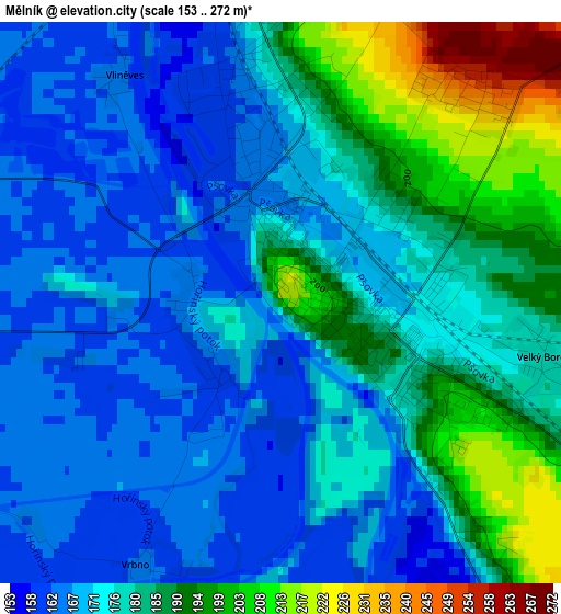
Below is the Elevation map of Mělník, which displays elevation range with different colors. Scale of the first map is from 153 to 272 m (502 to 892 ft) with average elevation of 178.1 meters (=584 ft) [note 1]
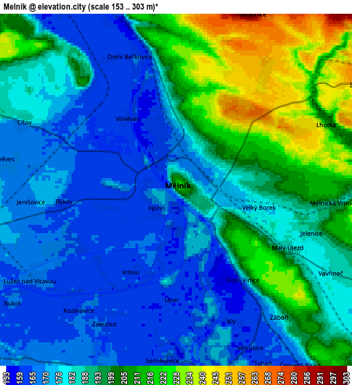
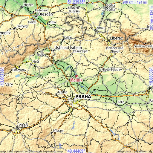
These maps also provides idea of topography and contour of this city, they are displayed at different zoom levels. More info about maps, scale and edge coordinates you can find below images.
| \ | Map #1 | Map #2 | Topo.Map |
| Scale [m] | 153..272 m | 153..303 m | × |
| Scale [ft] | 502..892 ft | 502..994 ft | × |
| Average | 178.1 m = 584 ft | 188.1 m = 617 ft | × |
| Width | 6.24 km = 3.9 mi | 12.47 km = 7.7 mi | 199.5 km = 124 mi |
| Height | 6.24 km = 3.9 mi | 12.47 km = 7.7 mi | 199.5 km = 124 mi |
| ↑Max Latitude | 50.378533° | 50.406549° | 51.23935° |
| Latitude at center | 50.3505° | 50.3505° | 50.3505° |
| ↓Min Latitude | 50.322451° | 50.294385° | 49.44469° |
| ← Min Longitude | 14.430165° | 14.386219° | 13.06786° |
| Longitude center | 14.47411° | 14.47411° | 14.47411° |
| →Max Longitude | 14.518055° | 14.562001° | 15.88036° |
Nearby cities:
Cities around Mělník sort by population:
• Neratovice elevation 170 m
10.6 km,  163°
163°
• Štětí 160 m
13.4 km,  328°
328°
• Všetaty 181 m
11.4 km,  132°
132°
• Libiš 165 m
8.7 km,  166°
166°
• Veltrusy 176 m
13.6 km,  229°
229°
• Tišice 165 m
10.6 km,  147°
147°
• Lužec nad Vltavou 169 m
6.2 km,  238°
238°
• Dolní Beřkovice 163 m
5 km,  340°
340°
• Byšice 200 m
10.7 km,  114°
114°
• Bechlín 218 m
11.9 km,  307°
307°
• Horní Počaply 163 m
10.2 km,  324°
324°
• Cítov 182 m
5.9 km,  294°
294°
Multilingual:
 En español:
Mělník elevación 219 m.
 En France:
Mělník élévation 219 m.


Sources and notes:
- [note 1] Map square and city borders are not equal. Map elevation data is calculated only from area inside that square.
- [src 1] Elevation data from geonames database provided with same terms of usage.
- [src 2] The elevation map of Mělník is generated using elevation data from NASA's 3 arcsec (90m) resolution SRTM data.
- [src 3] Base (background) map © OpenStreetMap contributors tiles are generated by Geofabrik and OpenTopoMap.
Copyright & License:
This Mělník Elevation Map is licensed under CC BY-SA. You may reuse any part from this page, if you give a proper credit by linking to this URL:
 More info on terms of use page.