Napajedla elevation
Napajedla (Zlín, Okres Zlín), Czech Republic elevation is 185 meters and Napajedla elevation in feet is 607 ft above sea level [src 1]. Napajedla is a populated place (feature code) with elevation that is 160 meters (525 ft) smaller than average city elevation in Czech Republic.
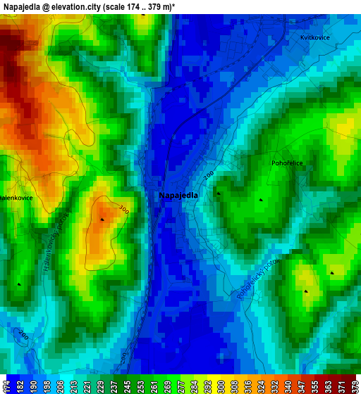
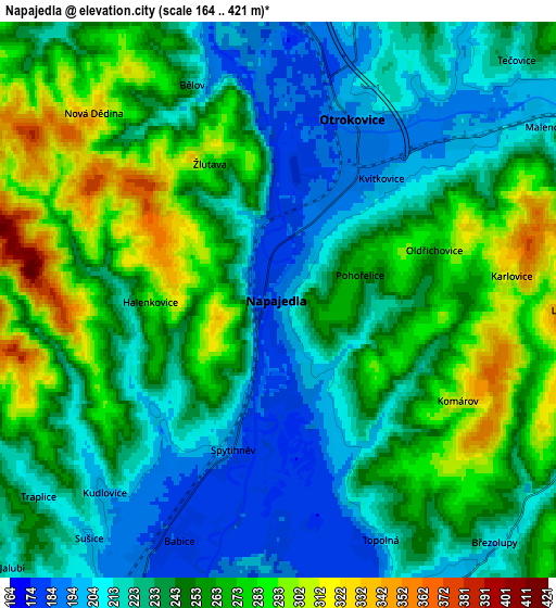
Below is the Elevation map of Napajedla, which displays elevation range with different colors. Scale of the first map is from 174 to 379 m (571 to 1243 ft) with average elevation of 235.7 meters (=773 ft) [note 1]
These maps also provides idea of topography and contour of this city, they are displayed at different zoom levels. More info about maps, scale and edge coordinates you can find below images.
| \ | Map #1 | Map #2 | Topo.Map |
| Scale [m] | 174..379 m | 164..421 m | × |
| Scale [ft] | 571..1243 ft | 538..1381 ft | × |
| Average | 235.7 m = 773 ft | 244.5 m = 802 ft | × |
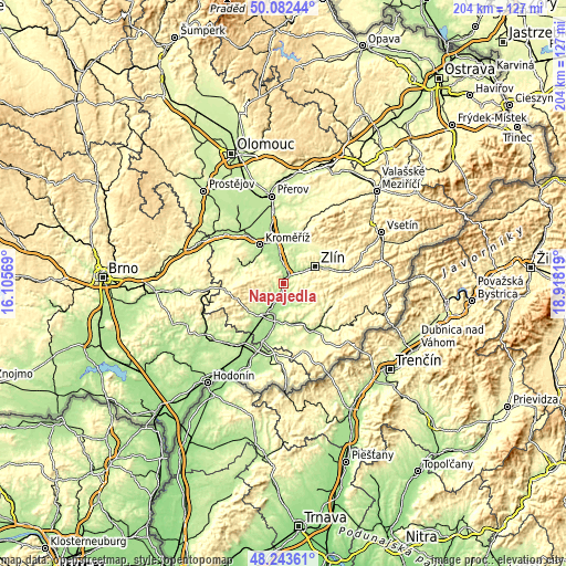
| Width | 6.39 km = 4 mi | 12.78 km = 7.9 mi | 204.5 km = 127.1 mi |
| Height | 6.39 km = 4 mi | 12.78 km = 7.9 mi | 204.4 km = 127 mi |
| ↑Max Latitude | 49.200283° | 49.228989° | 50.08244° |
| Latitude at center | 49.17156° | 49.17156° | 49.17156° |
| ↓Min Latitude | 49.14282° | 49.114064° | 48.24361° |
| ← Min Longitude | 17.467995° | 17.424049° | 16.10569° |
| Longitude center | 17.51194° | 17.51194° | 17.51194° |
| →Max Longitude | 17.555885° | 17.599831° | 18.91819° |
Nearby cities:
Cities around Napajedla sort by population:
• Otrokovice elevation 196 m
4.7 km,  25°
25°
• Kvasice 194 m
8.4 km,  338°
338°
• Babice 182 m
6 km,  202°
202°
• Halenkovice 297 m
2.9 km,  268°
268°
• Spytihněv 186 m
3.5 km, 196°
• Bílovice 190 m
8.5 km,  161°
161°
• Březolupy 205 m
7.5 km,  138°
138°
• Topolná 195 m
6 km, 156°
• Tečovice 209 m
7.8 km,  44°
44°
• Traplice 211 m
7.1 km,  230°
230°
• Kněžpole 180 m
8.1 km,  177°
177°
• Žlutava 281 m
3.5 km,  333°
333°
Multilingual:
 En español:
Napajedla elevación 185 m.
 En France:
Napajedla élévation 185 m.
 Auf Deutsch:
Napajedla höhe über dem Meeresspiegel ist 185 m.

Sources and notes:
- [note 1] Map square and city borders are not equal. Map elevation data is calculated only from area inside that square.
- [src 1] Elevation data from geonames database provided with same terms of usage.
- [src 2] The elevation map of Napajedla is generated using elevation data from NASA's 3 arcsec (90m) resolution SRTM data.
- [src 3] Base (background) map © OpenStreetMap contributors tiles are generated by Geofabrik and OpenTopoMap.
Copyright & License:
This Napajedla Elevation Map is licensed under CC BY-SA. You may reuse any part from this page, if you give a proper credit by linking to this URL:
 More info on terms of use page.