Pohořelice elevation
Pohořelice (South Moravian, Okres Brno-venkov), Czech Republic elevation is 183 meters and Pohořelice elevation in feet is 600 ft above sea level [src 1]. Pohořelice is a populated place (feature code) with elevation that is 162 meters (531 ft) smaller than average city elevation in Czech Republic.
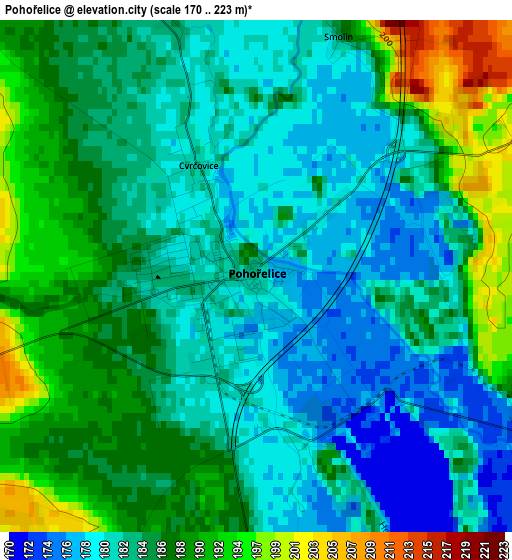
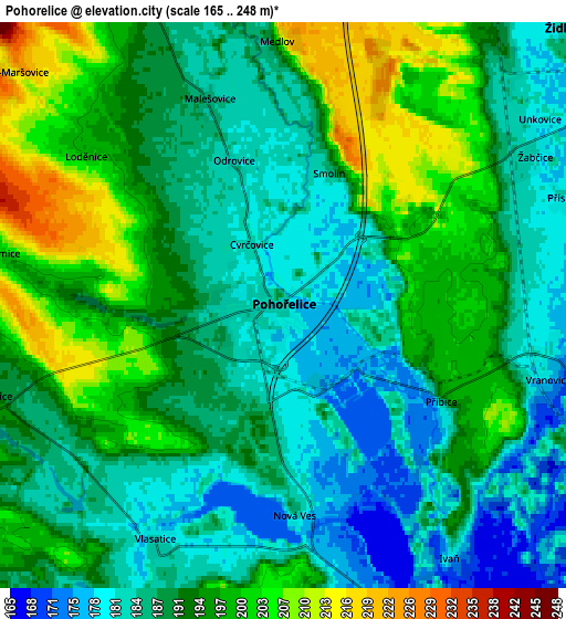
Below is the Elevation map of Pohořelice, which displays elevation range with different colors. Scale of the first map is from 170 to 223 m (558 to 732 ft) with average elevation of 185.1 meters (=607 ft) [note 1]
These maps also provides idea of topography and contour of this city, they are displayed at different zoom levels. More info about maps, scale and edge coordinates you can find below images.
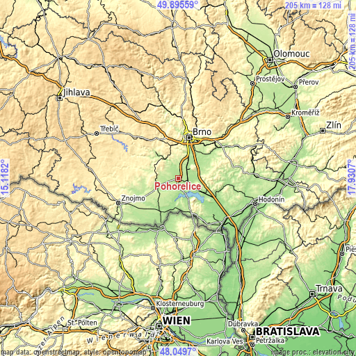
| \ | Map #1 | Map #2 | Topo.Map |
| Scale [m] | 170..223 m | 165..248 m | × |
| Scale [ft] | 558..732 ft | 541..814 ft | × |
| Average | 185.1 m = 607 ft | 191 m = 627 ft | × |
| Width | 6.41 km = 4 mi | 12.83 km = 8 mi | 205.2 km = 127.5 mi |
| Height | 6.41 km = 4 mi | 12.83 km = 8 mi | 205.2 km = 127.5 mi |
| ↑Max Latitude | 49.010023° | 49.03884° | 49.89559° |
| Latitude at center | 48.98119° | 48.98119° | 48.98119° |
| ↓Min Latitude | 48.95234° | 48.923473° | 48.0497° |
| ← Min Longitude | 16.480505° | 16.436559° | 15.1182° |
| Longitude center | 16.52445° | 16.52445° | 16.52445° |
| →Max Longitude | 16.568395° | 16.612341° | 17.9307° |
Nearby cities:
Cities around Pohořelice sort by population:
• Židlochovice elevation 194 m
9.5 km,  46°
46°
• Hrušovany u Brna 185 m
8.2 km,  38°
38°
• Rajhrad 196 m
13.4 km,  25°
25°
• Dolní Kounice 199 m
10.8 km,  336°
336°
• Blučina 189 m
12 km, 46°
• Vranovice 176 m
6.2 km,  105°
105°
• Drnholec 184 m
14 km,  191°
191°
• Velké Němčice 183 m
10.8 km,  83°
83°
• Žabčice 181 m
6.6 km,  59°
59°
• Nosislav 184 m
10.1 km,  69°
69°
• Olbramovice 197 m
8.9 km,  272°
272°
• Vojkovice 184 m
9.9 km, 38°
Multilingual:
 En español:
Pohořelice elevación 183 m.
 En France:
Pohořelice élévation 183 m.
 Auf Deutsch:
Pohořelice höhe über dem Meeresspiegel ist 183 m.

Sources and notes:
- [note 1] Map square and city borders are not equal. Map elevation data is calculated only from area inside that square.
- [src 1] Elevation data from geonames database provided with same terms of usage.
- [src 2] The elevation map of Pohořelice is generated using elevation data from NASA's 3 arcsec (90m) resolution SRTM data.
- [src 3] Base (background) map © OpenStreetMap contributors tiles are generated by Geofabrik and OpenTopoMap.
Copyright & License:
This Pohořelice Elevation Map is licensed under CC BY-SA. You may reuse any part from this page, if you give a proper credit by linking to this URL:
 More info on terms of use page.